
| Area | Basinwide/General |
| Topic | Sediment: Matthews Sediment Landslides by Type and Period 1933-1999 |
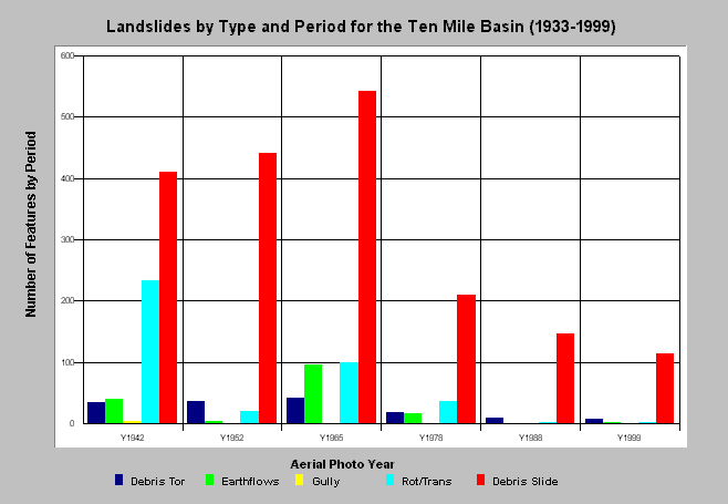
| Caption: The chart above shows the type of landslide and the period of initiation for the Ten Mile River basin taken from Matthews and Associates (2000). The slides were mapped from aerial photos and the photo years are on the X-axis. The first period is estimated to cover features spanning back to 1933 and the other periods are those bracketed by the photo years. Debris slides were the most common landslide feature. Far fewer landslides have occurred in recent periods. Click on Info Links for more information. | |
 |
To learn more about this topic click here .
To view the table with the chart's data, click Chart Table web page.
To download the table with the chart's data, click slidetypextab.dbf (size 562 bytes) .
To see meta information about the data table used for this topic click here
| www.krisweb.com |