
| Area | Basinwide/General |
| Topic | Sediment: V* for Ten Mile and Nearby Streams 1992 |
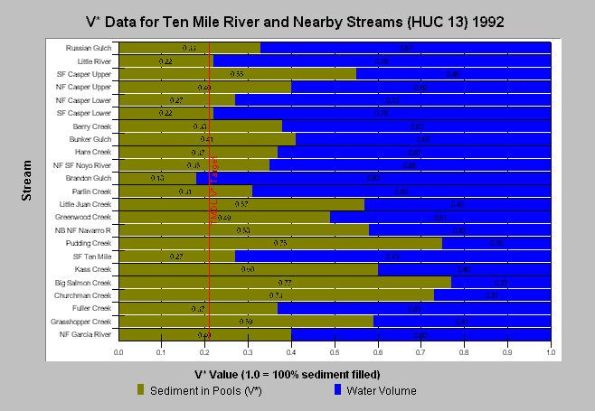
| Caption: The above chart shows V* results from Knopp (1993). A V* of 0.5 indicates that half of the pool is filled with fine sediment. The TMDL target of 0.21 was adopted for the Ten Mile River. Of the two Ten Mile River basin streams sampled, the South Fork Ten Mile had a moderate V* of 0.27 and Churchman Creek measured a very high 0.73. Knopp (1993) found that intensity of watershed management and timber harvest were reflected in V* values. See Info Links for more information. | |
 |
To learn more about this topic click here .
To view the table with the chart's data, click Chart Table web page.
To download the table with the chart's data, click vstar_huc13.dbf (size 2,764 bytes) .
To see meta information about the data table used for this topic click here
To view the table with the chart's source data, click Source Table web page.
To download the table with the chart's source data, click vstar_huc13.dbf (size 2,764 bytes)
| www.krisweb.com |