
| Area | Basinwide/General |
| Topic | Ten Mile River Basin Maps: Geography |
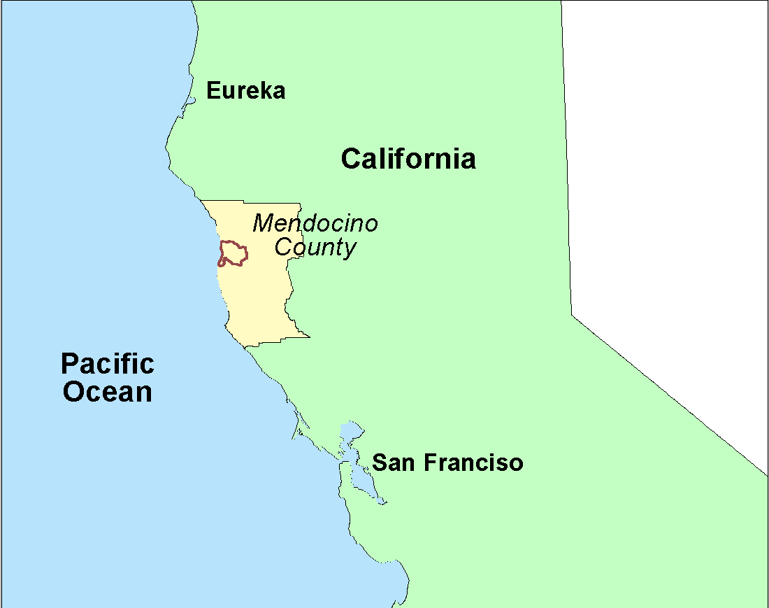
This map shows the Ten Mile Basin in relation to California and Mendocino County and is taken from the KRIS Ten Mile Map project. Click on Info Links to find out more about the companion KRIS ArcView project.
This map shows the Ten Mile Basin as used in analysis by Matthews and Associates (2000). sub-basins are the same as those designated by the KRIS project: South Fork, Middle Fork, North Fork and Lower Ten Mile.
This view from the KRIS Ten Mile Map project shows the basin relief in meters for the project area and Calwater planning watershed boundaries. The highest elevation is along the ridge that borders the basin to the east while the coastal plain in the west has very low relief and elevation.
This is Figure 2 from Matthews and Associates (2000) and shows a tiled aerial mosaic of the Ten Mile River watershed in 1999. Large sub-basin groups are shown in red and with smaller watershed areas with them in green. The photographs are not ortho-rectified and contrast and lighting are responsible for shading and edge effects in the image. Note extensive clear cuts in the South Fork sub-basin and natural grasslands in the northeastern portion of the basin.
The image above comes from the KRIS Ten Mile Map project and shows timber harvests as mapped by the California Department of Forestry by year from 1990-2000. The timber harvests shown above are for the entire basin and have been approved but may not have been implemented when the 1999 aerial photo (Picture #4) was taken.
This image from the KRIS Ten Mile River Map project shows USFS vegetation and stand types for the entire Ten Mile River watershed derived from a 1994 Landsat (see USFS VegType Topics for more information). The large areas of Non-Forest in the west of the basin are dunes, a grassy coastal plain, agricultural lands and the estuary. In the east Non-Forest is in part natural grasslands associated with earthflow terrain. The checkered pattern of Non-Forest and Saplings in the South Fork are associated with recent timber harvest. See Picture #5. Scale of accuracy for stands is one hectare.
The image above is from the EPA Land Cover project, which is included in the KRIS Ten Mile Map project. The sand dunes of the beach show as bare rock in the west, and pastureland is also strongly represented. The northeastern portion of the watershed shows as grasslands, shrubland and mixed forest due to earthflow terrain in this region (see next Topic on Geology maps). Patches of mixed forest and shrubland disbursed throughout the watershed reflect early seral conditions after timber harvest.
This image is from Matthews and Associates (2000) and shows timber harvest back to 1941 as discerned from aerial photos. The map shows four waves of logging: the early 1940s, early 1950's, early to mid 1960s and the 1990s.
 Click on image to enlarge (15K).
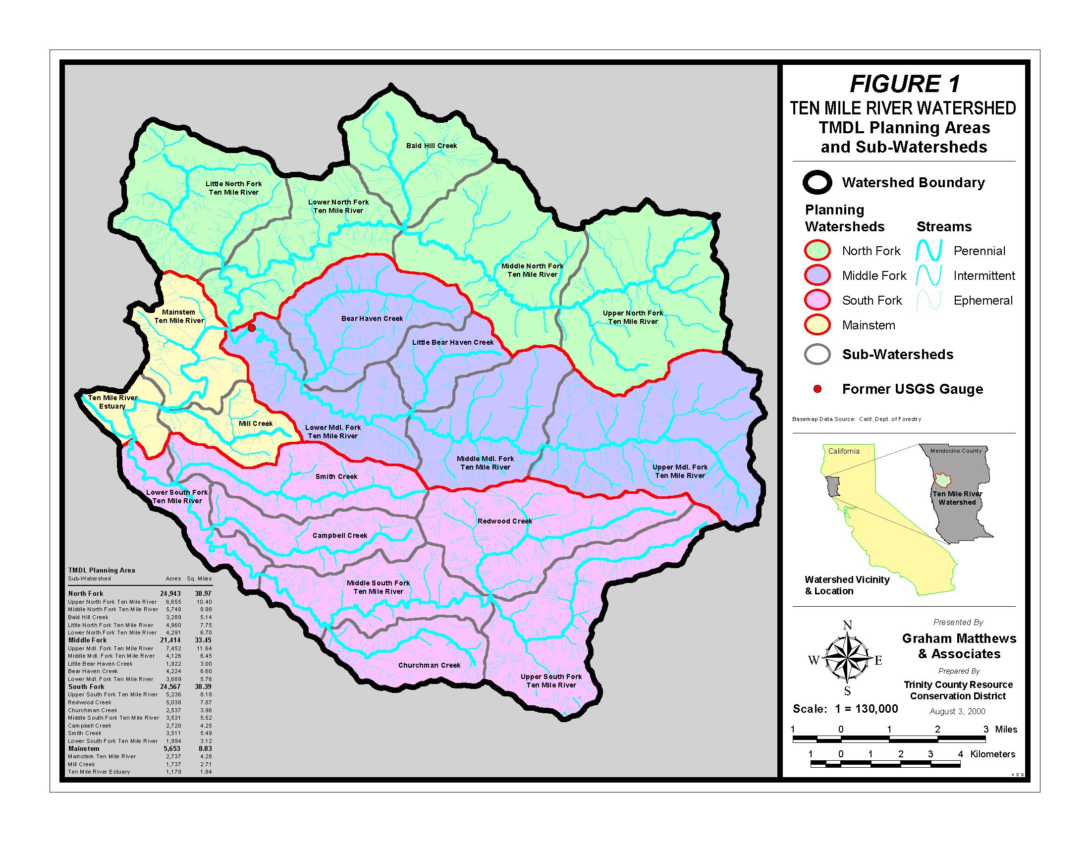 Click on image to enlarge (554K).
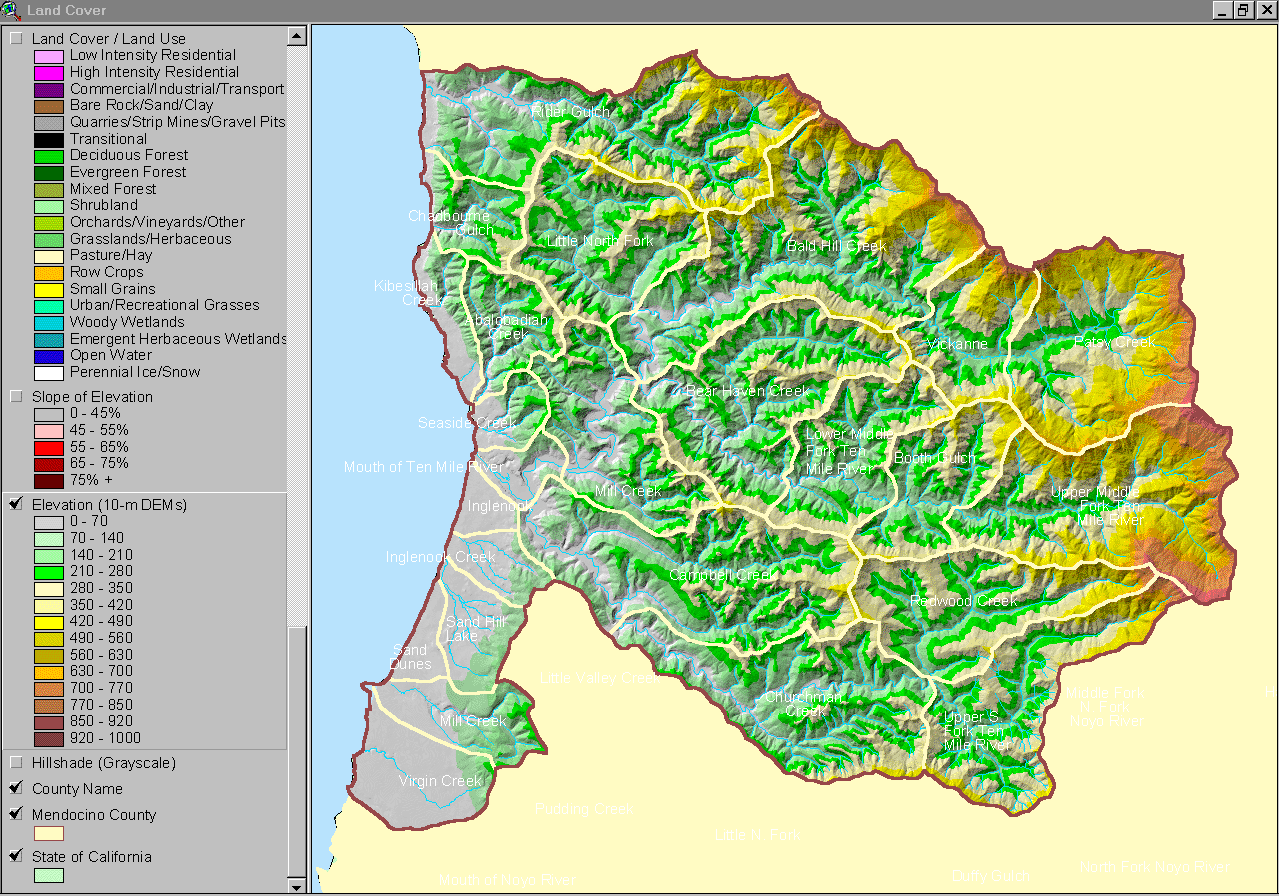 Click on image to enlarge (298K).
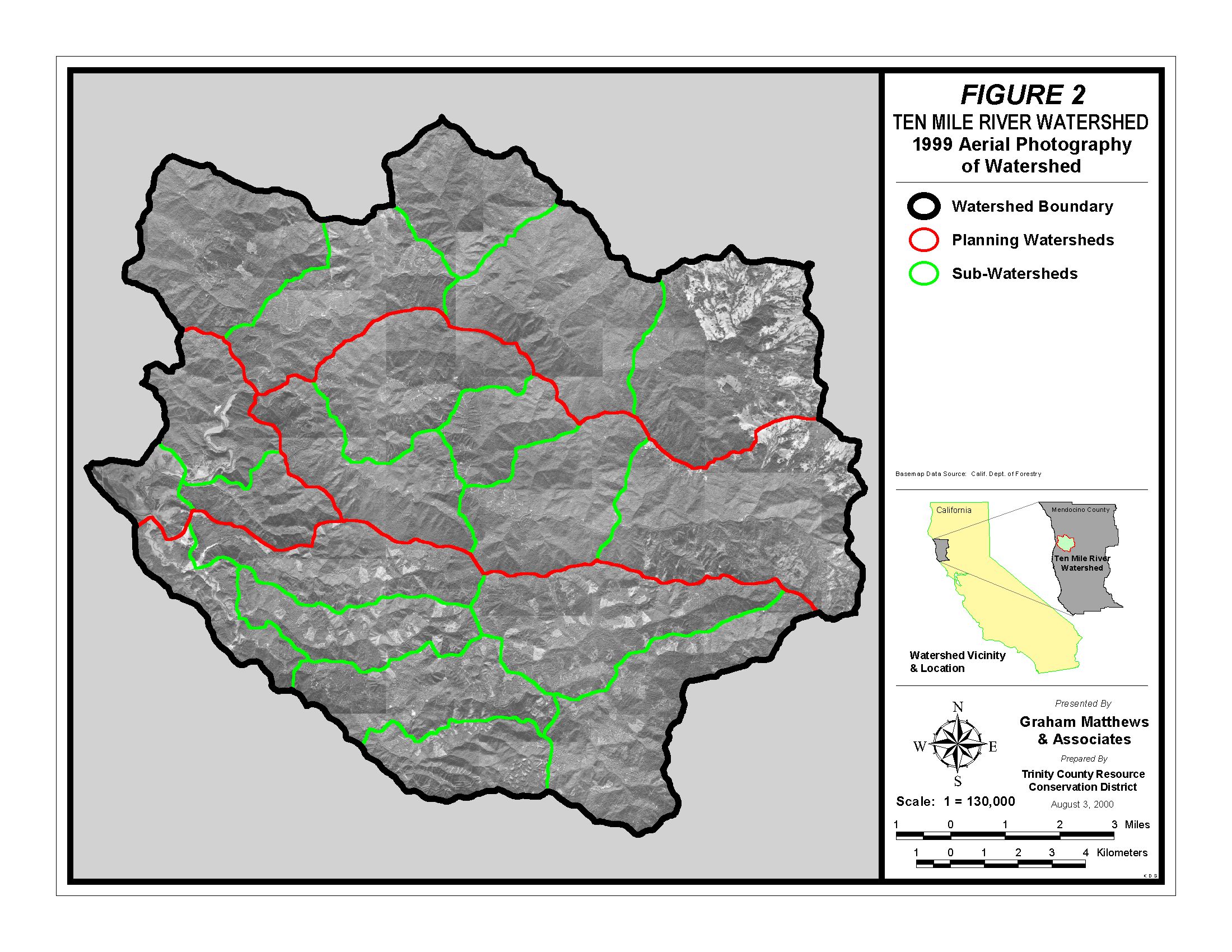 Click on image to enlarge (560K).
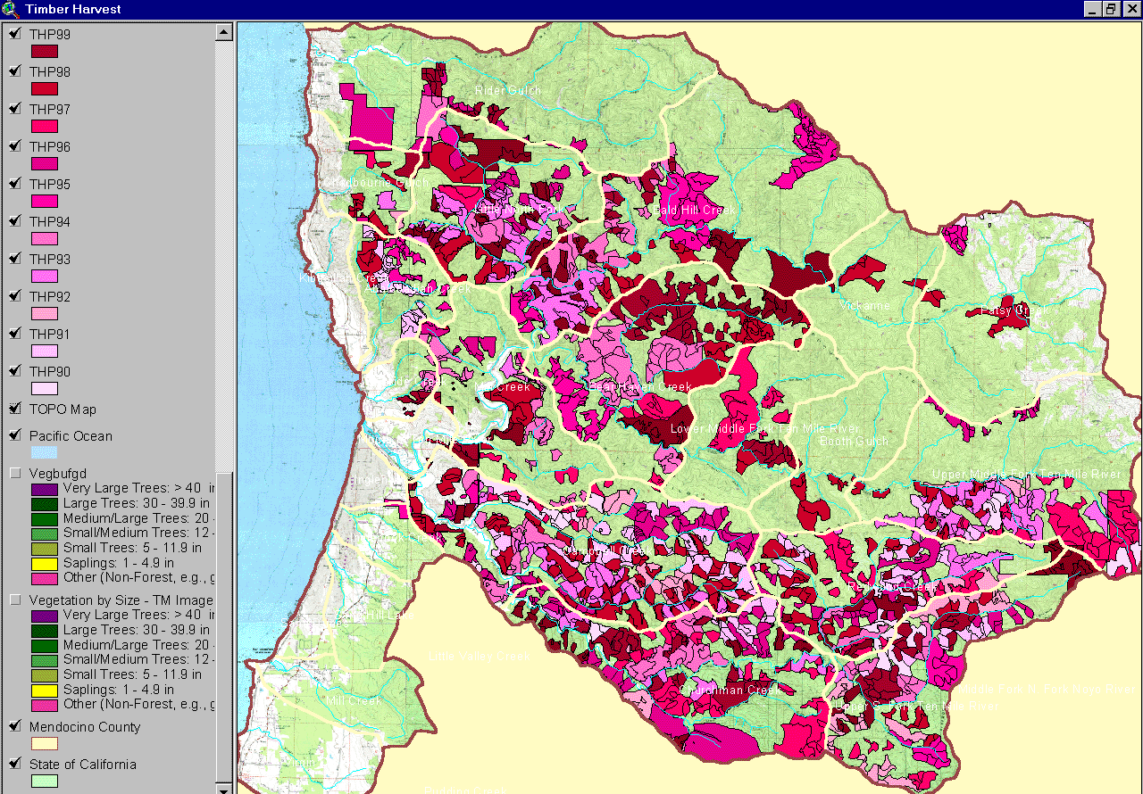 Click on image to enlarge (383K).
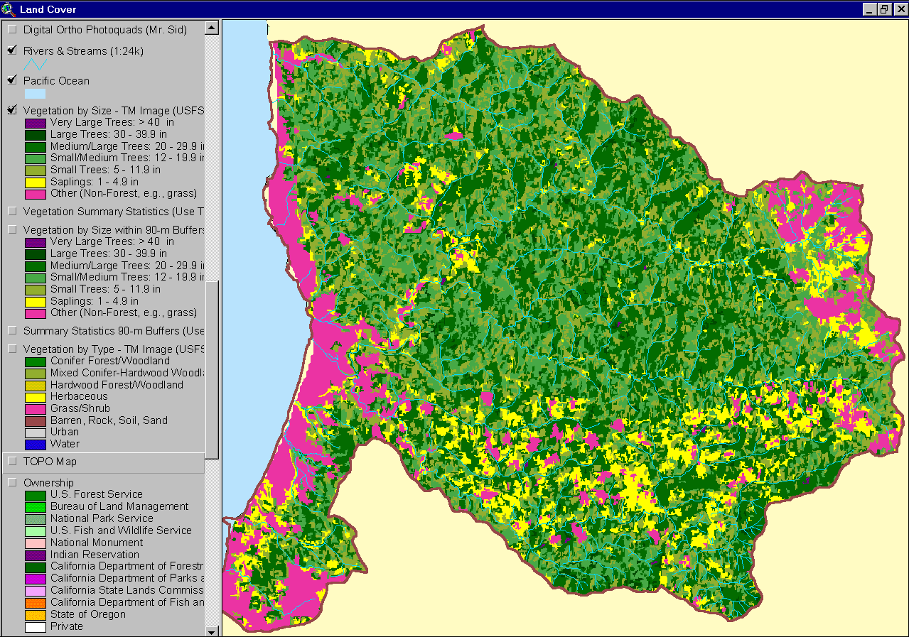 Click on image to enlarge (147K).
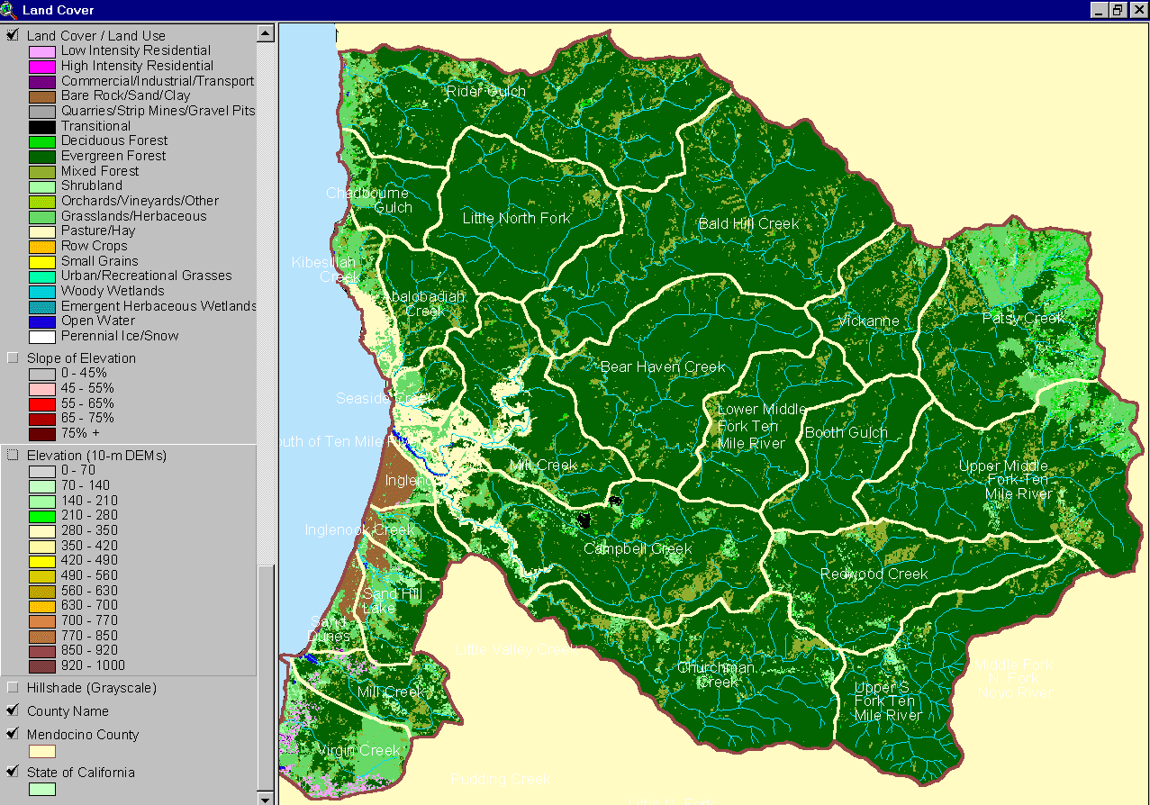 Click on image to enlarge (119K).
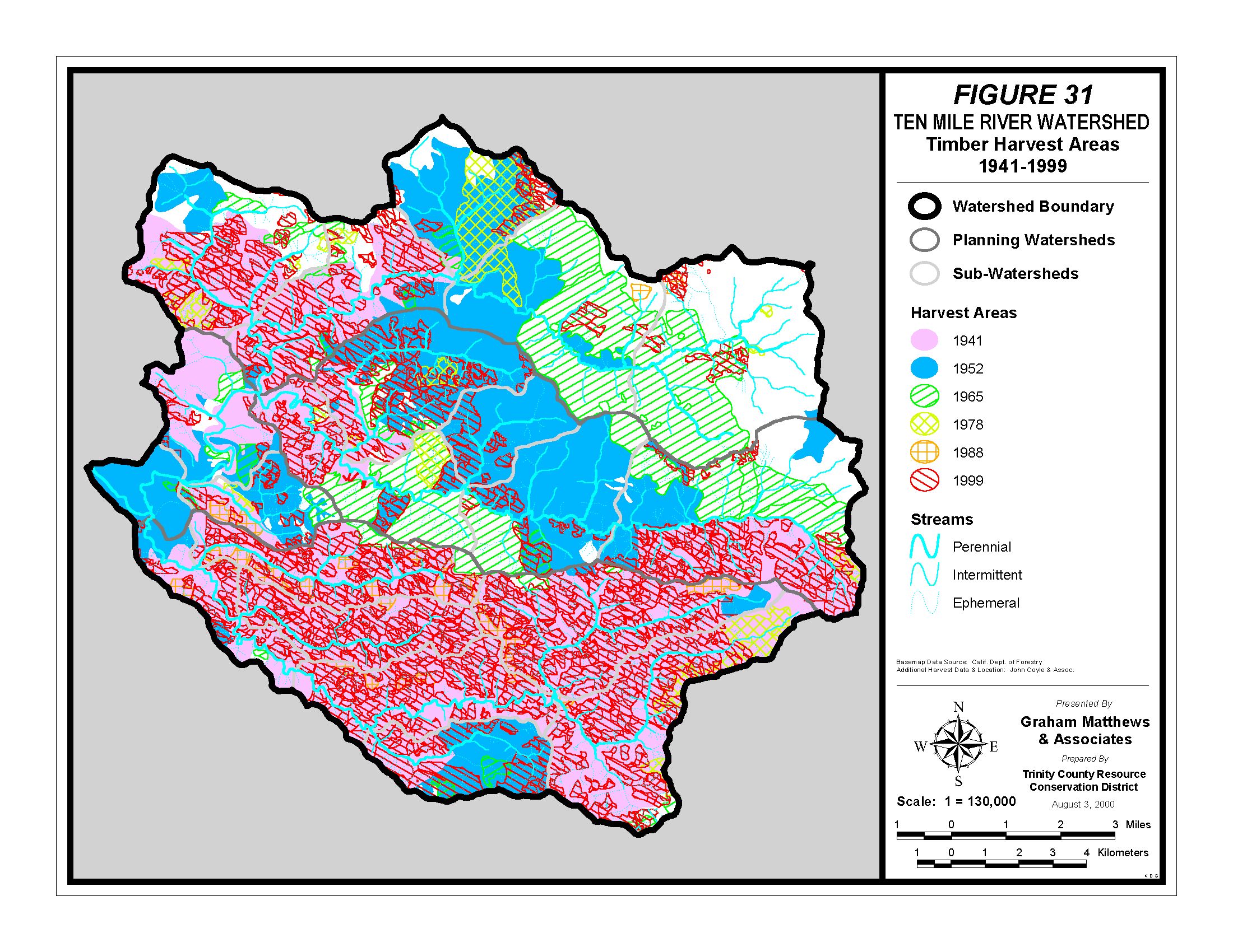 Click on image to enlarge (785K).
To learn more about this topic click here
| www.krisweb.com |