
| Area | Basinwide/General |
| Topic | Sediment: Matthews Sediment Landslides Total by Period 1933-1999 |
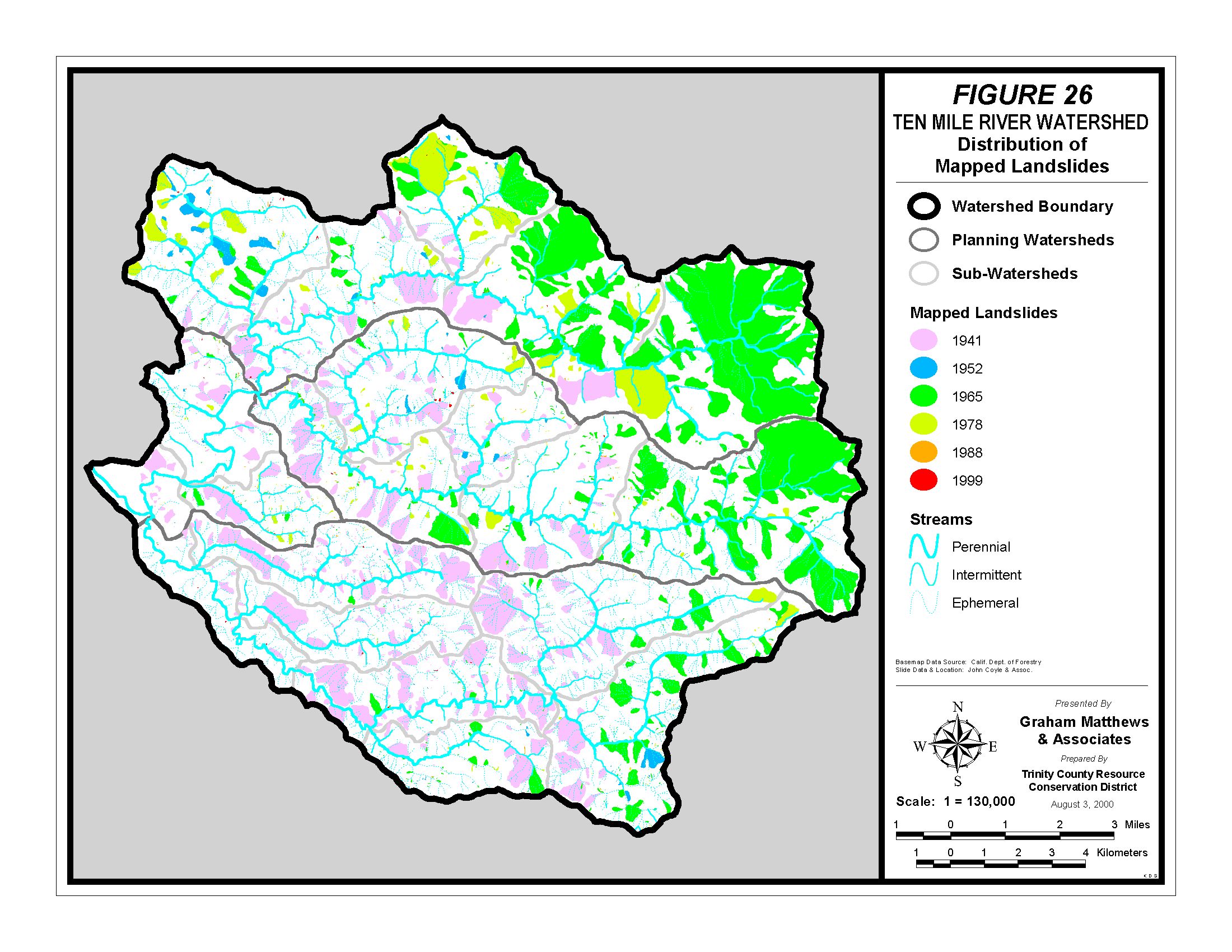
Matthews and Associates (2001) mapped active landslides from sequential aerial photos and they are displayed above. The most active slides seem related to the first round of timber harvest in 1941 and following the 1964 storm. Slides in the northern portion of the basin were also extensive in the period prior to 1978.
 Click on image to enlarge (568K).
To learn more about this topic click here
| www.krisweb.com |