
| Area | Basinwide/General |
| Topic | Timber Harvest: Matthews by sub-basin (Percent) 1933-1999 |
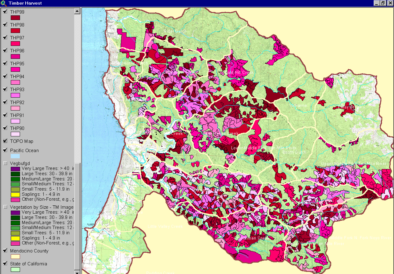
The map image above is from the KRIS Ten Mile Map project in ArcView and shows timber harvests from 1990 to 1999. The layer is derived from data provided by the California Department of Forestry. The legend at left shows timber harvest plans (THP) as they were approved by year (plans in 1990 = THP90). Calwater boundaries are shown for geographic reference.
The image above shows timber harvests of different historical periods as presented in Matthews and Associates (2000) as Figure 31. Analysis was done using aerial photos. The most recent timber harvest plan data (post-1988) comes from the California Department of Forestry.
Figure 43 from Matthews and Associates (2000) shows the percentage of each Planning Watershed (large sub-basins) harvested by period. The data is derived from aerial photographs except for the most recent period when data relies on information provided by the California Department of Forestry.
The image above is of Figure 46 from Matthews and Associates (2000) and shows the amount of sediment in tons coming from timber harvest activities by period. Analysis was done using aerial photos. The most recent wave of logging did not trigger the extensive mass wasting of earlier logging periods, which is reflected in less sediment yield.
The aerial photograph above is taken from Matthews and Associates (2000) and shows the entire Ten Mile River basin as of 1999. The aerial photos were tiled but not ortho-corrected. Differences in shading show at the edges of photo images. Planning watershed boundaries used by Matthews (larger sub-basins) are shown in red while smaller hydrologic basins (sub-watersheds) used are shown in green. Zoom and Pan to see basin areas up close (Press F1 for Help with KRIS Tools).
 Click on image to enlarge (383K).
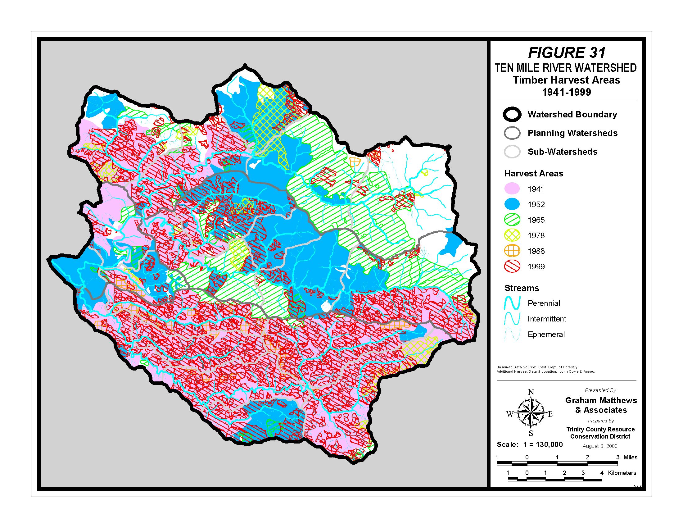 Click on image to enlarge (785K).
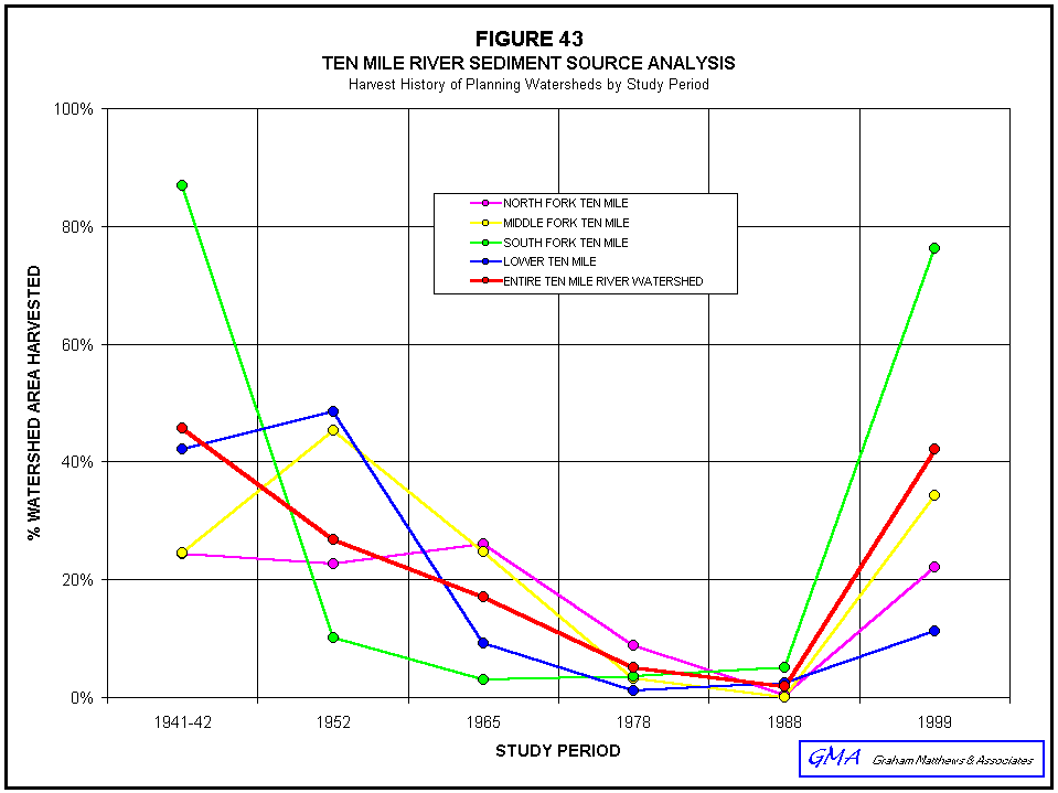 Click on image to enlarge (21K).
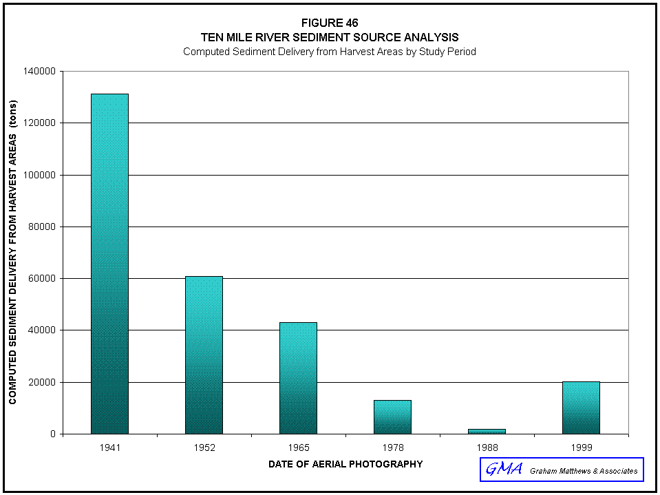 Click on image to enlarge (20K).
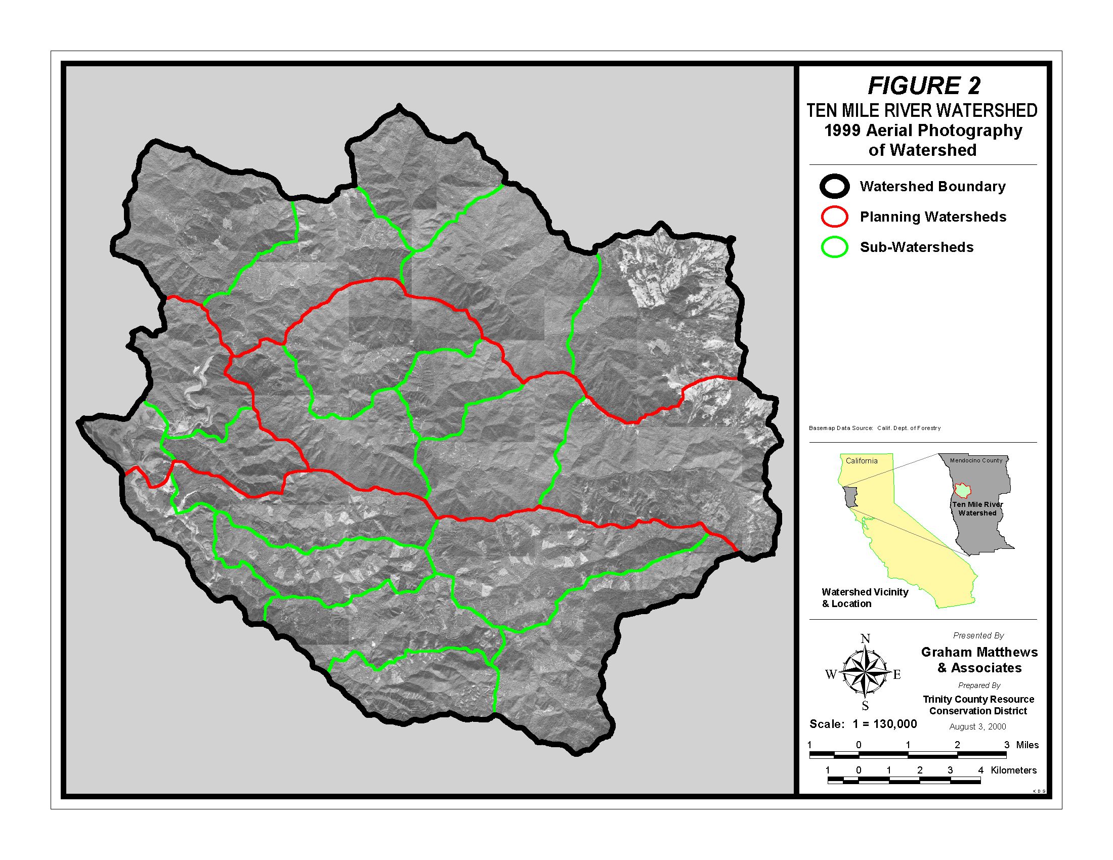 Click on image to enlarge (560K).
To learn more about this topic click here
| www.krisweb.com |