
| Area | Basinwide/General |
| Topic | Wood: Removed Jams in 1982 |
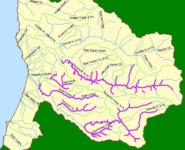
This map image shows in pink the reaches of the Ten Mile River basin where wood removal activities were conducted by CDFG in 1982 according to work reports. The reports described stream reach start and endings and provided township and range. This information was converted to the above spatial data by Campbell Hawthorne staff.
 Click on image to enlarge (108K).
To learn more about this topic click here
| www.krisweb.com |