
| Area | Coastal Tribs |
| Topic | Coastal Tribs North of the Ten Mile River: Basin Maps |
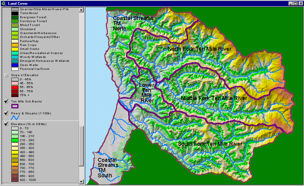
The image above is from the KRIS Ten Mile Map project and shows the elevation of the Ten Mile watershed and sub-basins as they appear in the KRIS database. The small coastal tributaries to the north of the Ten Mile River rise sharply off the coastal terrace. Wages Creek, which is the largest and most northerly watershed, attains and elevation over 2,500 feet in the east.
The image above is from the KRIS Ten Mile Map project and shows stream gradient, including streams north of the Ten Mile, but not including Wages Creek. Abalobadiah Creek looks as if it has suitable gradient for coho salmon.
The image above is from the KRIS Ten Mile Map project and shows slopes over 45% on a gray scale hillshade backdrop. Very steep slopes occur in both upper Wages Creek and in the center of the Abalobadiah Creek watershed.
The image above is from the KRIS Ten Mile Map project and shows timber harvest plans approved between 1990 and 2000. Timber harvests were most concentrated in northern Wages Creek and upper the Abalobadiah watershed in this period. THP data provided by the California Department of Forestry.
The image above is from the KRIS Ten Mile Map project and shows vegetation as interpreted from a 1994 Landsat image by the U.S. Forest Service Remote Sensing Lab. As of 1994, upper Wages Creek exhibited early seral vegetation associated with timber harvest. The large contiguous non-forest signature in the west is beach and grasslands on the coastal plain.
 Click on image to enlarge (259K).
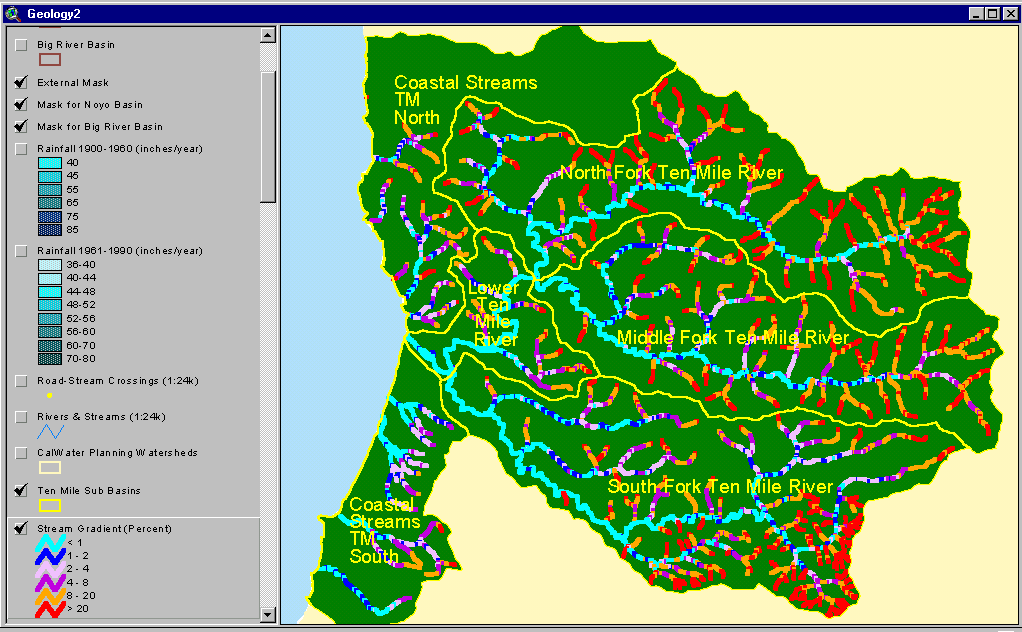 Click on image to enlarge (61K).
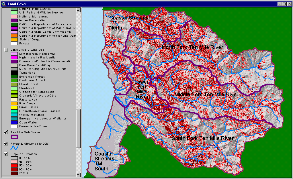 Click on image to enlarge (153K).
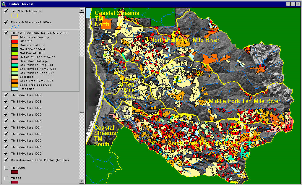 Click on image to enlarge (215K).
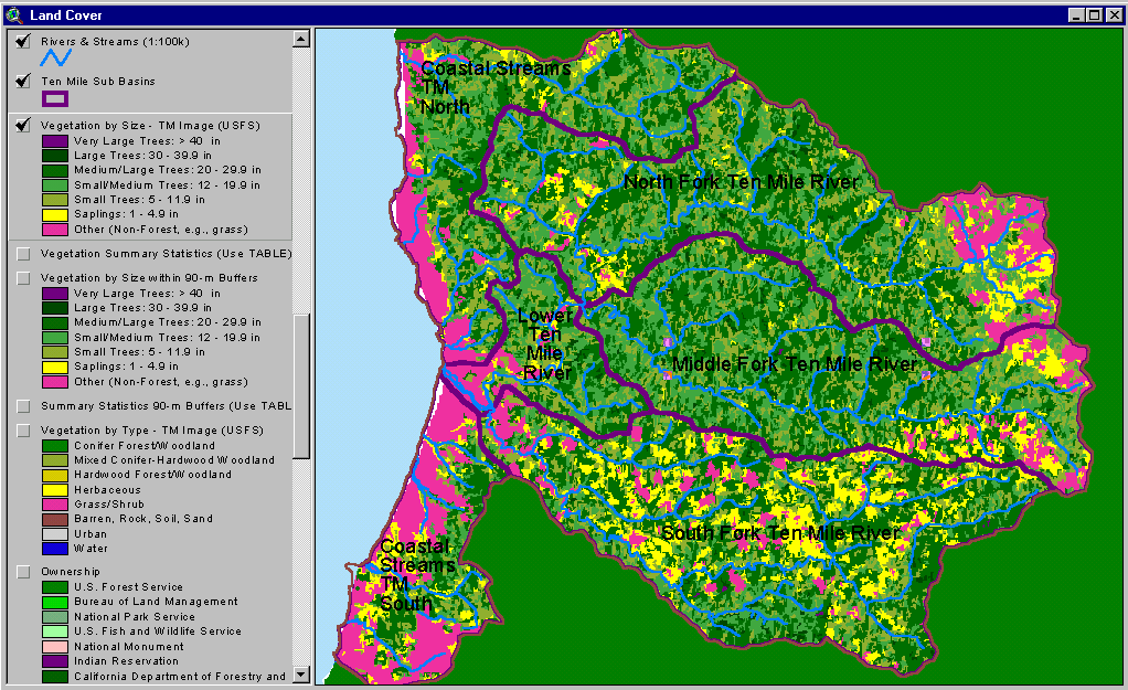 Click on image to enlarge (97K).
To learn more about this topic click here
| www.krisweb.com |