
| Area | Lower Ten Mile |
| Topic | Timber Harvest: Matthews Lower Ten Mile sub-basin (Area) 1933-1999 |
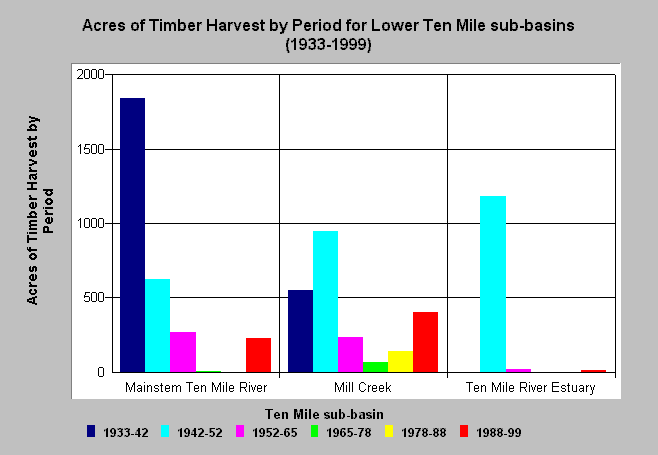
| Caption: The chart above shows timber harvest in acres by period for each Lower Ten Mile River sub-basin and indicates that the most extensive logging in this sub-basin took place prior to in the 1940's and 1950's. Estimates are generated largely from aerial photos and years shown above are the year of the photo used back to the previous photo year. Matthews Associates (2000) state: "Prior to 1988, the history was developed primarily from interpretation of aerial photography. From 1988 to present, road and harvest history was obtained from CDF GIS coverages which had been developed by directly inputting information provided as part of submitted Timber Harvest Plans (THPs)." See Info Links for more background information and links to references. | |
 |
To learn more about this topic click here .
To view the table with the chart's data, click Chart Table web page.
To download the table with the chart's data, click ltthp42_99.dbf (size 3,858 bytes) .
To see meta information about the data table used for this topic click here
To view the table with the chart's source data, click Source Table web page.
To download the table with the chart's source data, click thps42_99sb.dbf (size 3,966 bytes)
| www.krisweb.com |