
| Area | Lower Ten Mile |
| Topic | Tour: Lower Ten Mile Ground Photos 1995-2000 River Shots |
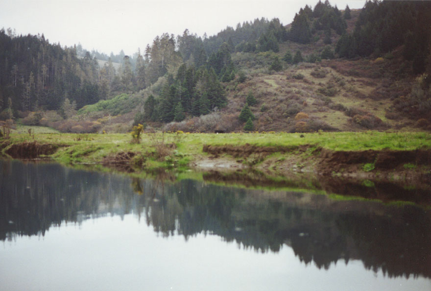
This photo was taken in the lower Ten Mile River and shows a meadow with cows grazing. The vegetation in upslope area is in transition coastal shrub to coniferous forest. The bank is showing some signs of erosion.
The streamside fence on this meadow on the South Fork Ten Mile is protecting the banks from stock impacts. Note that vegetation is more abundant in the fenced reach, which improves bank protection and increases filter capacity for sediment and nutrients in run off from fields.
This is a recently rebuilt steel bridge on the HTC haul road where it crosses the South Fork at the confluence with the mainstem Ten Mile River.
The fallen trees along the lower Ten Mile River below the South Fork provides cover for juvenile salmonids. Young alders and berry vines hold the soil of the bank.
Segments of the north bank of the Lower Ten Mile River appear to be eroding in this photo. Aggradation of the stream bed sometimes promote an increase bank erosion. Removal of vegetation by livestock can also contribute to such conditions.
This picture of the lower South Fork Ten Mile shows an eroding bank and small, even particle size distribution. Eroding banks can contribute to sedimentation of stream beds which reduces salmon and steelhead spawning success and production of aquatic insects upon which juvenile salmonids feed. Bank erosion can sometimes be natural but increased peak flows or sediment transport related to cumulative watershed effects can accelerate this process.
This aerial photo shows the eroding bank at the Hawthorne Timber Company haul road. The eroded material and bedload from upstream creates a shallow streambed, forcing the power winter floodwaters against the banks. Note the shallowness of the stream in response to aggradation.
The terrace at left on the lower Ten Mile River is colonized with alders with pasture land to the right. Bank erosion at right may be in part owing to grazing stock. Bank erosion may also be increased due to cumulative effects. When sediment from upstream moves through low gradient reaches, it typically causes channel widening because of decreased channel capacity.
 Click on image to enlarge (93K).
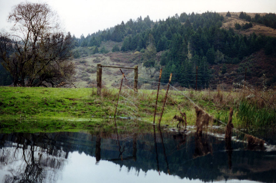 Click on image to enlarge (139K).
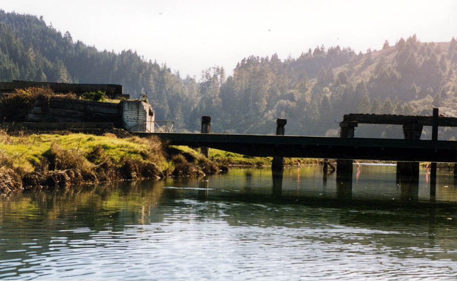 Click on image to enlarge (92K).
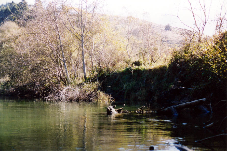 Click on image to enlarge (127K).
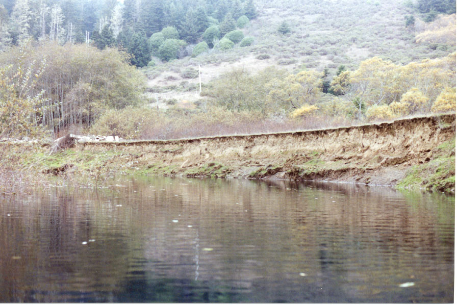 Click on image to enlarge (158K).
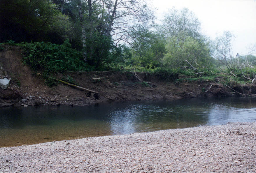 Click on image to enlarge (125K).
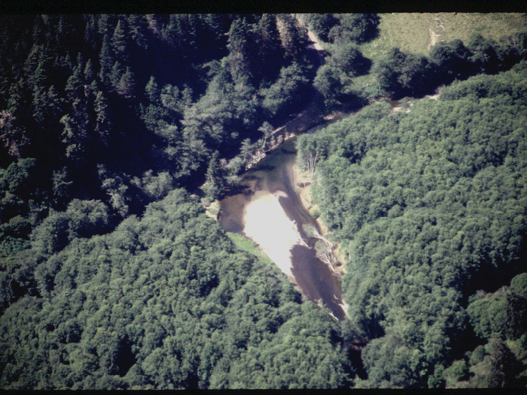 Click on image to enlarge (246K).
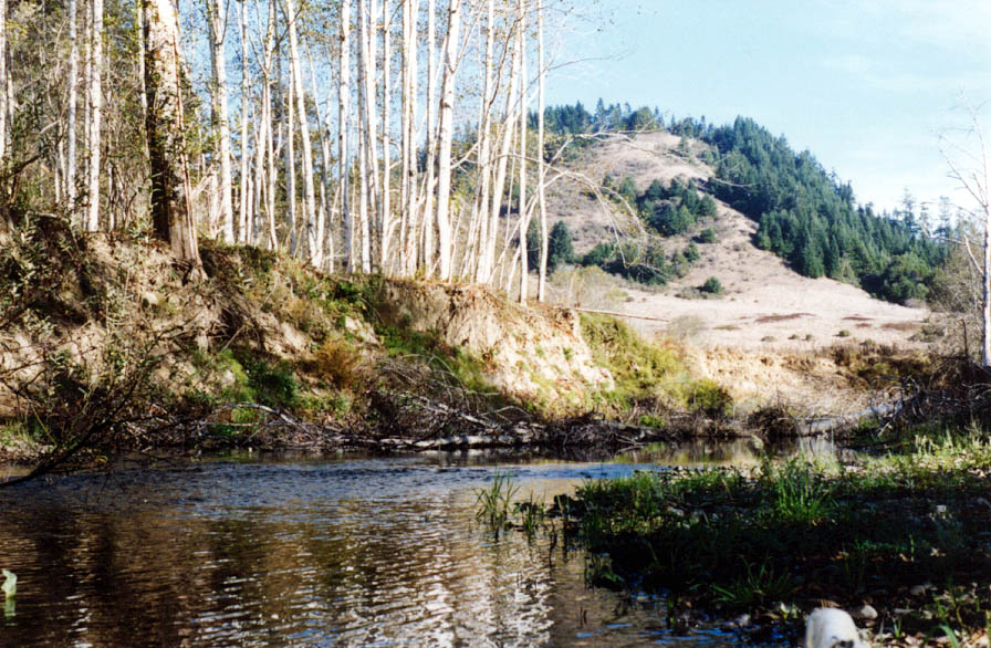 Click on image to enlarge (167K).
To learn more about this topic click here
| www.krisweb.com |