
| Area | Lower Ten Mile |
| Topic | Tour: Lower Ten Mile Photos Post 1964 Flood #1 (Perry Family) |
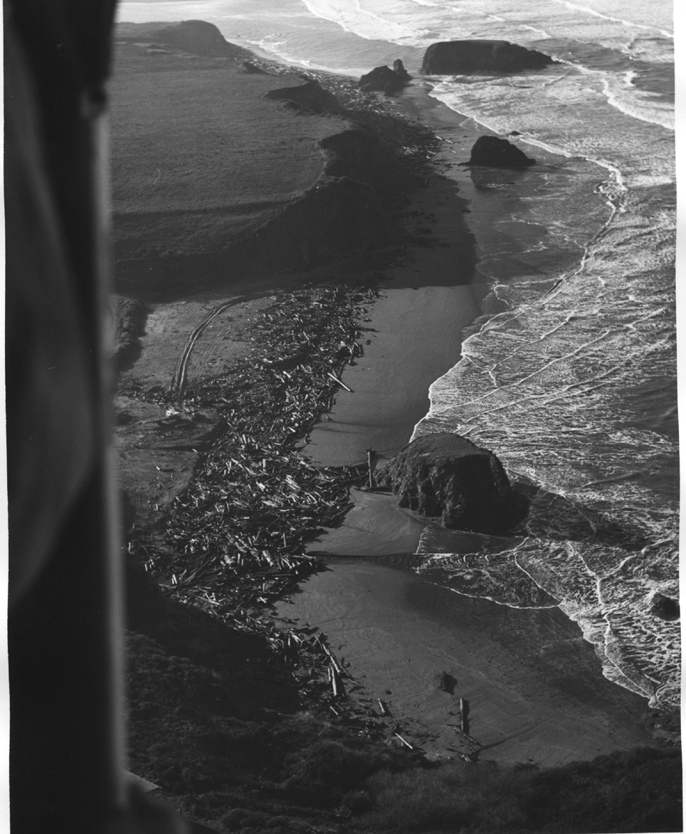
On Seaside Beach, south of Ten Mile River, quantities of large woody debris washed ashore after the 1964 flood. Photo taken by Peter Stackpole and provided for use in KRIS courtesy of Margaret Perry.
The Lower South Fork of the Ten Mile River, looking west toward the estuary shortly after the 1964 flood. The braided channel at left and terraces of sediment show effects of storm. The South Fork watershed was logged in the 1930's and early 1940's. Photo taken by Peter Stackpole and provided for use in KRIS courtesy of Margaret Perry.
Looking west where the South Fork Ten Mile River converges with mainstem. The road crossing at the center of photo is the old railroad grade which was converted to the haul road for trucks. The South Fork appears to be less turbid than the mainstem which is consistent with more recent logging in the North Fork and Middle Fork upstream. Photo taken by Peter Stackpole and provided for use in KRIS courtesy of Margaret Perry.
Looking west where the South Fork Ten Mile River meets the Ten Mile Estuary just after the 1964 flood. Photo taken by Peter Stackpole and provided for use in KRIS courtesy of Margaret Perry.
Looking north on the Lower South Fork Ten Mile at the convergence with the Mainstem. Fine sediment is evident on bars and in fields indicating considerable fine sediment yield as a result of the 1964 flood. The road at left is shown in recent ground photos elsewhere in KRIS Ten Mile. Photo taken by Peter Stackpole and provided for use in KRIS courtesy of Margaret Perry.
Crane removing large wood from above bridge on lower South Fork Ten Mile River (also the former railroad grade.) To the left of the river, what is now a berm used to be a trestle where the river could swell during high water. Photo taken by Peter Stackpole and provided for use in KRIS courtesy of Margaret Perry.
This photo shows the lower South Fork Ten Mile River converging with mainstem, and the haul road along the old railroad grade. Note the difference in turbidity between the mainstem and the South Fork. The Union Lumber Co right-of-way bridge is out. A length of old trestle was filled to make a trucking road from the railroad right-of-way. Note terraces of fine sediment on the lower South Fork resulting from the 1964 flood. Photo taken by Peter Stackpole and provided for use in KRIS courtesy of Margaret Perry.
The Lower South Fork Ten Mile River convergence with mainstem, looking north. Sedimentation and channel widening in this reach of the lower South Fork are the result of the 1964 storm. Photo taken by Peter Stackpole and provided for use in KRIS courtesy of Margaret Perry.
 Click on image to enlarge (331K).
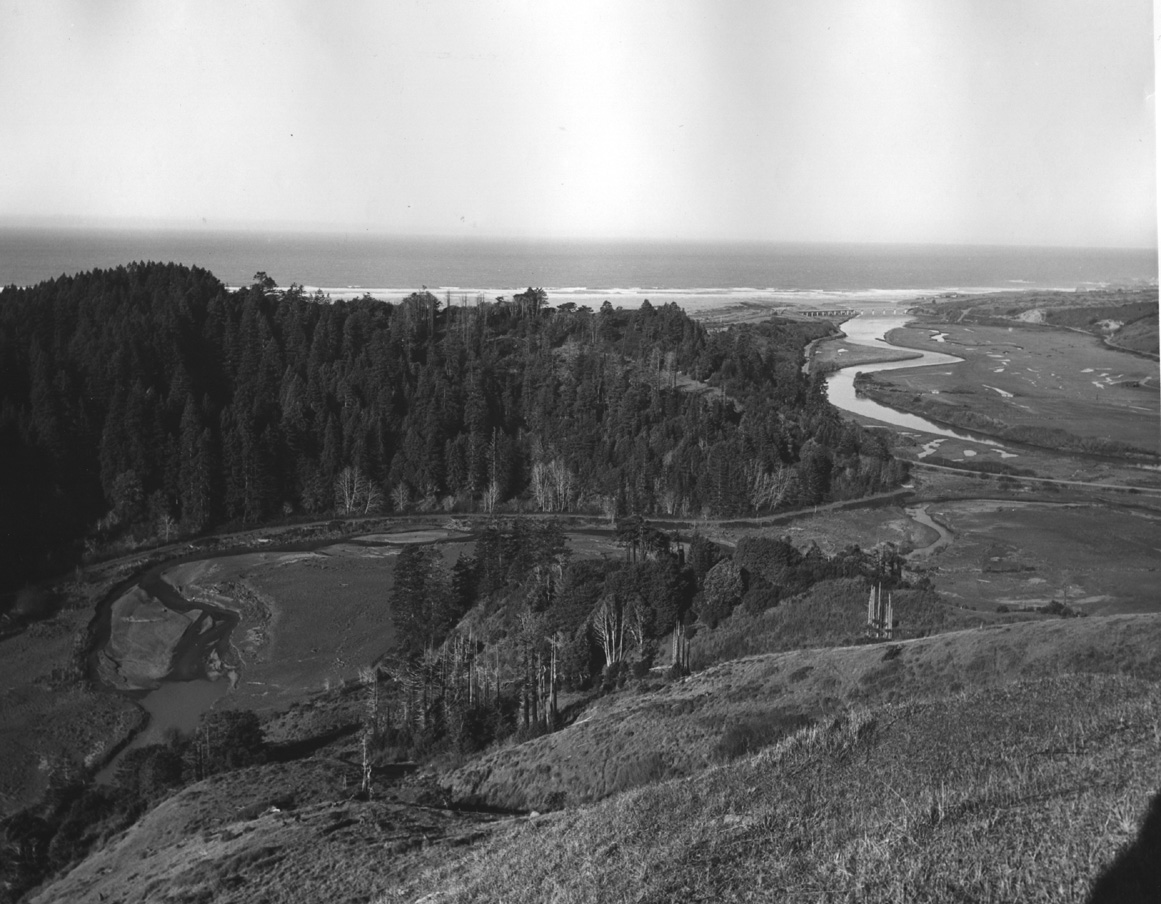 Click on image to enlarge (295K).
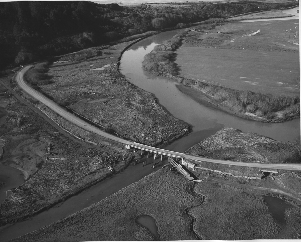 Click on image to enlarge (376K).
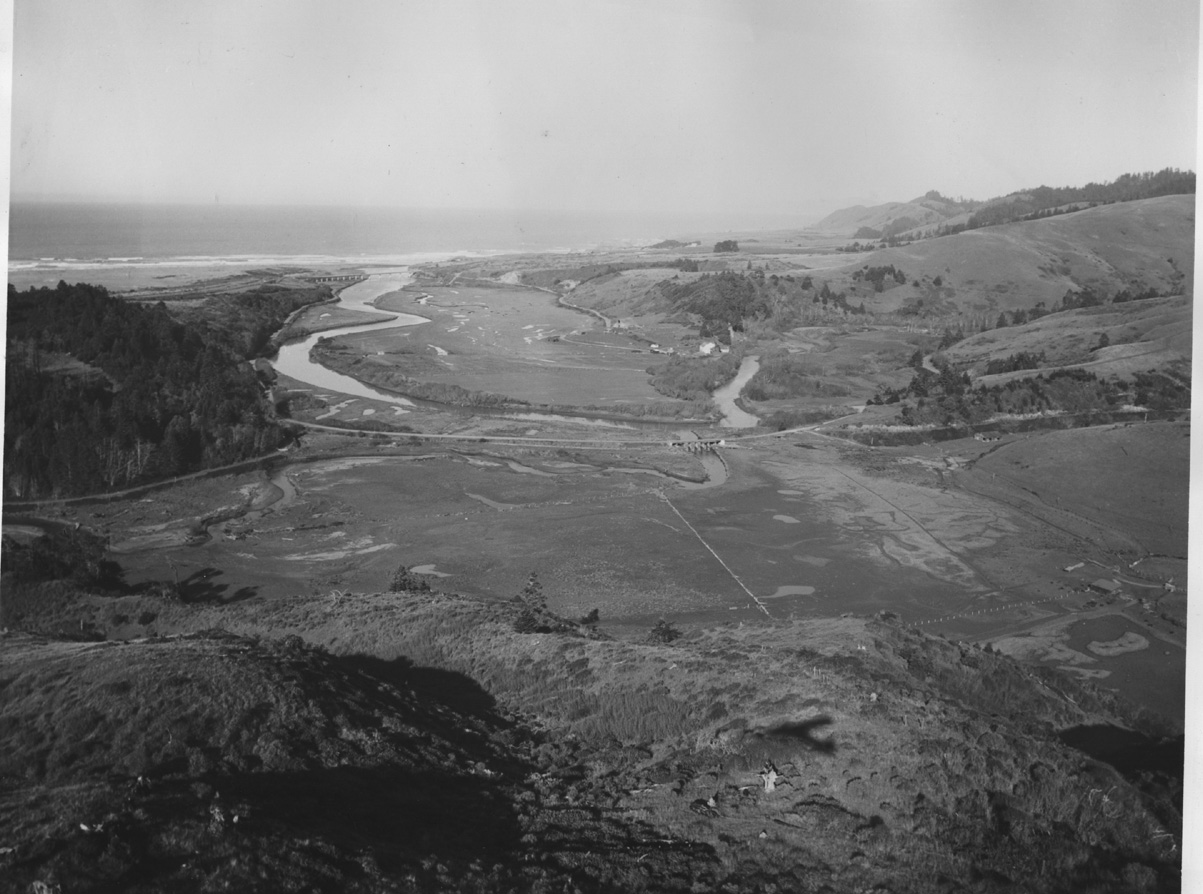 Click on image to enlarge (274K).
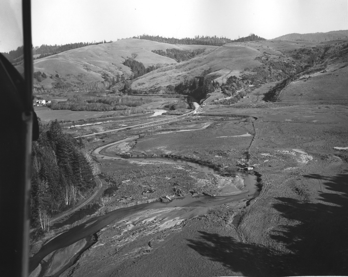 Click on image to enlarge (330K).
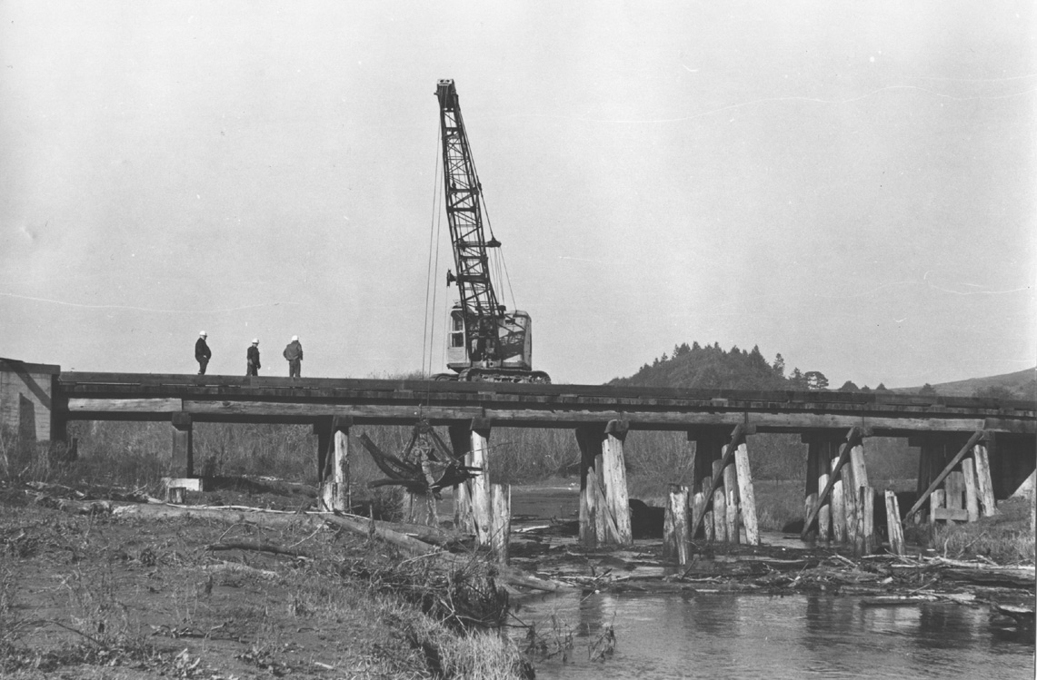 Click on image to enlarge (251K).
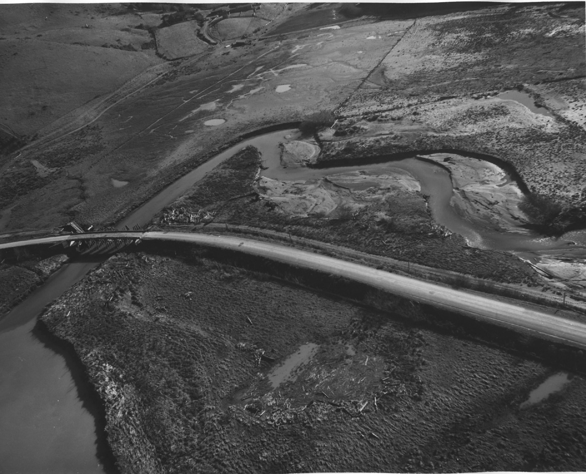 Click on image to enlarge (378K).
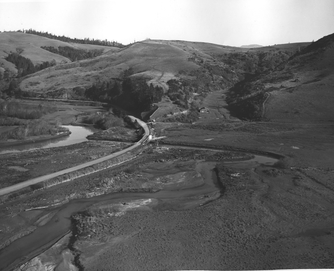 Click on image to enlarge (303K).
To learn more about this topic click here
| www.krisweb.com |