
| Area | Lower Ten Mile |
| Topic | Tour: Lower Ten Mile Photos Post 1964 Flood #2 (Perry Family) |
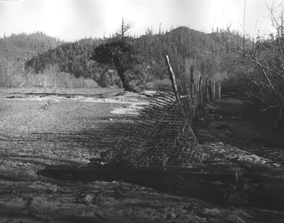
Fence downed by the 1964 flood along the lower Ten Mile River on the Perry Ranch, with silt extending across raspberry fields, in the vicinity of Mill Creek. Photo taken by Peter Stackpole and provided for use in KRIS courtesy of Margaret Perry.
The 1964 flood deposited huge quantities of soil on terraces in the lower Ten Mile River. Henry R. Smith (Margaret Perry's father) observes debris in the raspberry patch location. Part of Mill Creek is flowing by his feet but the channel may be braided. Mill Creek joins the main Ten Mile River just out of view. Silt terraces are 3-4 feet high. Photo taken by Peter Stackpole and provided for use in KRIS courtesy of Margaret Perry.
Henrietta Smith, Margaret Perry's grandmother, who moved here in 1930's, is shown here viewing the 1964 flood damage at the mouth of Mill Creek. Photo taken by Peter Stackpole and provided for use in KRIS courtesy of Margaret Perry.
Perry Ranch after the 1964 flood. The stream undercut the fence line and deposited silt and large woody debris. Photo taken by Peter Stackpole and provided for use in KRIS courtesy of Margaret Perry. Photo taken by Peter Stackpole and provided for use in KRIS courtesy of Margaret Perry.
Henry R Smith observing woody debris accumulated in the raspberry patch in the vicinity of Mill Creek after the 1964 flood. Some of the logs are log butts after timber harvest, and supplied salvage material. Margaret Perry said "it kept us in wood needed for fence posts for years." Photo taken by Peter Stackpole and provided for use in KRIS courtesy of Margaret Perry.
Looking to the east at main fork of the river, the old Ten Mile haul road is on the right side; on the left is the ranch road. The center, called the "pea flat", was covered with debris as a result of the 1964 flood. Extensive logging in the North Fork and Middle Fork Ten Mile just prior to 1964 lead to major sediment contributions. Deposition from the flood can also been seen in the field between the river and the road in the lower part of the photo. Alder seed was dumped there, and now huge alders grow there. Photo taken by Peter Stackpole and provided for use in KRIS courtesy of Margaret Perry.
The Perry Ranch after the 1964 flood in what was formerly the raspberry patch near Mill Creek , with a lone redwood in middle of the flat. Note woody debris and fencing material as well as tons of topsoil. among the debris. Photo taken by Peter Stackpole and provided for use in KRIS courtesy of Margaret Perry.
Fences out and berry vines covered with silt on the Perry Ranch after the 1964 flood. Note soil deposited by the flood is silty loam (not clay.) Photo taken by Peter Stackpole and provided for use in KRIS courtesy of Margaret Perry.
 Click on image to enlarge (343K).
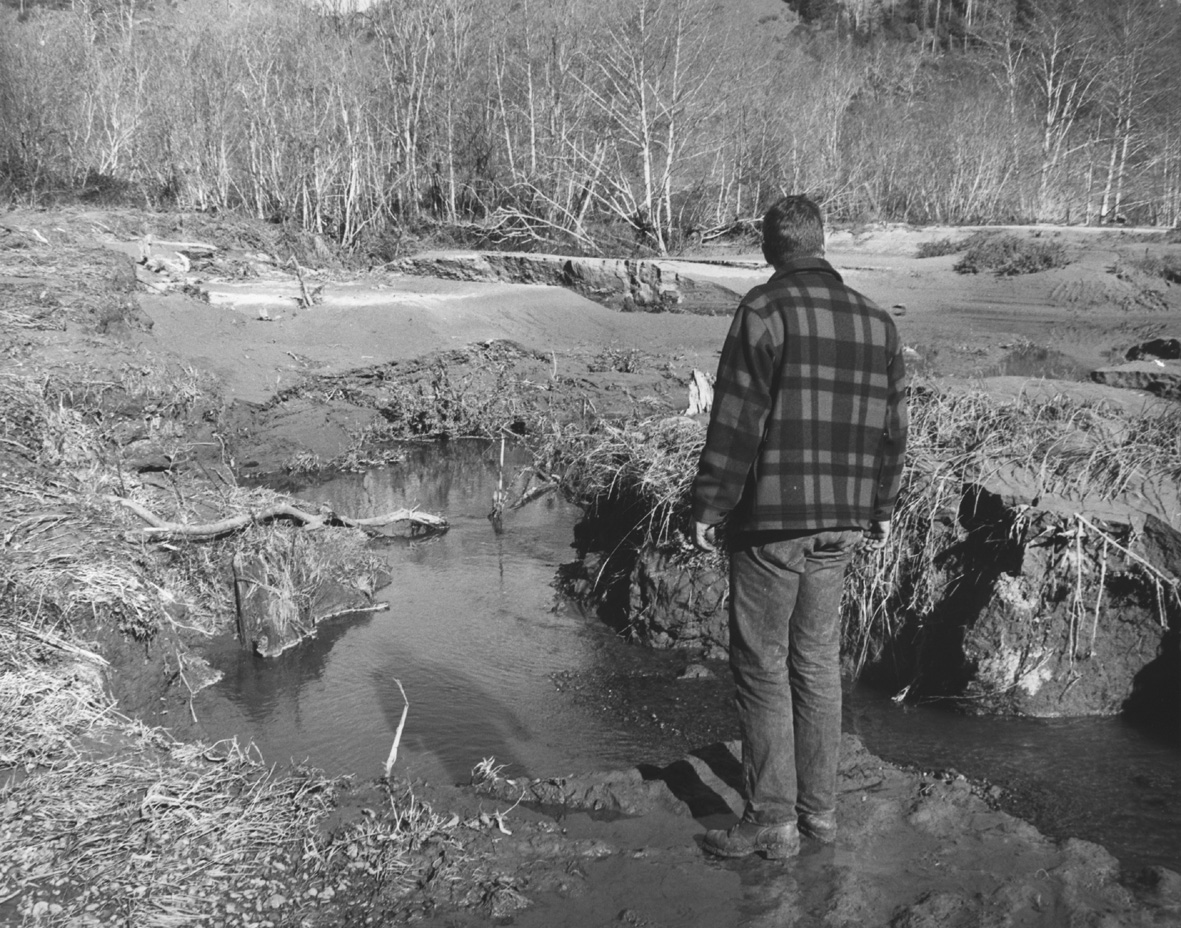 Click on image to enlarge (461K).
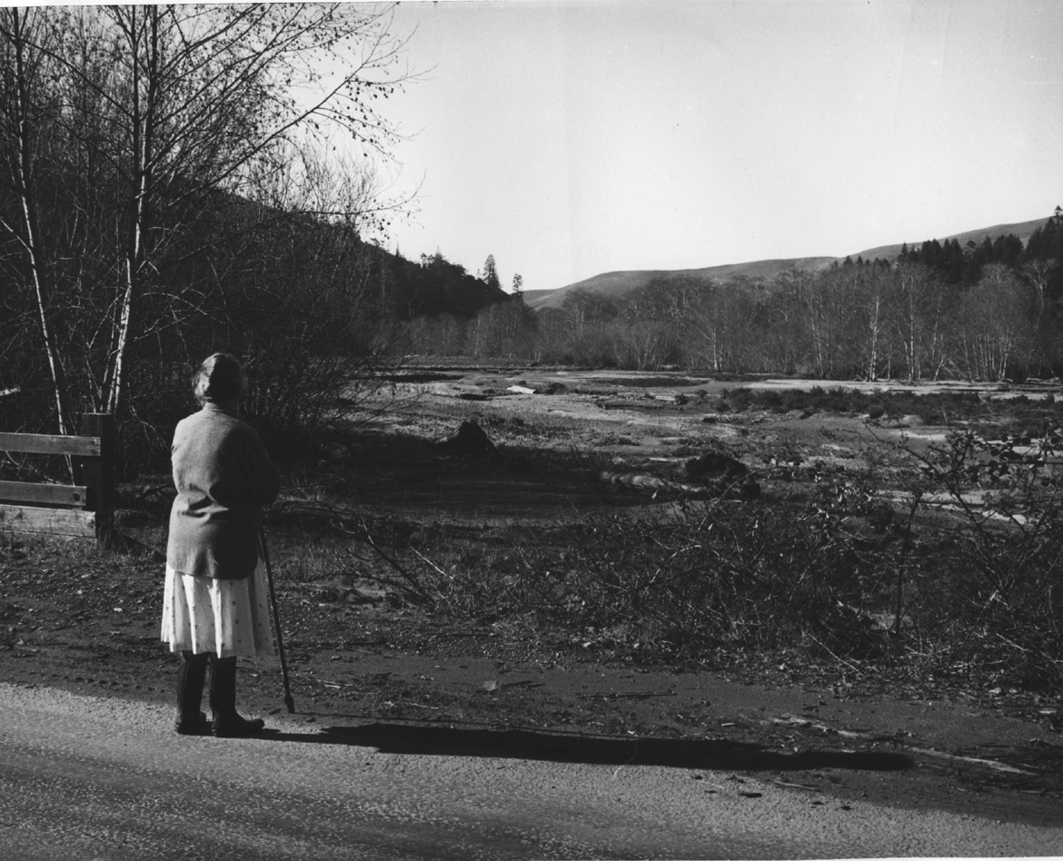 Click on image to enlarge (387K).
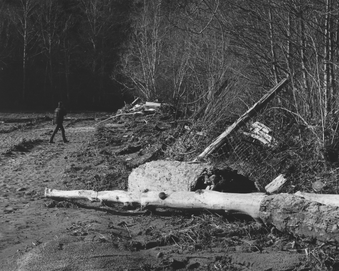 Click on image to enlarge (459K).
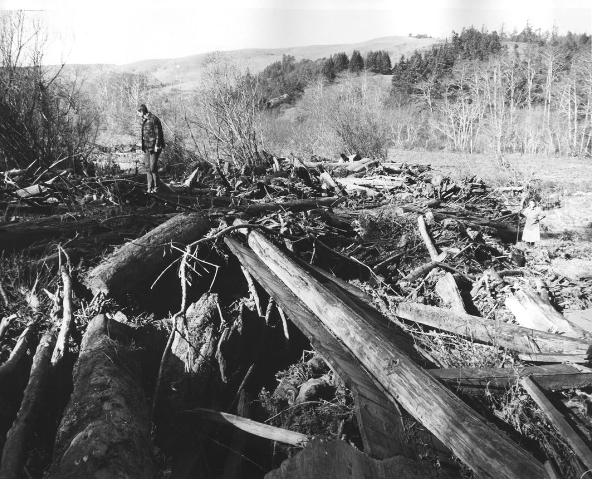 Click on image to enlarge (450K).
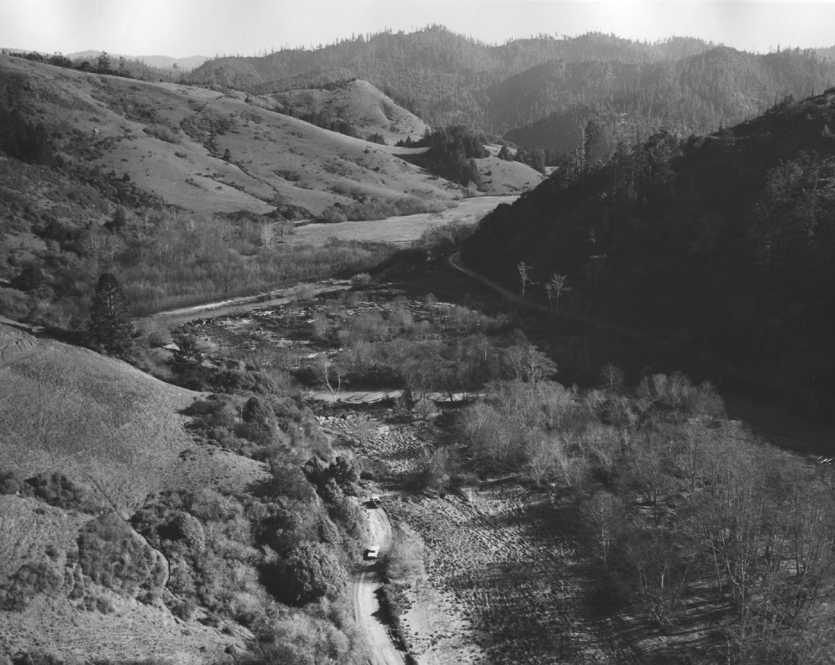 Click on image to enlarge (349K).
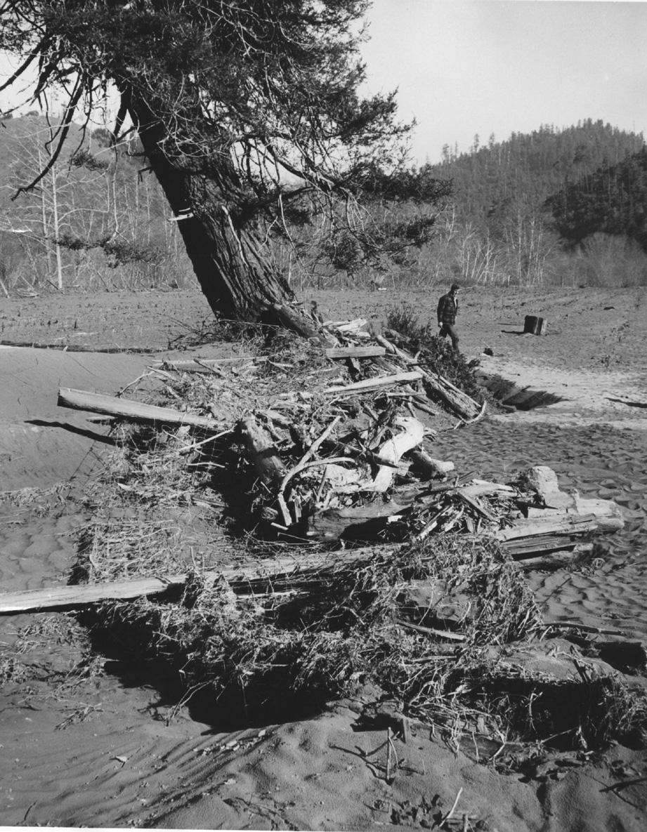 Click on image to enlarge (498K).
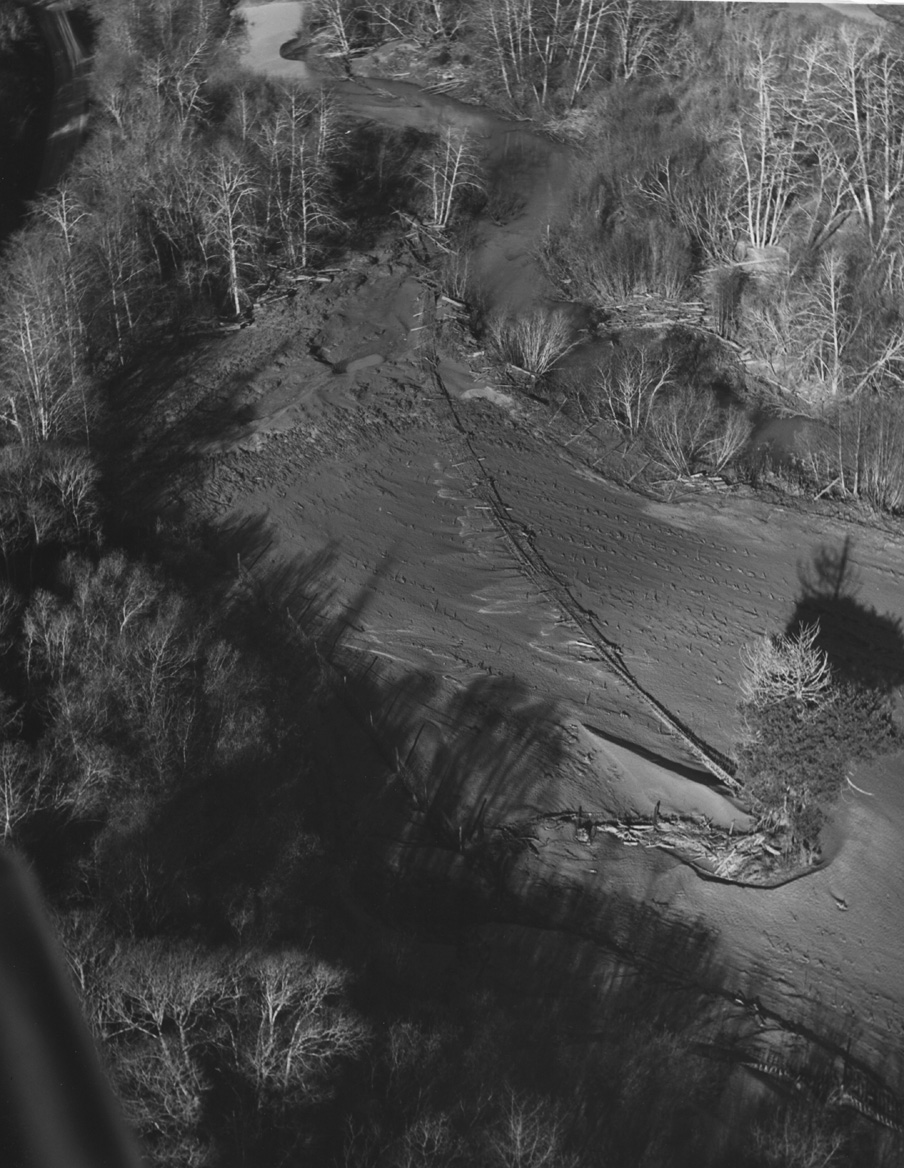 Click on image to enlarge (337K).
To learn more about this topic click here
| www.krisweb.com |