
| Area | Lower Ten Mile |
| Topic | Tour: Lower Ten Mile Photos Post 1964 Flood #3 (Perry Family) |
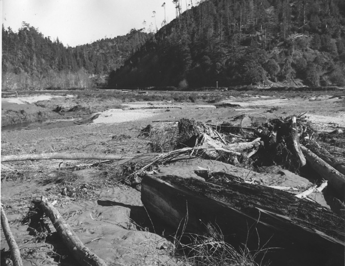
This picture shows woody debris and silt terraces deposited by the 1964 flood along lower Mill Creek, looking northeast. Note that recent logging upslope in this photo was not clear cut. Photo taken by Peter Stackpole and provided for use in KRIS courtesy of Margaret Perry.
A closer view of the lower Ten Mile River at the pea flat, a major depositional area in the 1964 flood. Much of the soil and woody debris likely came from recently logged areas in the North Fork and Middle Fork Ten Mile watersheds. Photo taken by Peter Stackpole and provided for use in KRIS courtesy of Margaret Perry.
Soil deposits at the Perry Ranch at the raspberry flat indicate extremely high sediment transport of the Ten Mile River as a result of the 1964 flood. Photo taken by Peter Stackpole and provided for use in KRIS courtesy of Margaret Perry.
This aerial photo was taken just after the 1964 flood and shows lower Mill Creek and sediment deposits. Photo taken by Peter Stackpole and provided for use in KRIS courtesy of Margaret Perry.
This aerial photo shows the lower Ten Mile River just after the 1964 flood with major deposits of fines in the margin. The old Stoddard Ranch, next owned by Harwood, is now the Parker Family Tree Farm. Photo taken by Peter Stackpole and provided for use in KRIS courtesy of Margaret Perry.
More views of Mill Creek, the Mainstem, and the raspberry patch. Photo taken by Peter Stackpole and provided for use in KRIS courtesy of Margaret Perry.
Looking to the south over Stoddard Ranch and the Mainstem, with Mill Creek and raspberry patch. Photo taken by Peter Stackpole and provided for use in KRIS courtesy of Margaret Perry.
Mill Creek, the Mainstem Ten Mile, and the raspberry patch just after the 1964 flood. Photo taken by Peter Stackpole and provided for use in KRIS courtesy of Margaret Perry.
 Click on image to enlarge (155K).
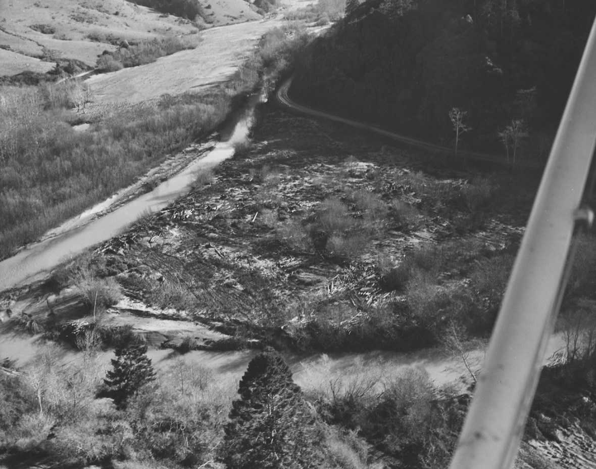 Click on image to enlarge (354K).
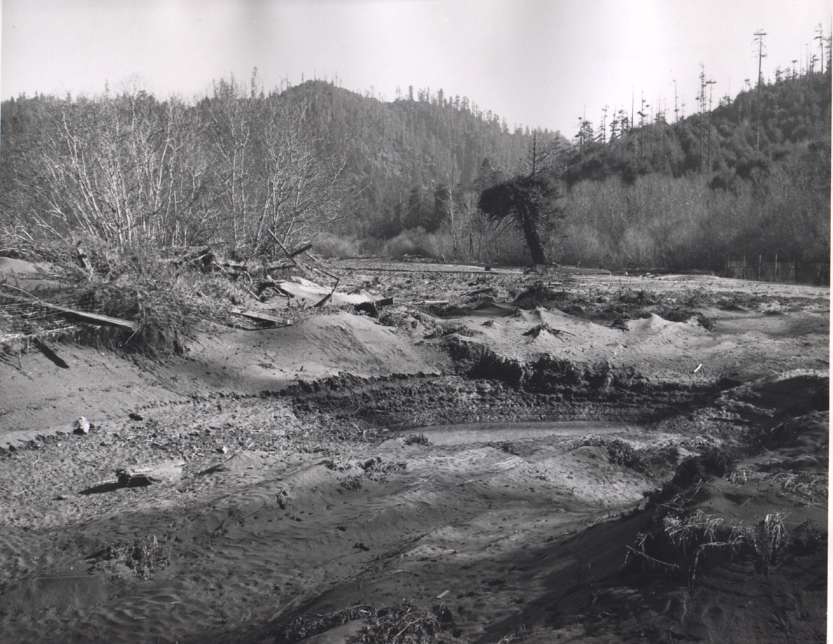 Click on image to enlarge (447K).
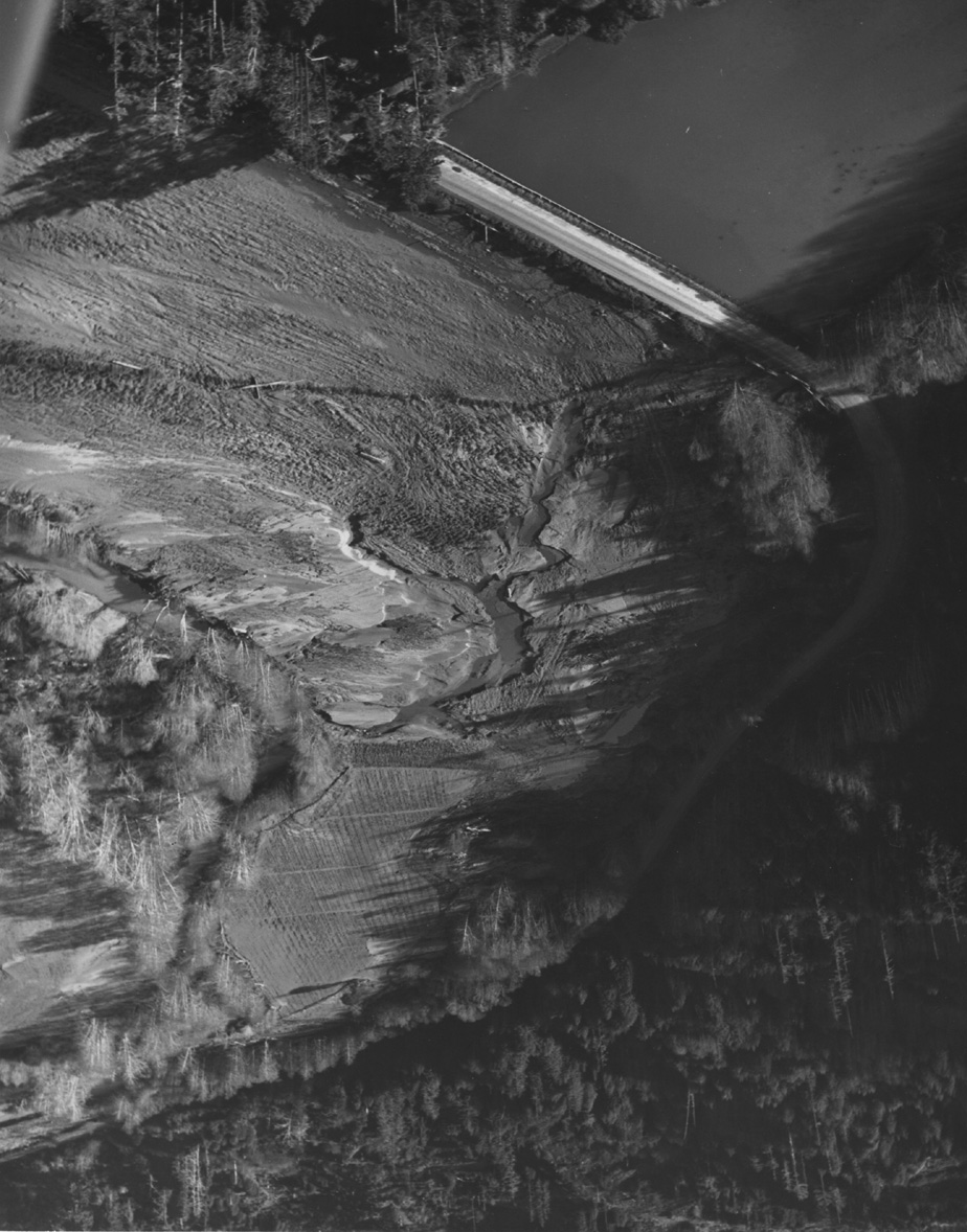 Click on image to enlarge (317K).
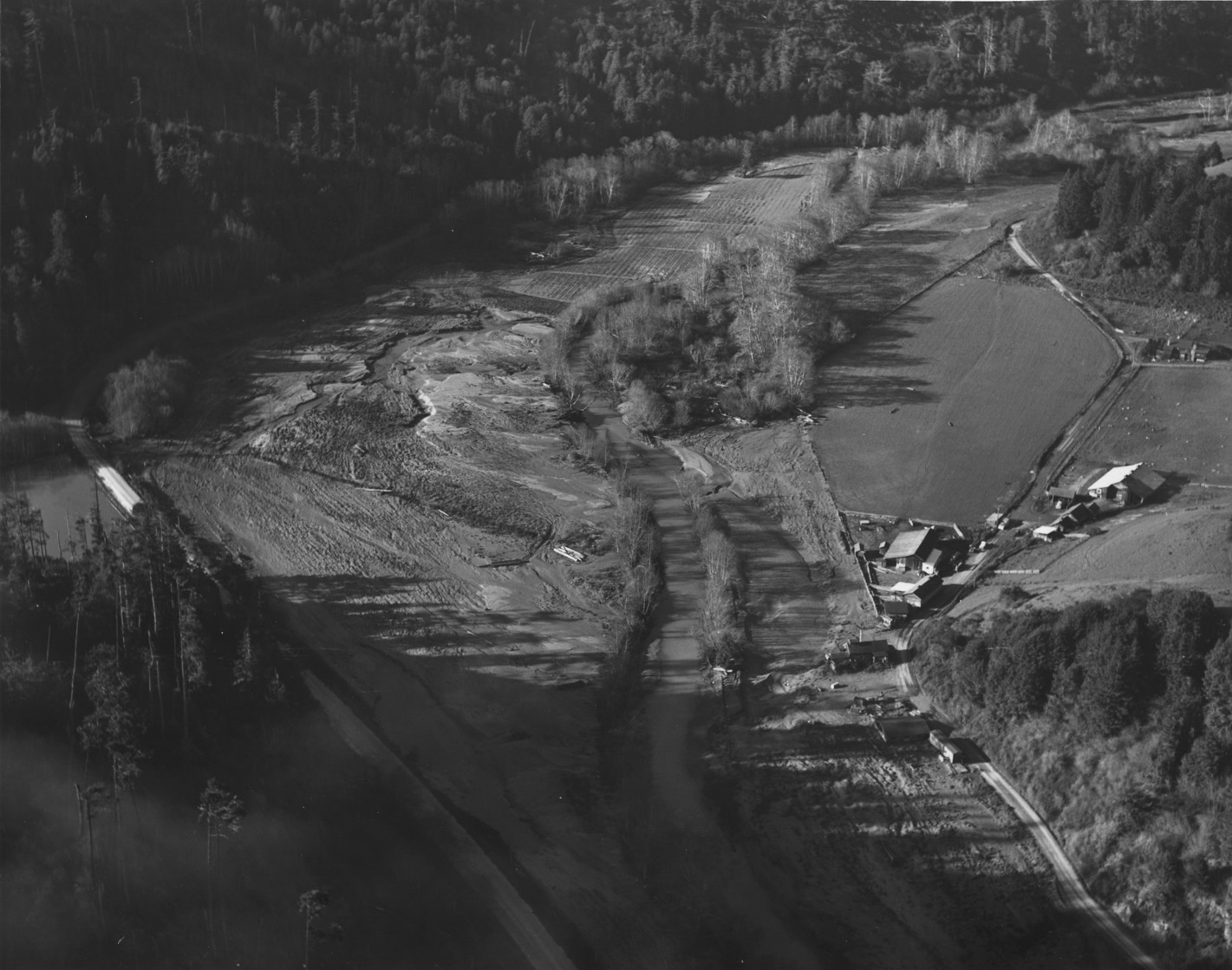 Click on image to enlarge (311K).
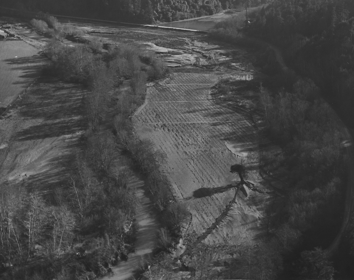 Click on image to enlarge (286K).
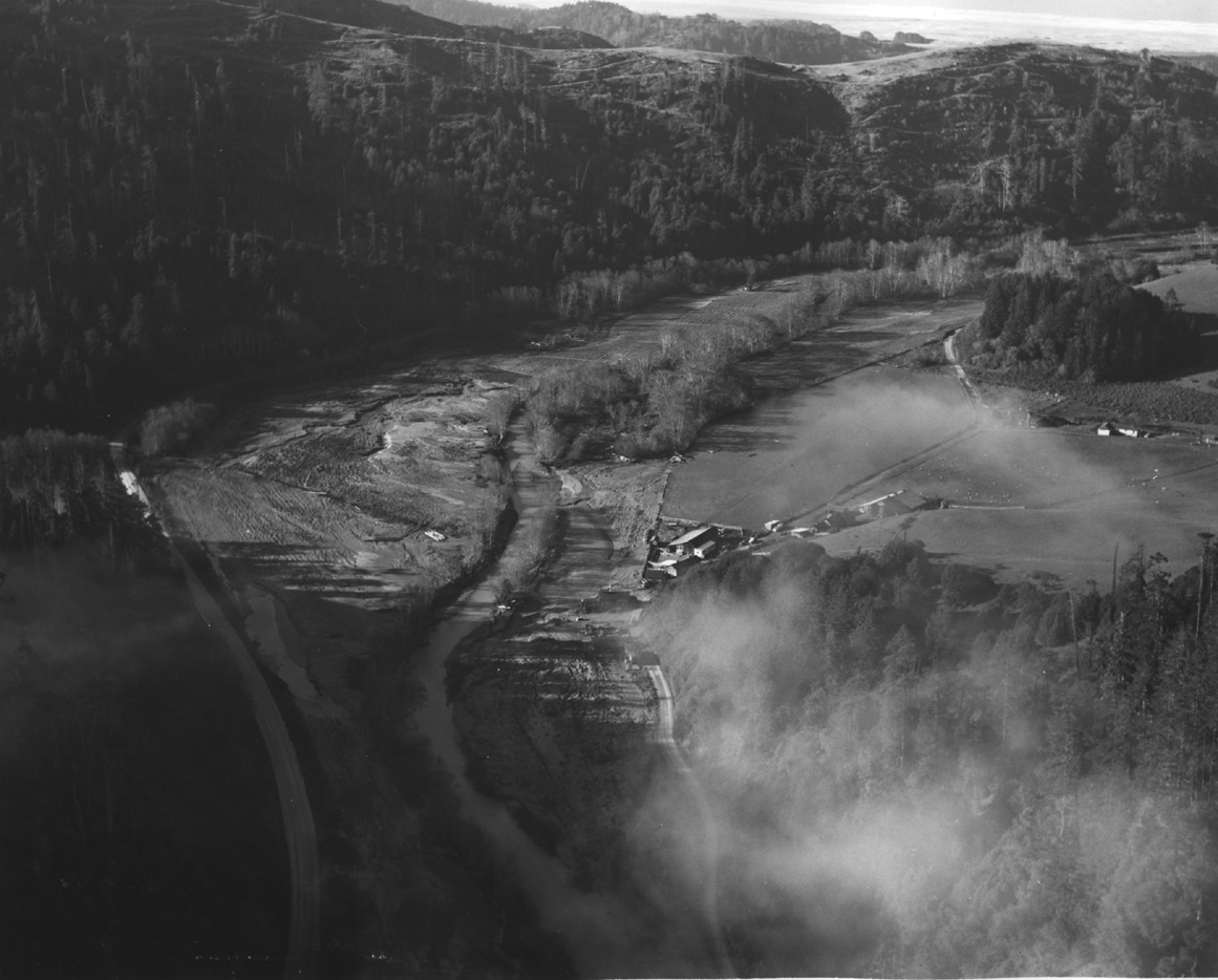 Click on image to enlarge (250K).
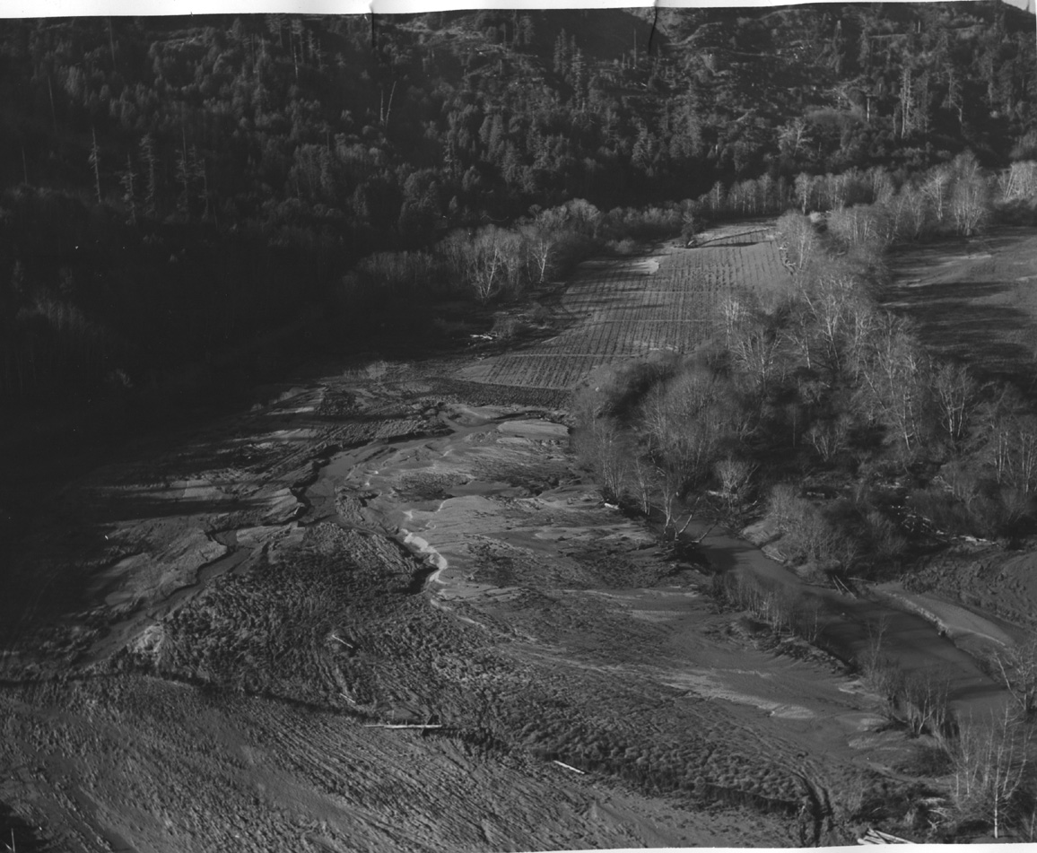 Click on image to enlarge (326K).
To learn more about this topic click here
| www.krisweb.com |