
| Area | Lower Ten Mile |
| Topic | USFS VegTypes: Campbell Creek Calwater 1994 |
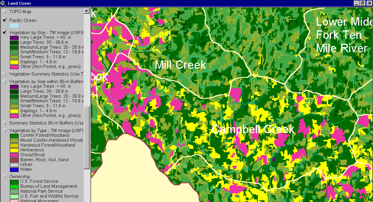
This image from the KRIS Ten Mile River Map project shows USFS vegetation and stand types for the Campbell Creek Calwater planning watershed derived from a 1994 Landsat (see Info Links for more background information). The large areas of Non-Forest in the west of the Calwater are agricultural lands, but to the east they represent recent timber harvests as do large components of saplings (yellow). See Picture #2 for a 1999 aerial photo and Picture #4 for a map of recent timber harvests. Scale of accuracy for stands is one hectare.
This is an aerial photo of the Campbell Creek Calwater Planning watershed as of 1999 provided by Matthews and Associates (2001).
This Landsat Vegetation view is taken from the KRIS Ten Mile Map project and shows most of the Campbell Creek Calwater as well as the Mouth of the Ten Mile River and Mill Creek Calwater planning watersheds and the Middle Fork, lower North Fork and part of the South Fork basin. See Picture #1 for a key to vegetation types.
The map above comes from the KRIS Ten Mile Map project and shows timber harvests as mapped by the California Department of Forestry by year from 1990-2000. The timber harvests shown above for the Campbell Creek Calwater have been approved but may not have been implemented when the 1999 aerial photo (Picture #2) was taken.
 Click on image to enlarge (99K).
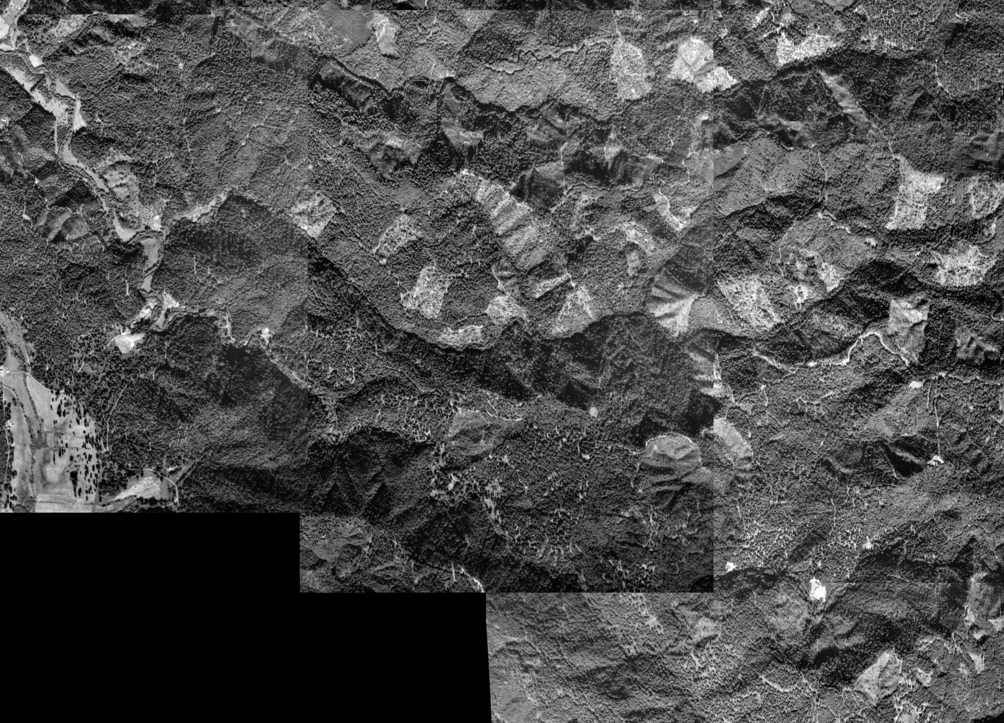 Click on image to enlarge (755K).
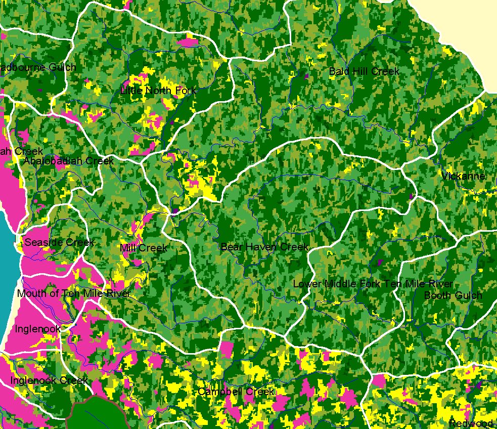 Click on image to enlarge (344K).
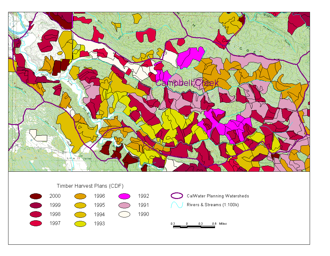 Click on image to enlarge (141K).
To learn more about this topic click here
| www.krisweb.com |