
| Area | Lower Ten Mile |
| Topic | USFS VegTypes: Mill Creek Calwater 1994 |
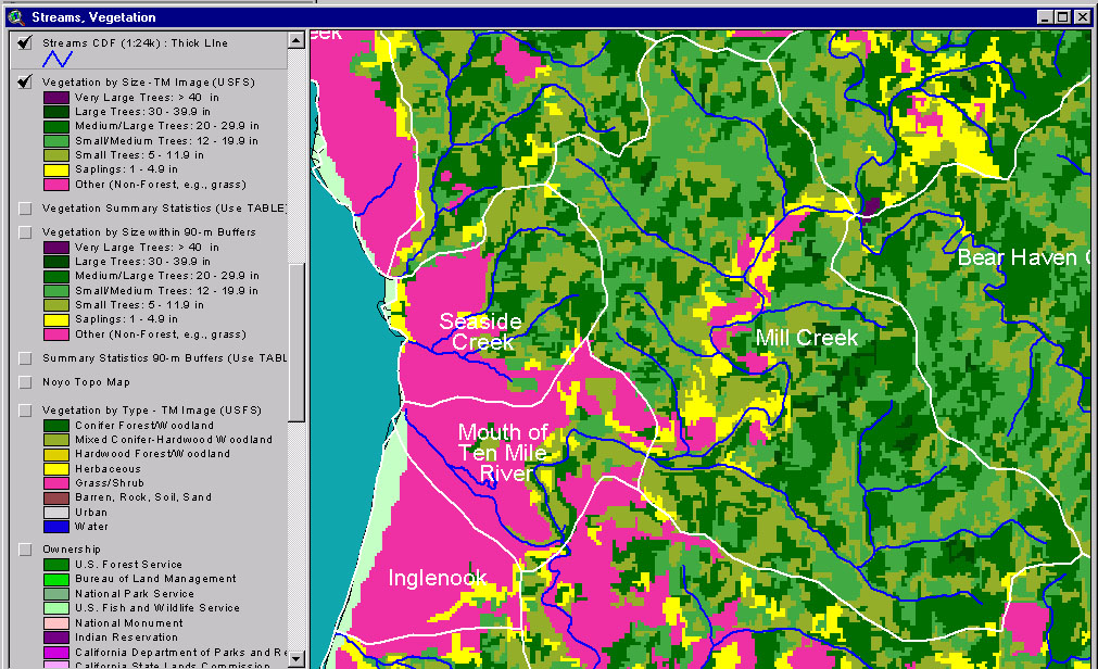
This image from the KRIS Ten Mile River Map project shows USFS vegetation and stand types for the Mill Creek and Mouth of the Ten Mile River Calwater planning watershed derived from a 1994 Landsat (see Info Links for more background information). Scale of accuracy for stands is one hectare. The Mill Creek Calwater includes a reach of the lower mainstem Ten Mile River as well. The Non-Forest component along the mainstem Ten Mile is grass areas used for agriculture. Early seral conditions such as Small Trees and Small-Medium trees indicate recent logging. See next Picture for aerial photo.
This is a 1999 aerial photo of the Mouth of the Ten Mile River and Mill Creek watershed to the south provided by Matthews and Associates (2001). Much of the Mill Creek Calwater is showing regrowth from past timber harvest. The photos have not been ortho-corrected and show some variation in contrast due to the different times of day that photos were taken.
This Landsat Vegetation view is taken from the KRIS Ten Mile Map project and shows the Mouth of the Ten Mile River and Mill Creek Calwater planning watersheds and those in the Middle Fork, lower North Fork and part of the South Fork basin. See Picture #1 for key to vegetation types.
This is a 1941 aerial photo of the lower Ten Mile River and Mill Creek watershed to the south provided by Matthews and Associates (2001). Much of this Calwater was logged in the years just prior to the photo.
The map above comes from the KRIS Ten Mile Map project and shows timber harvests as mapped by the California Department of Forestry by year from 1992-2000. The timber harvests shown above for the Mill Creek Calwater Planning watershed have been approved but may not have been implemented when the 1999 aerial photo (Picture #2) was taken.
 Click on image to enlarge (352K).
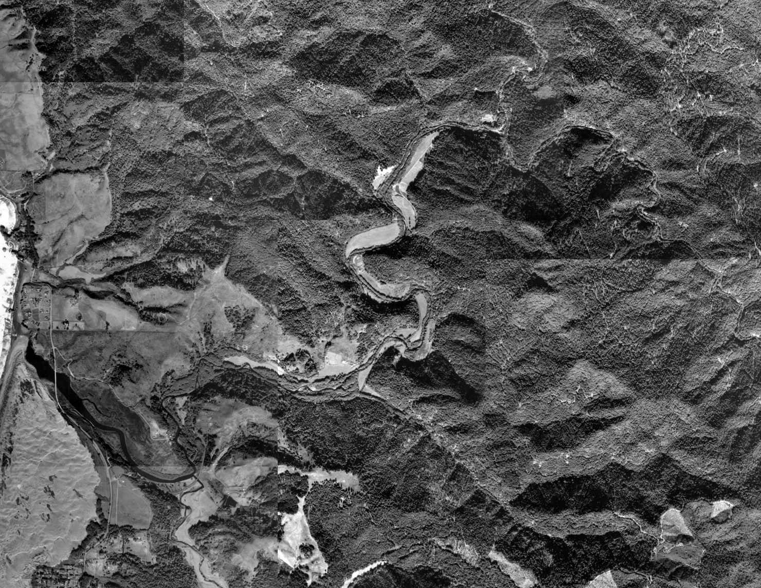 Click on image to enlarge (796K).
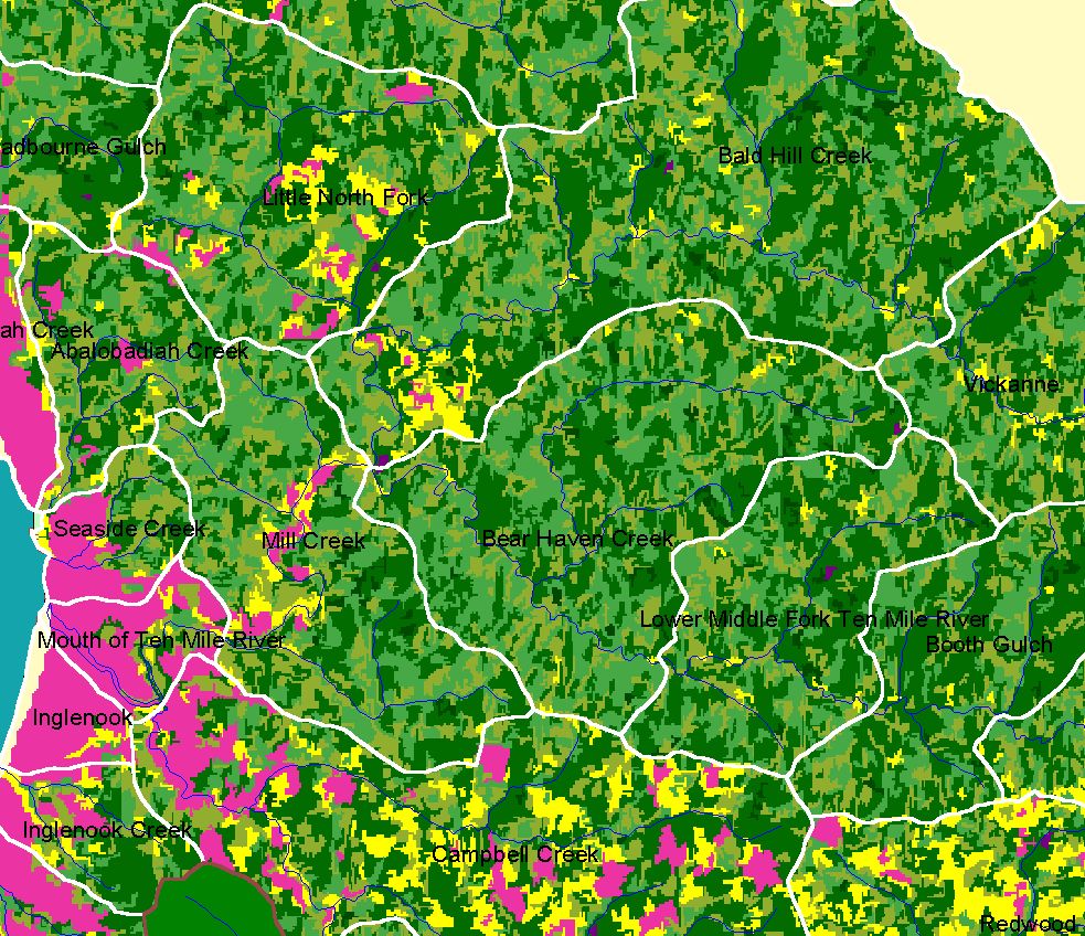 Click on image to enlarge (344K).
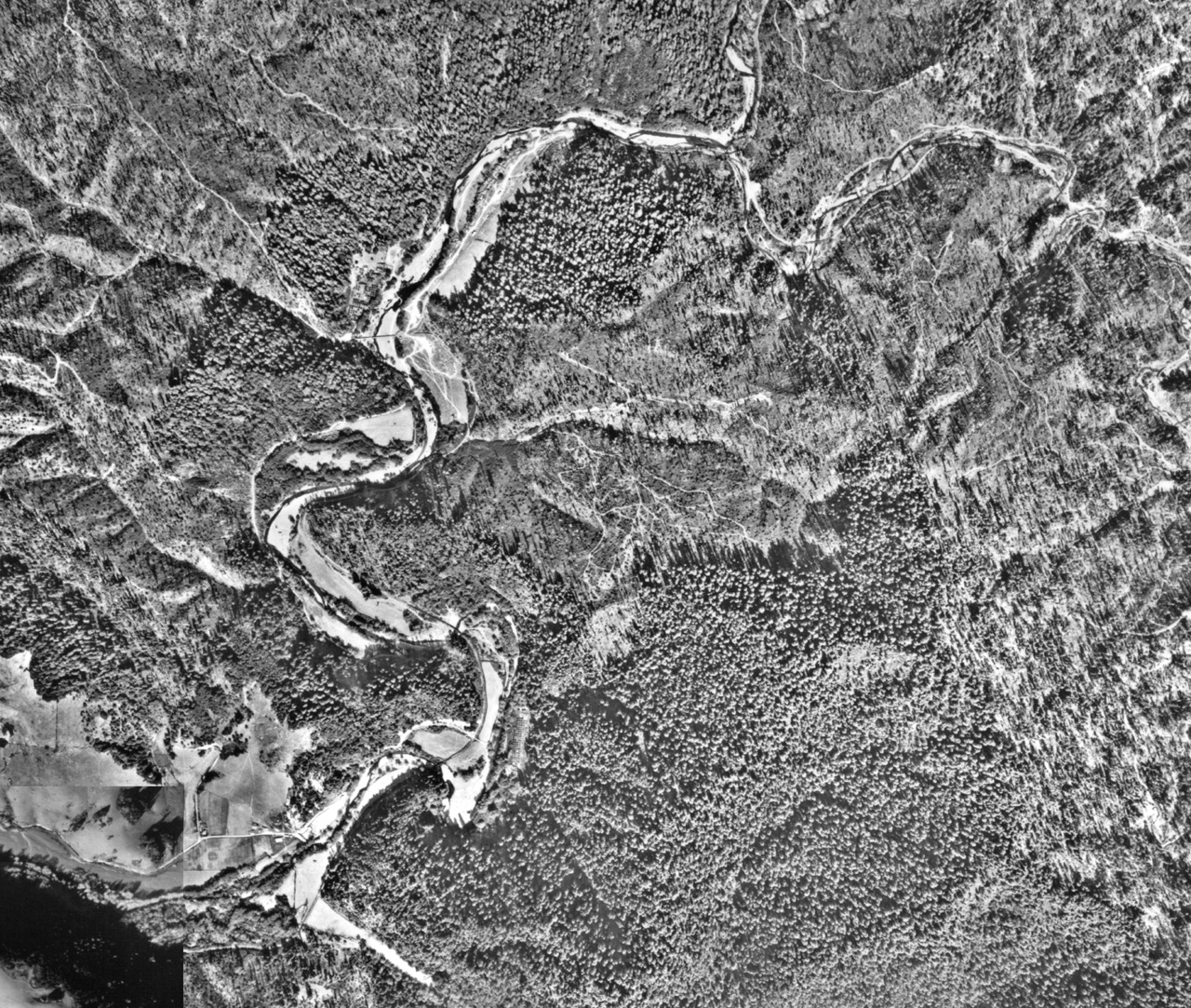 Click on image to enlarge (838K).
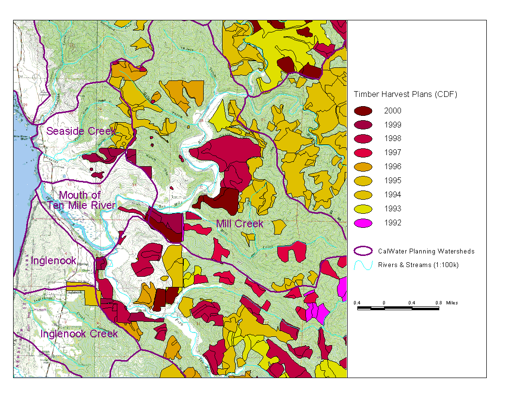 Click on image to enlarge (183K).
To learn more about this topic click here
| www.krisweb.com |