
| Area | Middle Fork Ten Mile |
| Topic | Temperature: All MFT Sites, MWAT by Year 1993-2001 |
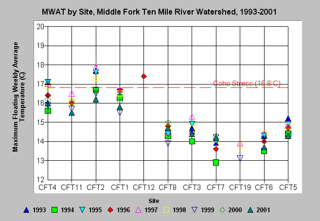
| Caption: Maximum floating weekly average temperature (MWAT) is charted above for each site in the Middle Fork Ten Mile Watershed for available data in the years 1993-2001. Sites begin near the confluence with the North Fork (CFT4) and are listed in order along the mainstem Middle Fork to the most headwaters site (CFT8). Sites following to the right are tributary locations. See Picture for a map. Coho stress value of 16.8 C comes from Welsh et al. (2001). See Info Links for more information. | |
 |
To learn more about this topic click here .
To view the table with the chart's data, click Chart Table web page.
To download the table with the chart's data, click temp_mwat_cft.dbf (size 1,977 bytes) .
To see meta information about the data table used for this topic click here
To view the table with the chart's source data, click Source Table web page.
To download the table with the chart's source data, click temp_mwat.dbf (size 4,946 bytes)
| www.krisweb.com |