
| Area | Middle Fork Ten Mile |
| Topic | Middle Fork Ten Mile River Basin Maps |
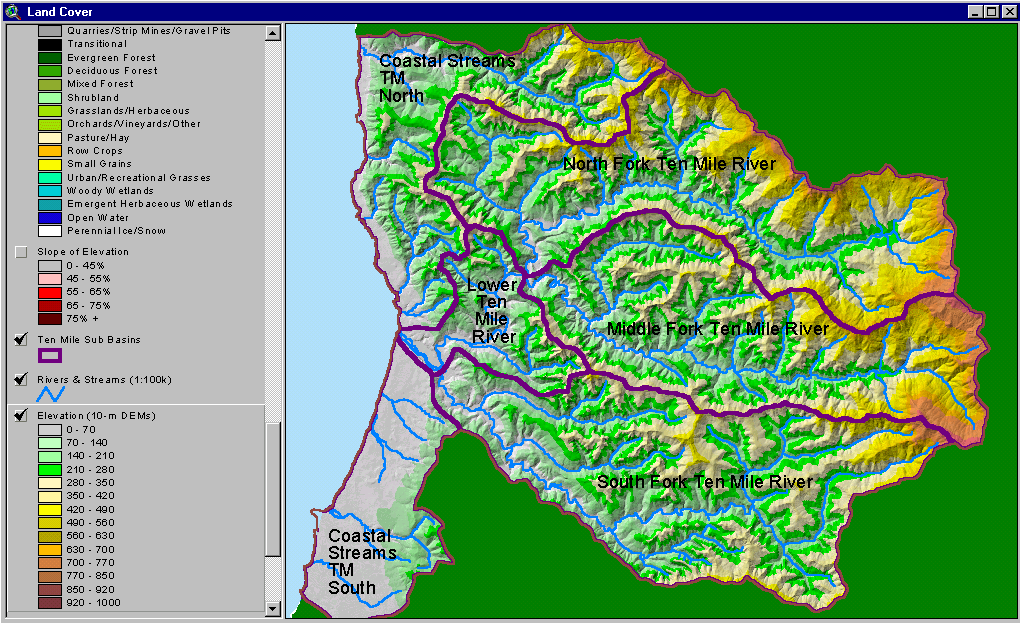
The image above is from the KRIS Ten Mile Map project and shows the elevation of the Ten Mile watershed and sub-basins as they appear in the KRIS database. The Middle Fork Ten Mile basin has low relief in the west but the eastern part of the watershed rises to over 3,000 feet in elevation.
The image above is from the KRIS Ten Mile Map project and shows stream gradient. While the Middle Fork Ten Mile River itself is very low gradient (<2%), most tributaries are too steep to be optimal habitat for coho. Bear Haven Creek in the west of the basin is an exception with extended reaches also below 2% in grade.
The image above is from the KRIS Ten Mile Map project and shows slopes over 45% on a gray scale hillshade backdrop. Slopes are steeper in the western portion of the sub-basin along the inner gorge of the Middle Fork above Bear Haven Creek and also within the lower Bear Haven watershed itself.
The image above is from the KRIS Ten Mile Map project and shows timber harvest plans approved between 1990 and 2000. Timber harvests were most concentrated in the southeastern part of the watershed and in the Bear Haven watershed in this period. THP data provided by the California Department of Forestry.
The image above is from the KRIS Ten Mile Map project and shows vegetation as interpreted from a 1994 Landsat image by the U.S. Forest Service Remote Sensing Lab. As of 1994, the Middle Fork Ten Mile sub-basin had indications of extensive areas of very early seral vegetation in the southeast portion of the watershed associated with timber harvest. In the northeast, larger contiguous non-forest areas represent natural grasslands associated with the Central Belt Franciscan formation. Mid-seral conditions prevailed in the north and central portions of this sub-basin as of 1994.
The map image above shows all Hawthorne Timber Company monitoring sites in the Middle Fork Ten Mile basin as CFT.
 Click on image to enlarge (259K).
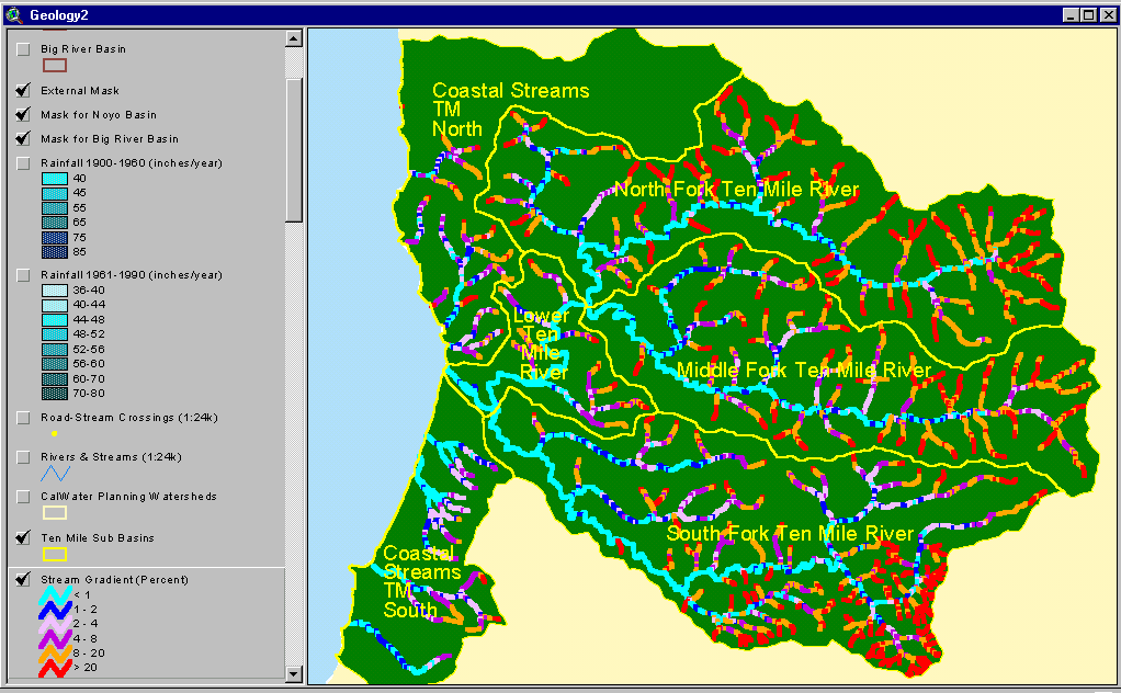 Click on image to enlarge (61K).
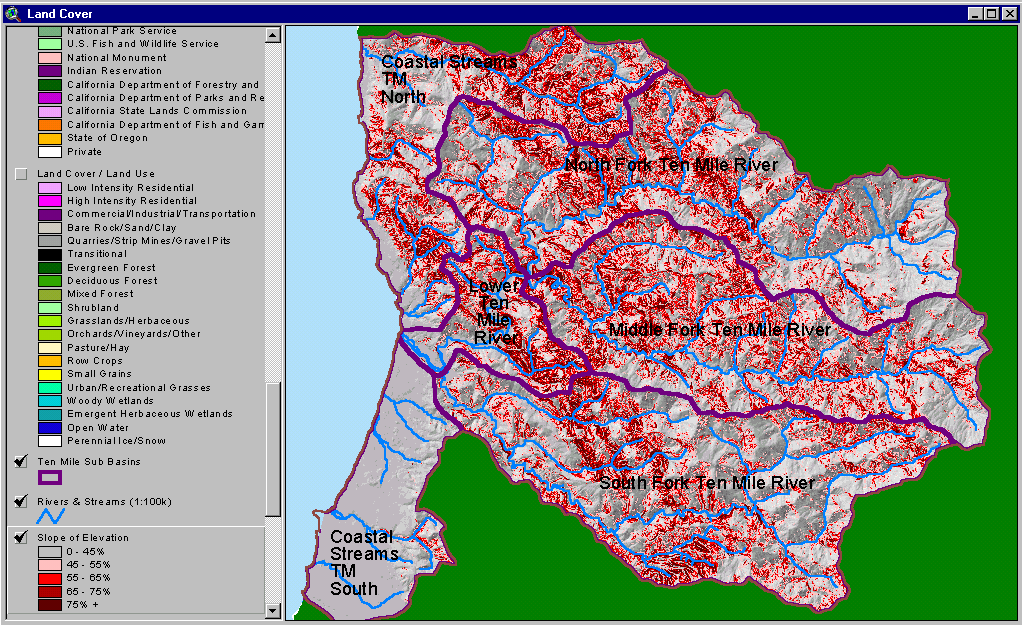 Click on image to enlarge (153K).
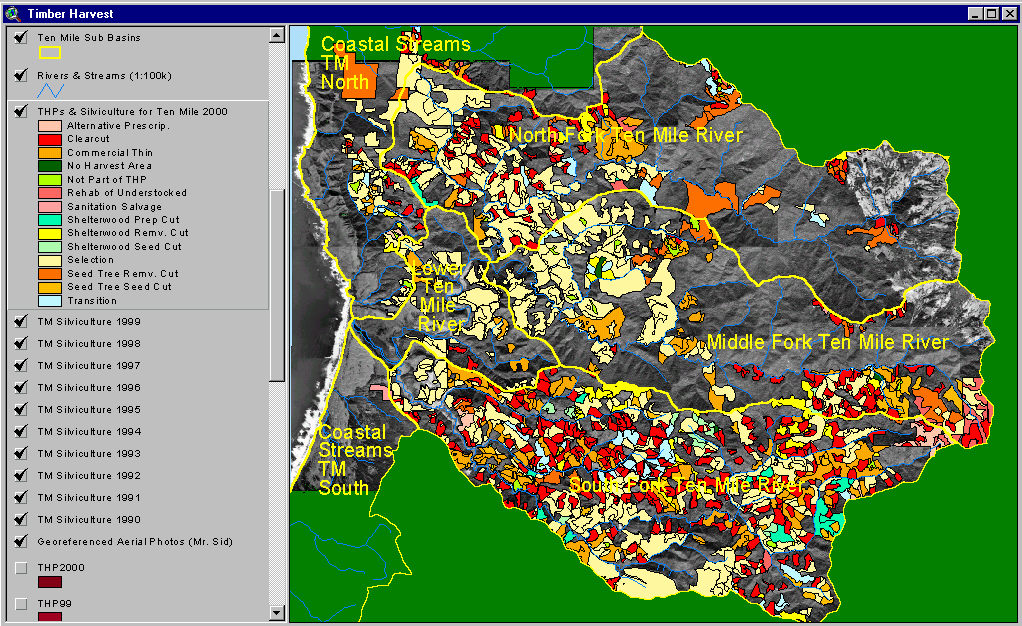 Click on image to enlarge (215K).
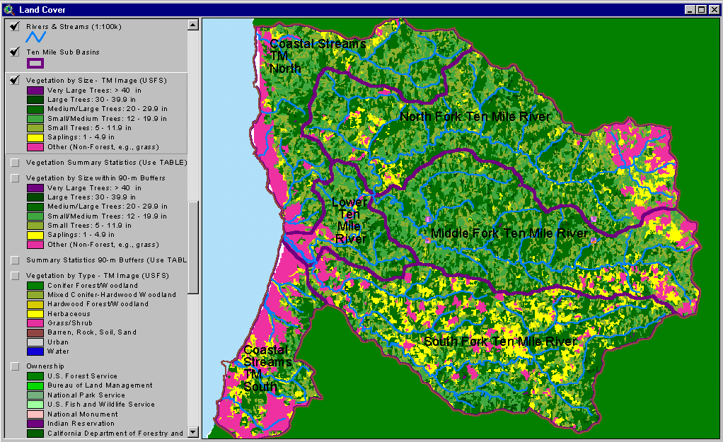 Click on image to enlarge (97K).
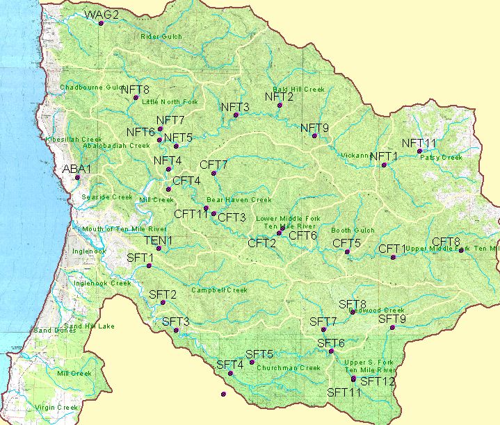 Click on image to enlarge (144K).
To learn more about this topic click here
| www.krisweb.com |