
| Area | Middle Fork Ten Mile |
| Topic | Timber Harvest: Matthews by MF sub-basin (Percent) 1933-1999 |
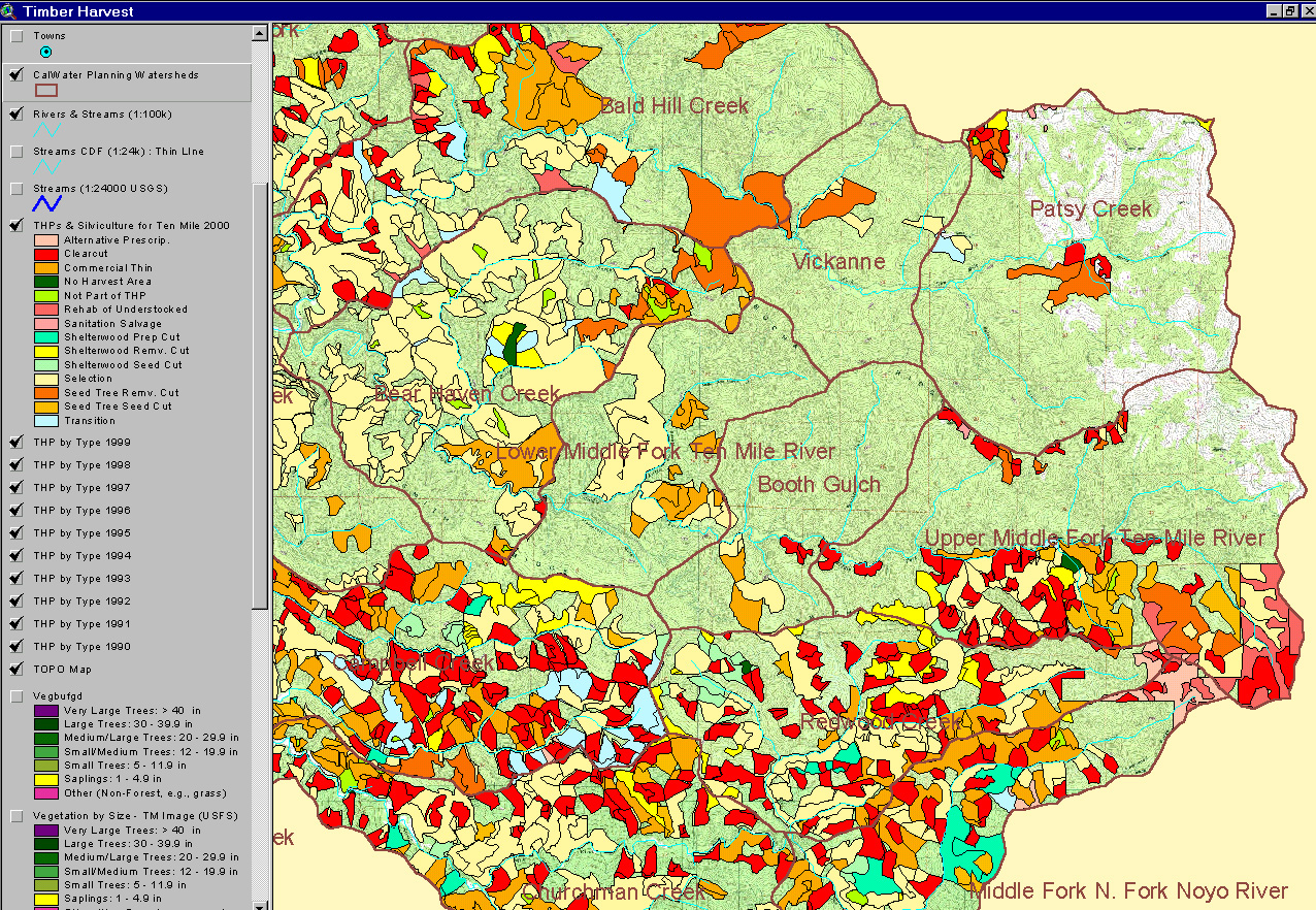
The map image above is from the KRIS Ten Mile Map project in ArcView and shows timber harvests from 1990 to 1999. The layer is derived from data provided by the California Department of Forestry. The legend at left shows timber harvest plans (THP) as they were approved by year (plans in 1990 = THP90). Calwater boundaries are shown for geographic reference.
The image above shows timber harvests of different historical periods as presented in Matthews and Associates (2000) as Figure 31. Analysis was done using aerial photos. The most recent timber harvest plan data (post-1988) comes from the California Department of Forestry.
 Click on image to enlarge (1,126K).
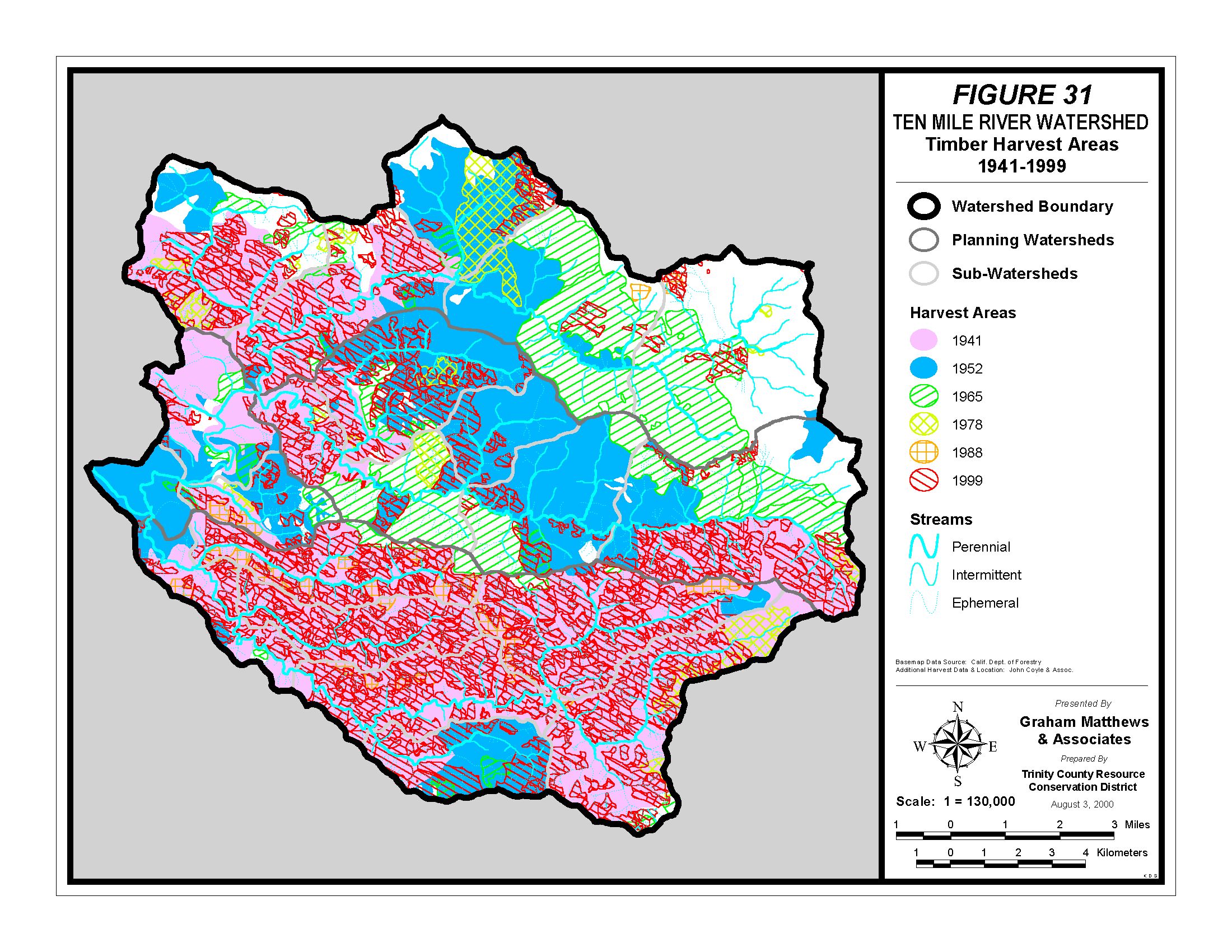 Click on image to enlarge (785K).
To learn more about this topic click here
| www.krisweb.com |