
| Area | Middle Fork Ten Mile |
| Topic | USFS VegTypes: Bear Haven Calwater 1994 |
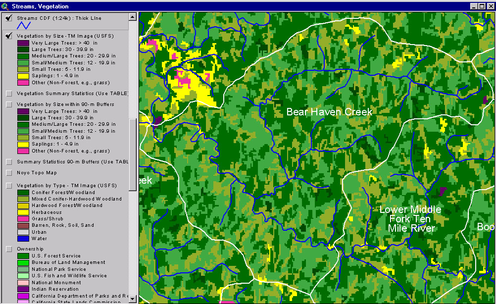
This image from the KRIS Ten Mile River Map project shows USFS vegetation and stand types for the Bear Haven Calwater planning watershed derived from a 1994 Landsat (see Info Links for more background information). Scale of accuracy for stands is one hectare. This Cal Water is dominated by Medium-Large Trees (20-29.9") but has substantial components of smaller tree sizes as well, but no Non-Forest and only small patches of Saplings (1-4.9").
This map view from the KRIS Ten Mile River project shows the Bear Haven Calwater watershed but also those surrounding units. See the previous Picture for a key to colors representing forest size and vegetation types.
 Click on image to enlarge (337K).
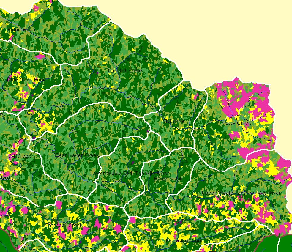 Click on image to enlarge (315K).
To learn more about this topic click here
| www.krisweb.com |