
| Area | North Fork Ten Mile |
| Topic | USFS VegTypes: Bald Hill Creek (NF Ten Mile River) Calwater 1994 |
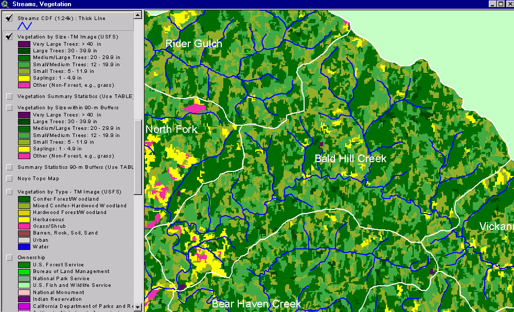
This image from the KRIS Ten Mile River Map project shows USFS vegetation and stand types for the Bald Hill Creek (Ten Mile River) Calwater planning watershed derived from a 1994 Landsat (see Info Links for more background information). Scale of accuracy for stands is one hectare. Substantial Small Tree and Small-Medium trees, suggests timber harvest in the previous 20 years. See next Picture for a 1999 aerial photo.
This is a 1999 aerial photo of the Bald Hills Creek (lower mainstem North Fork Ten Mile River) Calwater provided by Matthews and Associates (2001). The change in contrast across the image is as a result of joining aerial photos with different shading. Some logging has taken place between the time of the Landsat and the time of the photo.
This map view from the KRIS Ten Mile River project shows the Bald Hill Creek Calwater watershed but also those to the south, east and west. See the previous Picture for a key to colors representing forest size and vegetation types.
 Click on image to enlarge (356K).
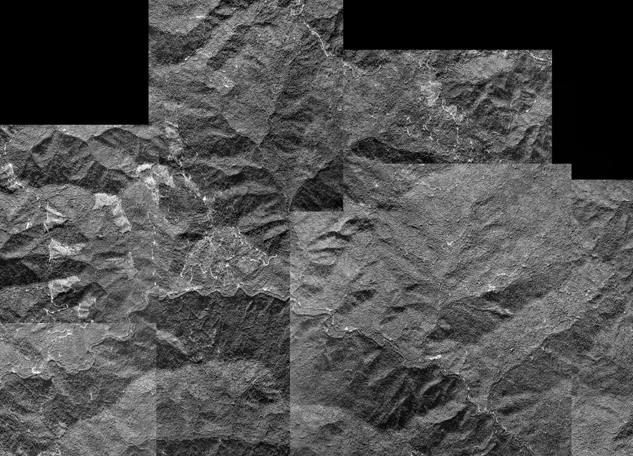 Click on image to enlarge (641K).
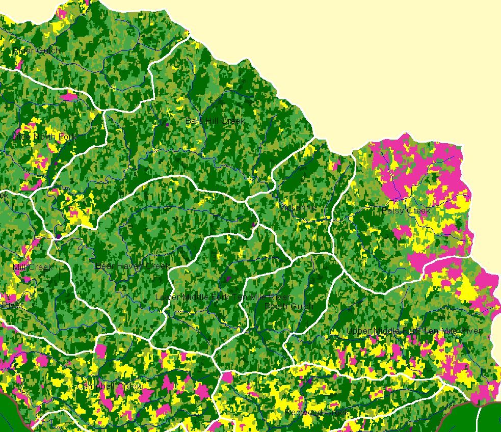 Click on image to enlarge (315K).
To learn more about this topic click here
| www.krisweb.com |