
| Area | North Fork Ten Mile |
| Topic | USFS VegTypes: Little NF Ten Mile Calwater 1994 |
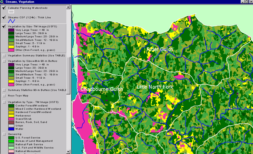
This image from the KRIS Ten Mile River Map project shows USFS vegetation and stand types for the Little North Fork (Ten Mile River) Calwater planning watershed derived from a 1994 Landsat (see Info Links for more background information). Scale of accuracy for stands is one hectare. The Non-Forest component is largely a result of timber harvests just prior to 1994. Substantial Small Tree and Small-Medium trees, suggests timber harvest in the previous 20 years. See next Picture for a 1999 aerial photo.
This is a 1999 aerial photo of the Little North Fork Ten Mile River Calwater provided by Matthews and Associates (2001). Much of this Calwater was logged in the years just prior to the photo.
This map view from the KRIS Ten Mile River project shows the Little North Fork Calwater watershed but also those to the south, east and west. See the previous Picture for a key to colors representing forest size and vegetation types.
Patch clear cuts in the North Fork Ten Mile River watershed shown in a 1998 photo. Pictures courtesy of Friends of the Ten Mile River.
 Click on image to enlarge (368K).
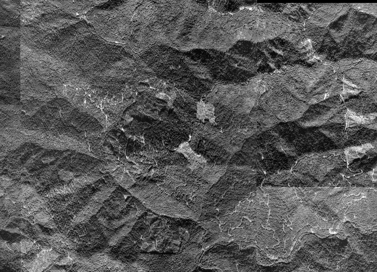 Click on image to enlarge (712K).
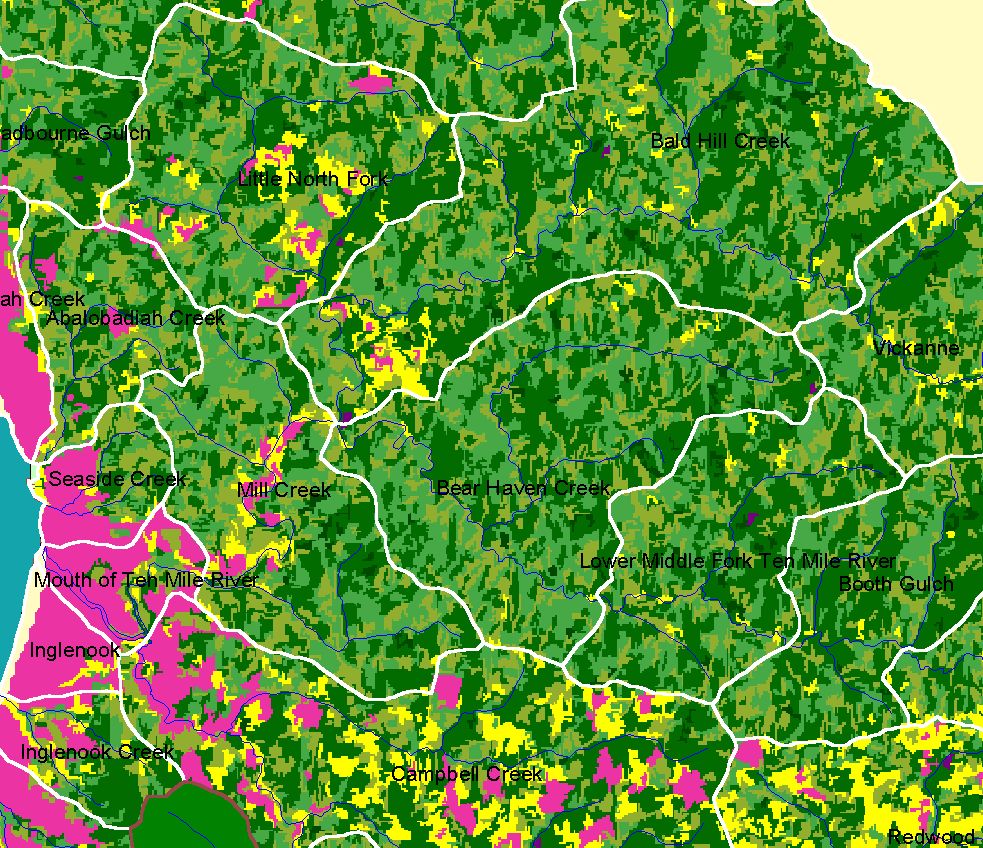 Click on image to enlarge (344K).
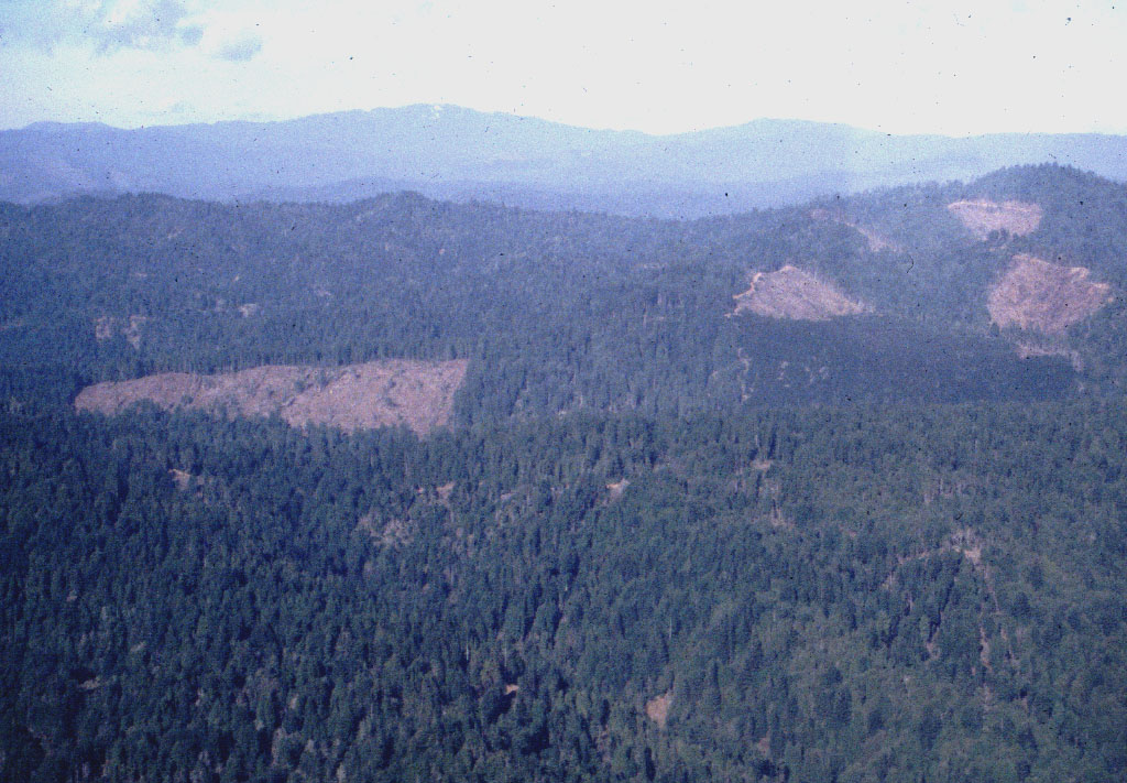 Click on image to enlarge (215K).
To learn more about this topic click here
| www.krisweb.com |