
| Area | South Fork Ten Mile |
| Topic | Habitat: Wood and Scour Formed Habitat by Area, SF and Tributaries |
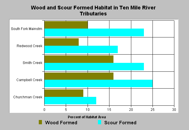
| Caption: The percent of habitat area formed by scour or large wood is charted above for all surveyed South Fork Ten Mile sub-basin streams. Large wood formed habitat is included in the scour formed habitat value. The highest and lowest values for these parameters were found in the North Fork Ten Mile sub-basin. Large wood formed habitat varied from 0% to 18% (Little North Fork), and scour formed habitat from 3% (Buckhorn and Gulch 23) to 28% (North Fork Mainstem) at the time of surveys in 1995-96. Streams are sorted by basin area. CRWQCB (2001) found a correlation between these parameters and where coho have persisted in the Ten Mile River basin. See Info Links for more information. | |
 |
To learn more about this topic click here .
To view the table with the chart's data, click Chart Table web page.
To download the table with the chart's data, click hab_sft_wq.dbf (size 3,481 bytes) .
To see meta information about the data table used for this topic click here
| www.krisweb.com |