
| Area | South Fork Ten Mile |
| Topic | South Fork Ten Mile River Basin Maps |
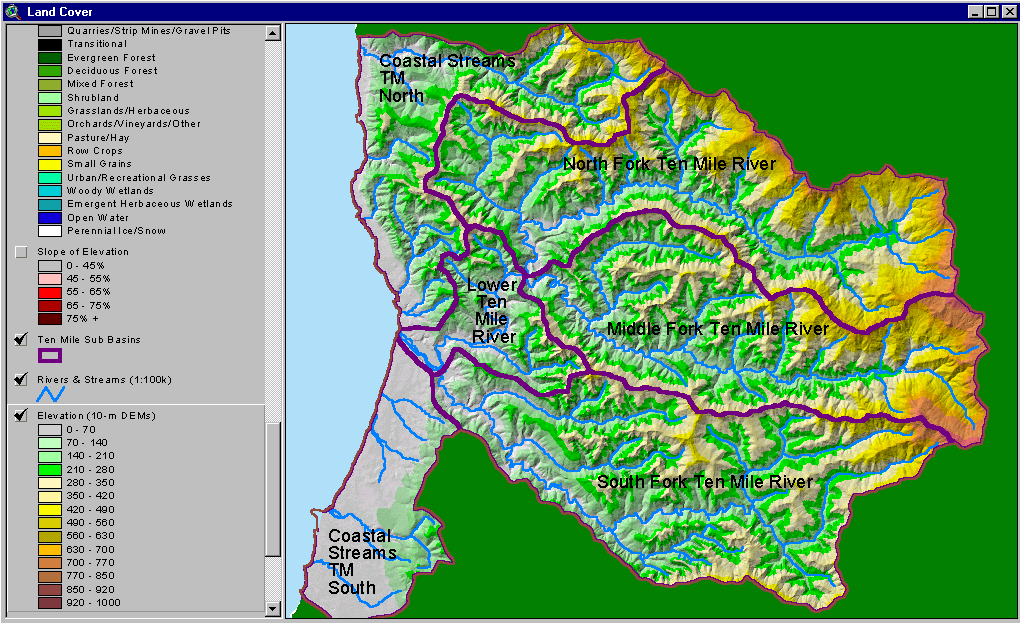
The image above is from the KRIS Ten Mile Map project and shows the elevation of the Ten Mile watershed and sub-basins as they appear in the KRIS database. The South Fork Ten Mile basin has lower relief in the west but the northeastern fringe of the watershed rises to over 3,000 feet in elevation.
The image above is from the KRIS Ten Mile Map project and shows stream gradient. The South Fork Ten Mile River itself is very low gradient (<2%) and optimal for coho salmon. Major tributaries with gradient suitable for coho in this sub-basin are Churchman, Smith, Campbell and Redwood Creeks..
The image above is from the KRIS Ten Mile Map project and shows slopes over 45% on a gray scale hillshade backdrop. Slopes are steepest in the western portion of the sub-basin in the Smith and Campbell Creek watersheds.
The image above is from the KRIS Ten Mile Map project and shows timber harvest plans approved between 1990 and 2000. According to Matthews (2000), 76% of the South Fork basin was harvested in this period. THP data provided by the California Department of Forestry.
The image above is from the KRIS Ten Mile Map project and shows vegetation as interpreted from a 1994 Landsat image by the U.S. Forest Service Remote Sensing Lab. Most of the South Fork Ten Mile sub-basin had indications of extensive areas of very early seral vegetation associated with recent timber harvest. There are no natural grasslands in this sub-basin.
The map image above shows all Hawthorne Timber Company monitoring sites in the South Fork Ten Mile basin as SFT.
The image above is from the KRIS Ten Mile Map project and shows patterns of vegetation as of 1999. The tiled aerial mosaic was originally created by Matthews (2000) and provided for use.
 Click on image to enlarge (259K).
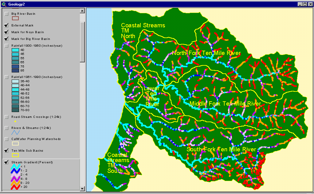 Click on image to enlarge (61K).
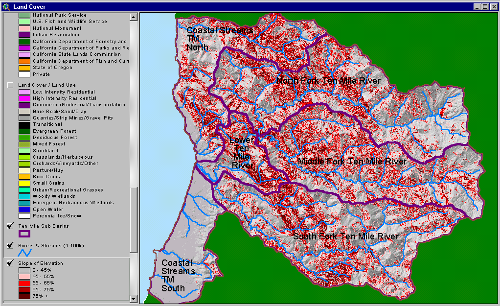 Click on image to enlarge (153K).
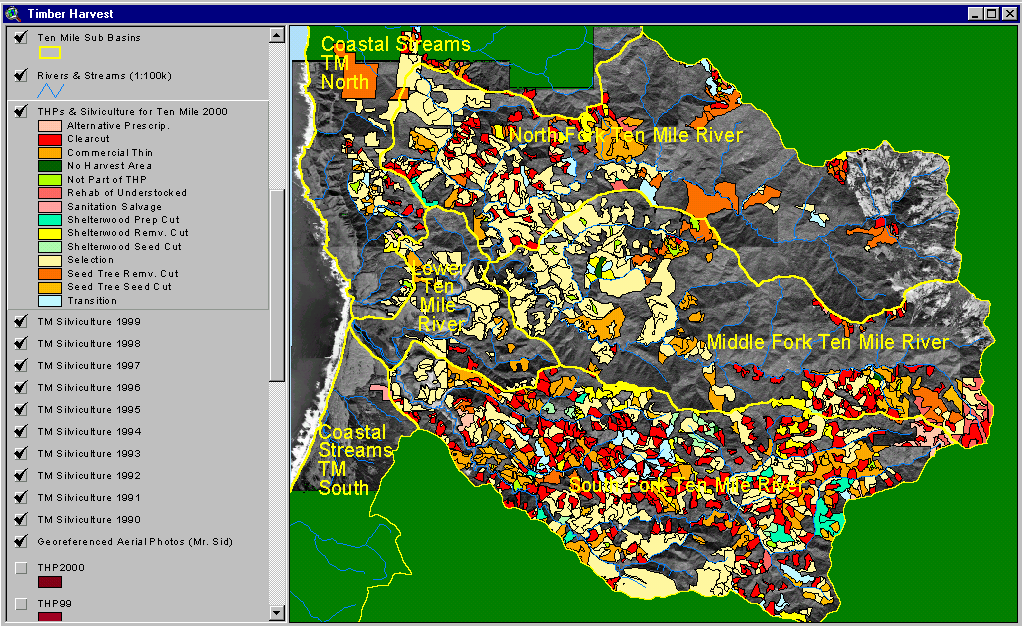 Click on image to enlarge (215K).
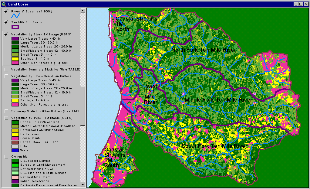 Click on image to enlarge (97K).
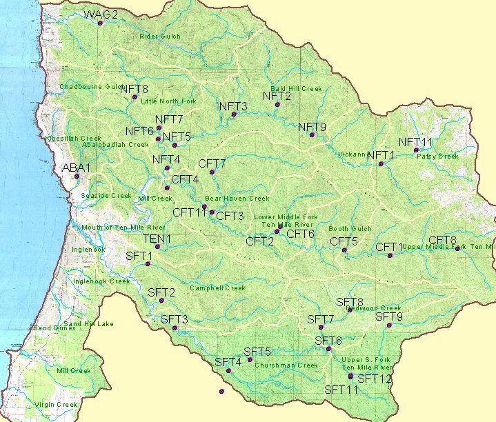 Click on image to enlarge (144K).
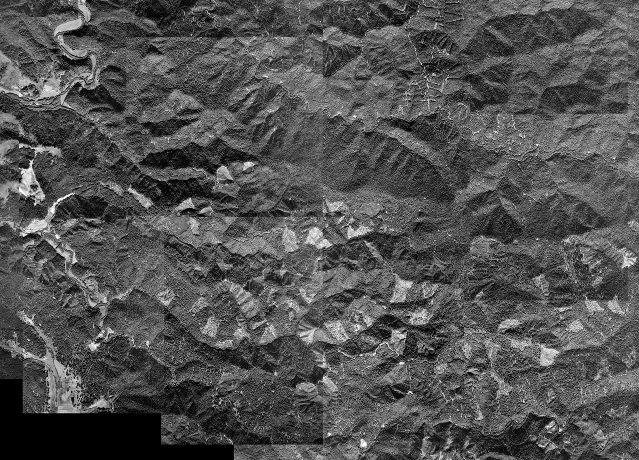 Click on image to enlarge (705K).
To learn more about this topic click here
| www.krisweb.com |