
| Area | South Fork Ten Mile |
| Topic | Tour: Aerial Photos and Map Images of Timber Harvest SF Ten Mile Basin |
 Click on image to enlarge (567K).
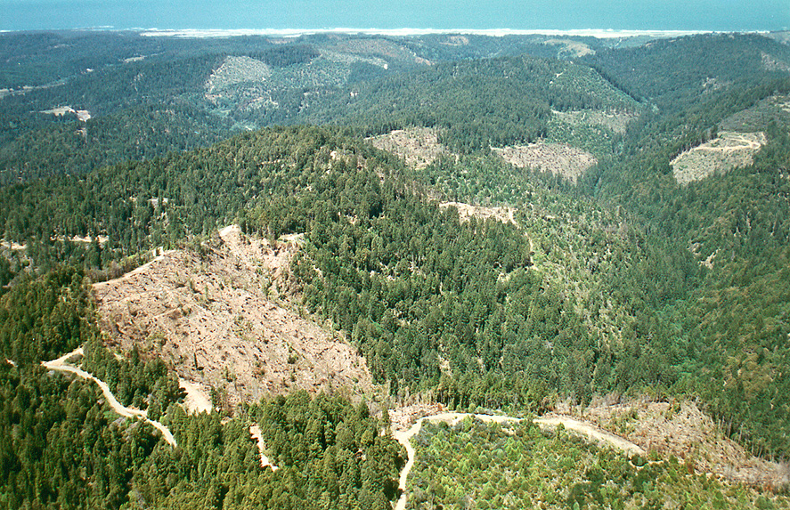
NW29 Jun99 - Aerial view of S. Fk. Ten Mile River looking west toward Ten Mile Beach at top of photo.. # Nicholas Wilson,707-937-0137, PO Box 943, Mendocino CA. Scanned from 4x6 color print @ 300dp. Photo 6/8/99/A14.
 Click on image to enlarge (663K).
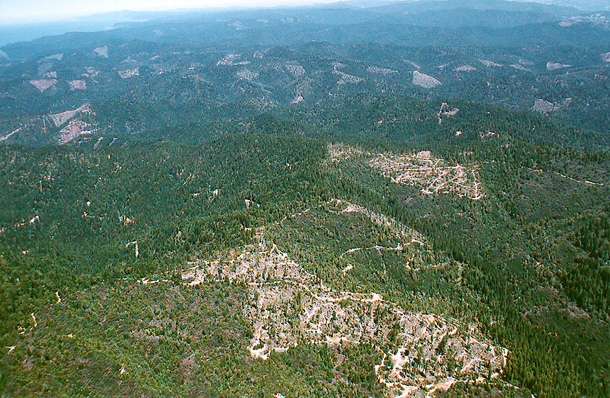
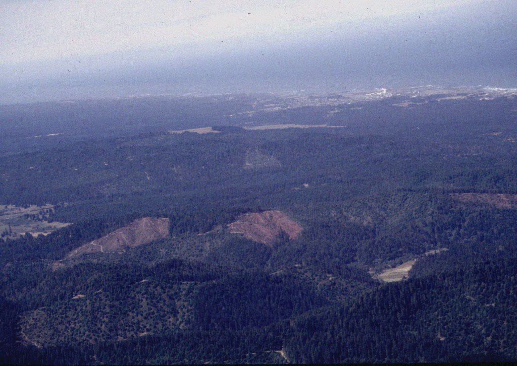
NW31 Jun99 - Aerial view of tractor logging on Ramsey Ridge at top of Duffy Gulch (right foreground), looking NNW over Ten Mile River watershed patch clearcuts toward Pacific Ocean and Cape Mendocino at top left. Approximate camera position 39º27'N 123º37.49'W. See NW34 for another view of Duffy Gulch. Photo # Nicholas Wilson,707-937-0137, PO Box 943, Mendocino CA. Scanned from 4x6 color print @ 300dpi. 6/8/99/A22
 Click on image to enlarge (766K).
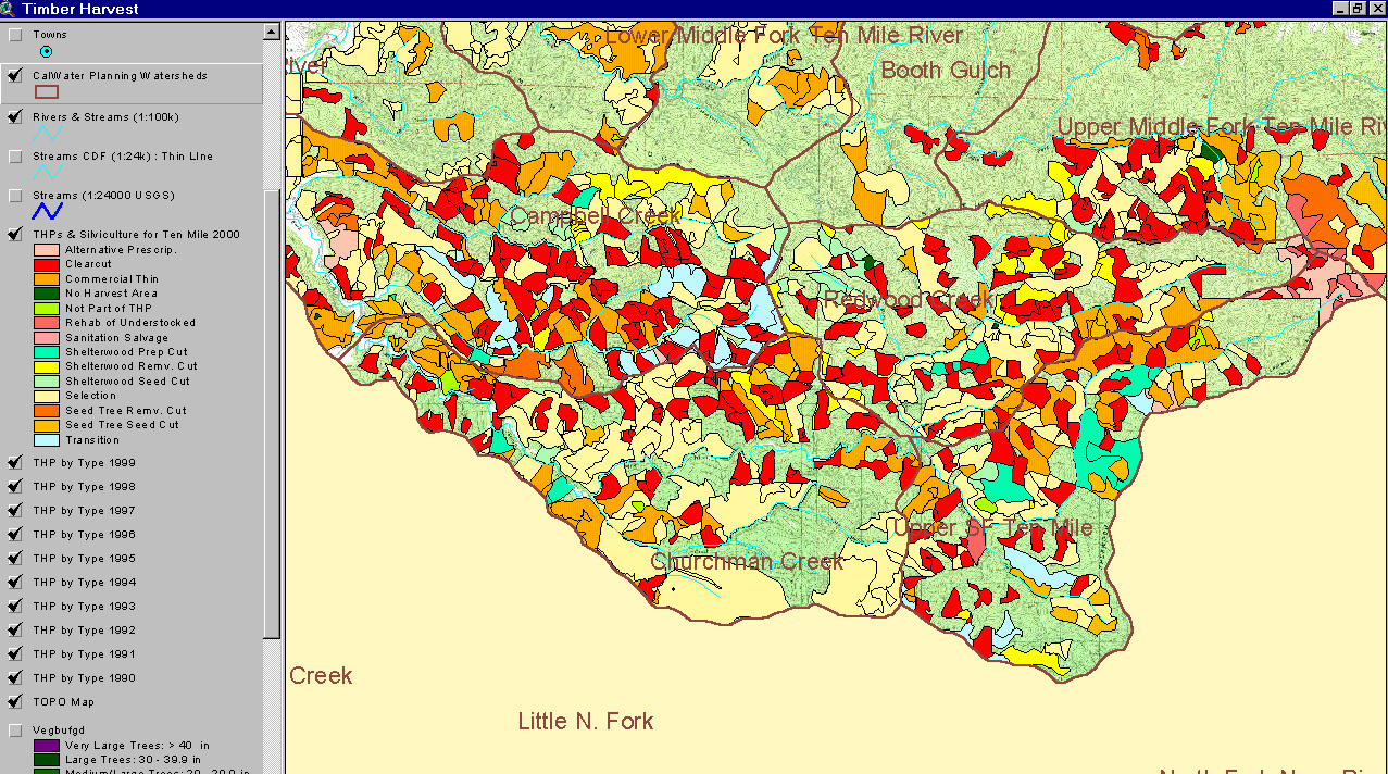
The map image above is from the KRIS Ten Mile Map project in ArcView and shows timber harvests from 1990 to 1999 in the South Fork Ten Mile basin. The layer is derived from data provided by the California Department of Forestry. The legend at left shows timber harvest plans (THP) as they were approved by year (plans in 1990 = THP90). Calwater boundaries are shown for geographic reference.
 Click on image to enlarge (335K).
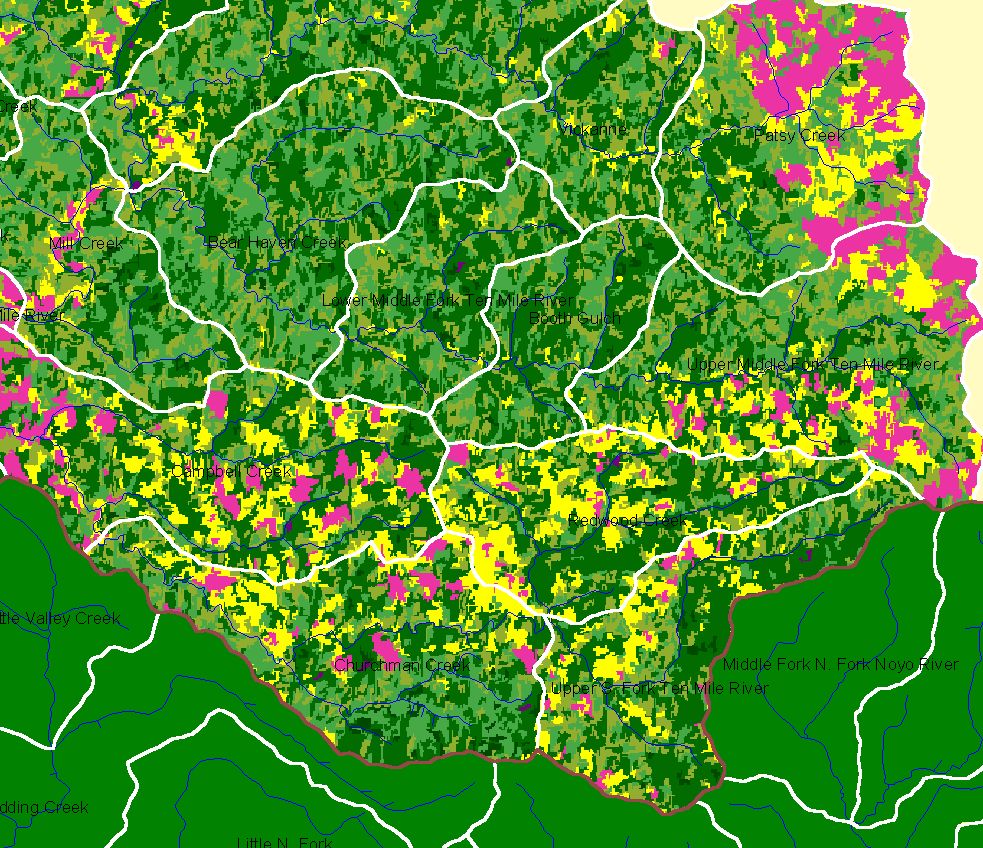
This is a map image from the KRIS Ten Mile Map project and it shows landscape vegetation from a Landsat 1994 image classified for timber size and vegetation type by the US Forest Service Spatial Analysis Lab in Sacramento. The light green colors are small diameter trees, dark greens are larger trees, yellow is shrubs and pink is non-forest. See Picture #6 for an image that has a key.
 Click on image to enlarge (1,930K).
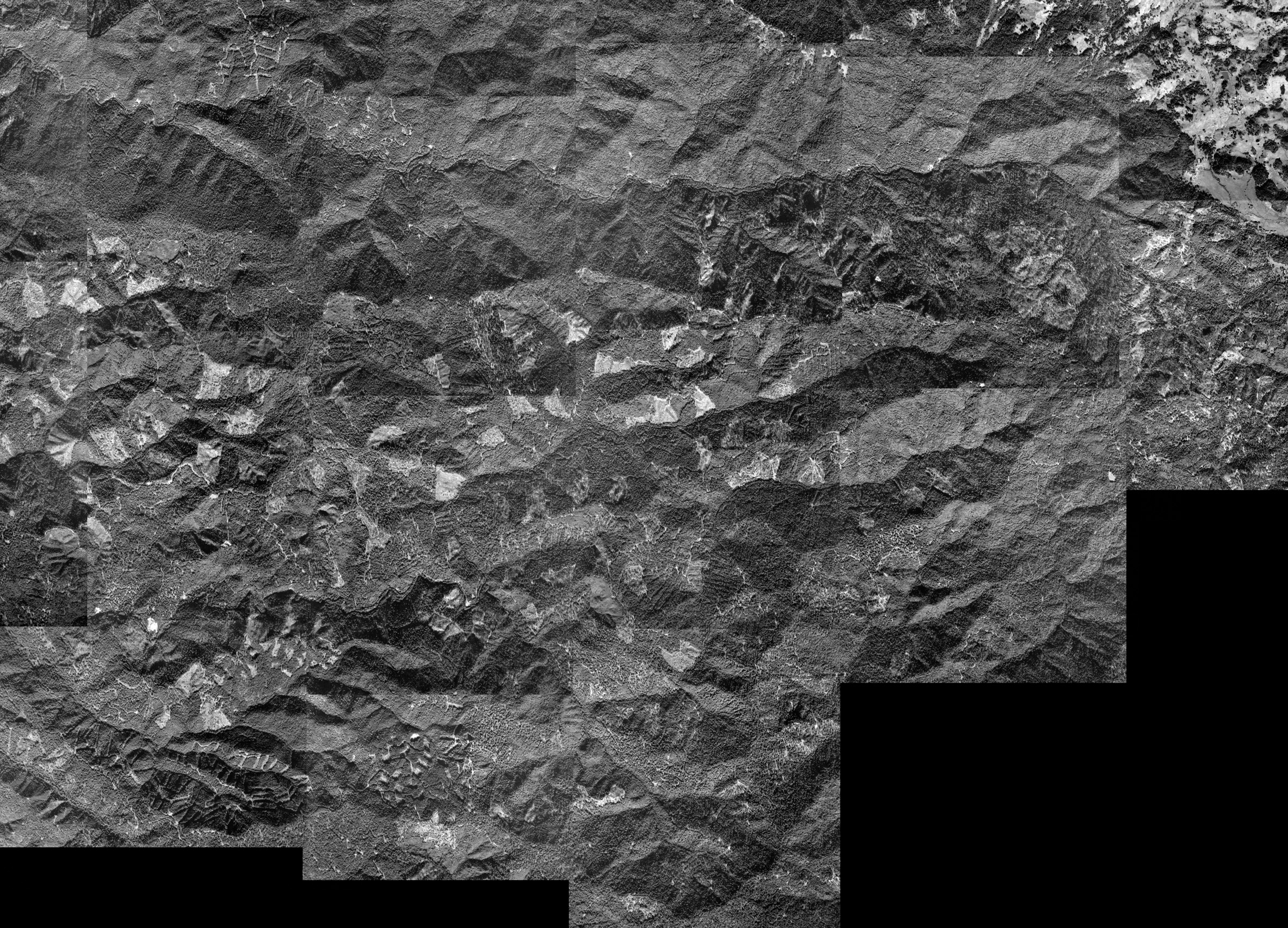
This image is from the ArcView project built to support Matthews (2000) and it is a stitched series of aerial photos from 1999. The patch work of clear cuts in the South Fork Ten Mile Basin are in the lower part of the photo.
 Click on image to enlarge (447K).
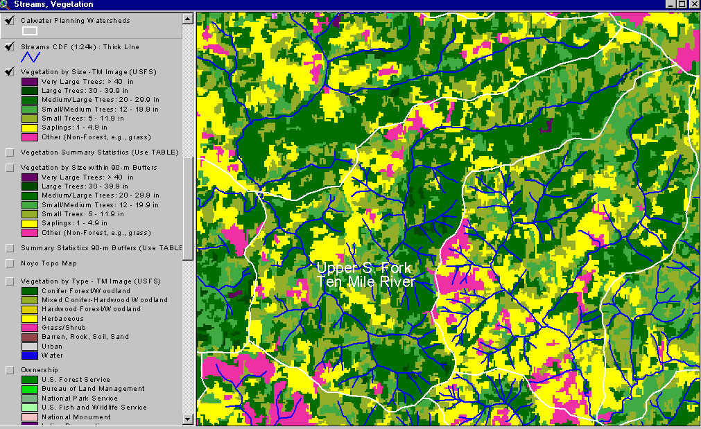
This image from the KRIS Ten Mile River Map project shows USFS vegetation and stand types for the Upper South Fork Ten Mile River Calwater planning watershed derived from a 1994 Landsat (see Info Links for more background information). Scale of accuracy for stands is one hectare. Substantial Small Tree, Non-Forest and Small-Medium trees, suggests timber harvest in the previous 20 years.
 Click on image to enlarge (185K).
TM25 Clearcuts on the SF. 97
To learn more about this topic click here
| www.krisweb.com |