
| Area | South Fork Ten Mile |
| Topic | USFS VegTypes: Upper SF Ten Mile River Calwater 1994 |
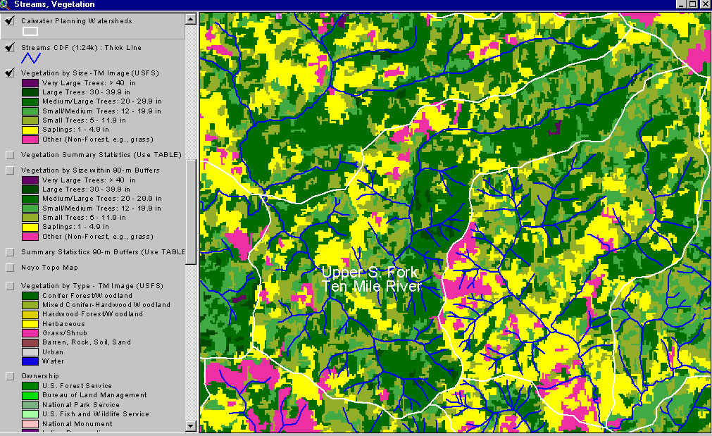
This image from the KRIS Ten Mile River Map project shows USFS vegetation and stand types for the Upper South Fork Ten Mile River Calwater planning watershed derived from a 1994 Landsat (see Info Links for more background information). Scale of accuracy for stands is one hectare. Substantial Small Tree and Small-Medium trees, suggests timber harvest in the previous 20 years (see Picture #3). See Picture #4 for a 1999 aerial photo.
This map view from the KRIS Ten Mile River project shows the Upper South Fork Ten Mile River Calwater watershed but also those to the north and west. See the previous Picture for a key to colors representing forest size and vegetation types.
This is a map of approved timber harvest in the Upper South Fork Ten Mile River Calwater provided by the California Department of Forestry. Harvests that took place after 1993 would not be reflected in the Landsat imagery as early seral.
 Click on image to enlarge (447K).
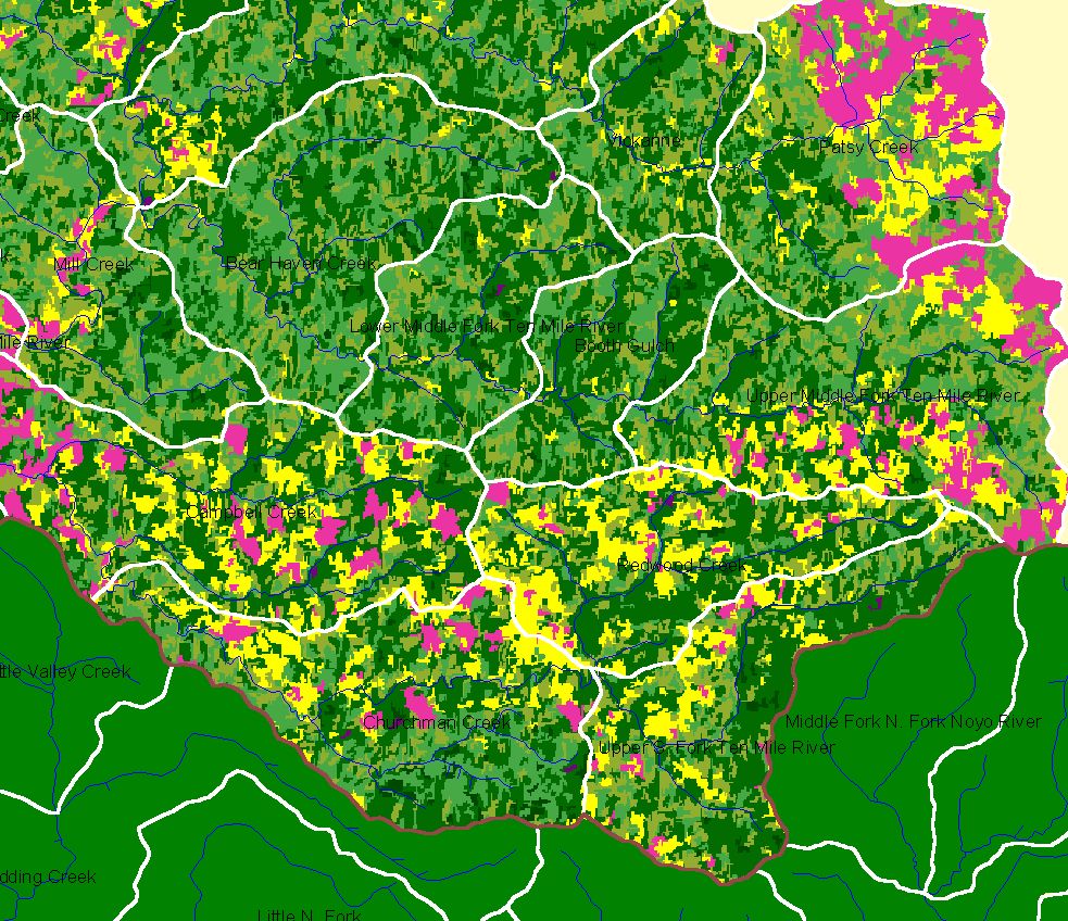 Click on image to enlarge (335K).
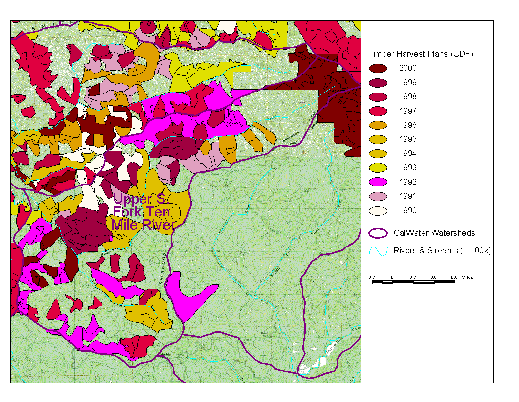 Click on image to enlarge (161K).
To learn more about this topic click here
| www.krisweb.com |