 |
Bibliography | Home | |
 |
|
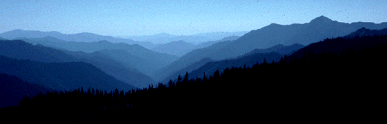
The Trinity River is fed by steep tributary streams flowing from the Trinity Alps and the Trinity Mountains. These alps are part of the Klamath Mountain Province, which occupies a large part of north western California and part of southwest Oregon. Collisions of ocean floor plates and the continental plate just to the west have caused uplifting and mountain building. The steep landscape of the Trinity Basin and deeply incised streams reflect this uplift. Natural over-steepening of the landscape causes inherently high erosion risk which can be increased further by human activities such as logging and road building. The plate collisions have brought together a jumble of different rock types. Long ago, some of the rocks that now make up the Trinity Mountains were at the bottom of the ocean. The 30 million year old Weaverville formation harbors fossils of plant species such as bald cypress and magnolia that indicate that the area may have been wet and swampy before mountain building. Geologists now believe that the Klamath Mountains were raised in the last two to three million years, which is very young in geologic terms. In the last 10,000 years, glaciers formed at high altitudes in the Trinity Alps and at other locations in the Klamath Mountains. The erosive force of these massive sheets of ice sculpted knife edged ridges and the smooth rounded bowls which characterize the rugged scenery of today's Trinity Alps. The digging action of glaciers also carved depressions that formed cirque lakes, which are popular destinations for back packers. |
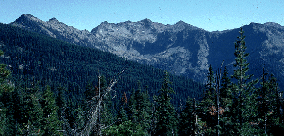 Glaciers have left sharp ridges and bowl shaped or U shaped valleys in part of the Trinity Alps |
| During periods of
mountain building, there have also been great eruptions in the Klamath Mountains.
Some of the hot magma erupted above ground, but most stayed under the existing
rocks, in great masses called batholiths. The well recognized granite and
diorite of the Trinity Alps were formed in this way. Erosion has exposed
some of these to view. Because they have been melted under high pressure
and temperatures, they are different from the surrounding rocks.
Although granitic rocks form the impressive peaks of the Trinity Alps, granite can be highly erodible if it contains mica, which expands when wet, or if it was not subjected to enough heat and pressure during formation. A band of highly erodible decomposed granite crosses the Trinity Basin from Grass Valley Creek north through the upper Trinity River. Land management on decomposed granitic (DG) soils is problematic. If areas are clear cut and surface erosion causes loss of top soil, DG soils have almost no ability to retain moisture and are non-cohesive. This means that it is difficult to re-establish forest vegetation and a great deal of soil is lost through surface erosion subsequently. Roads crossing DG soils contribute large amounts of sand to water courses as a result of cut-slope and fill slope surface erosion. Watersheds with DG soils and intensive management are also extremely susceptible to gully erosion. |
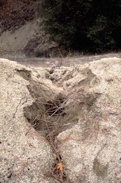
This gully is developing from a road in decomposed granitic soil. Grass Valley Creek watershed. |
![]()
| www.krisweb.com |