
| Area | S Marin/Redwood Creek |
| Topic | Climate: Redwood Creek Mean Monthly Rainfall and Evaporation 1941-1994 |
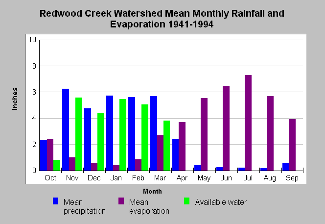
| Caption: This chart shows mean monthly precipitation, evaporation, and available water in inches for the Redwood Creek watershed using data for the period 1941-1994. Analysis was conducted by Philip Williams & Associates, Ltd. for the California Department of Transportation as part of environmental assessment for the restoration of Big Lagoon (located at the mouth of Redwood Creek). Data were gathered by the Golden Gate National Recreation Area (GOGA), the Marin Municipal Water District (MMWD), and the National Park Service. See Map for gauge locations and Info Links for more information. | |
 |
To learn more about this topic click Info Links .
To view additional information (data source, aquisition date etc.) about this page, click Metadata .
To view the table with the chart's data, click Chart Table web page.
To download the table with the chart's data, click climate_redwood_monthlyrain_pwa.xls.db (size 4,096 bytes) .
| www.krisweb.com |