
| Area | Mainstem Battle |
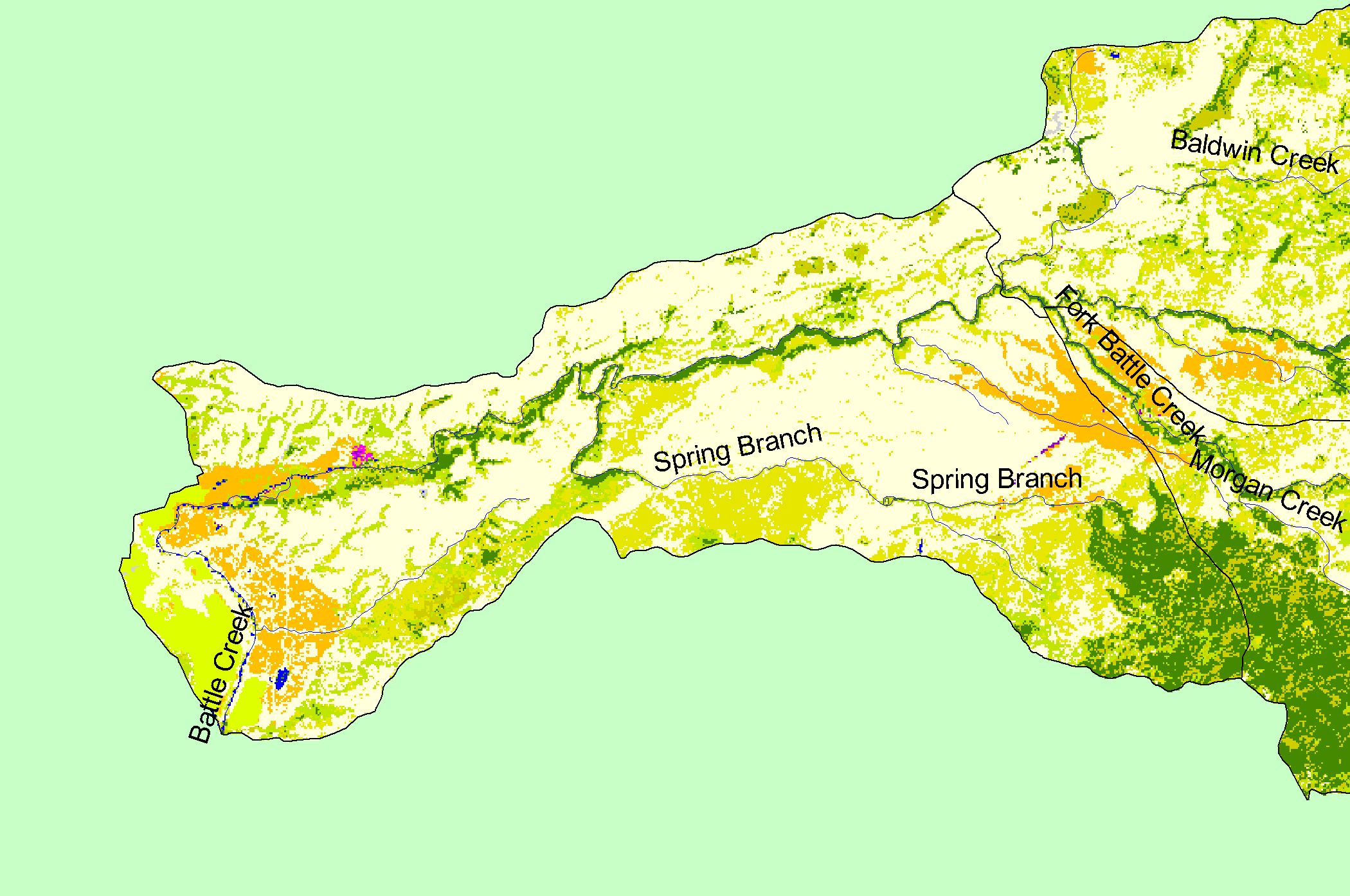
| Topic | Map: 1D EPA Landcover/Landuse, Mainstem Battle Sub-basin |
| This is a map of the 1992 Environmental Protection Agency Landcover/Landuse in the Mainstem Battle sub-basin, displayed along with 1:100,000 scale streams and KRIS sub-basins. These data are derived from a 1992 Landsat image. The sub-basin is dominated by grasslands, shrubs, and agriculture. Scale = 1:54,021 . | |||
 |
 |
||
To view metadata about a map layer, click on a link in the table below.
| Name of Layer in Map Legend | Metadata File Name |
|---|---|
| Sub-basins (no labels) | subbasins.shp.txt |
| Streams (1:100k scale)(w/ labels) | stms100.shp.txt |
| EPA Landcover (1992 Aggregated)(TIFF) | lndcov2.tif.txt |
| www.krisweb.com |