| Area |
Mainstem Battle |
| Topic |
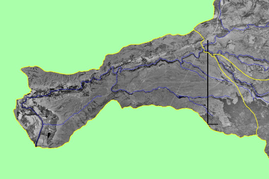
Map: 1G Digital Orthophoto Quadrangles (DOQ), Mainstem Battle |
To view a more detailed version of this map click
here
|
This map shows digital orthophoto quadrangles (DOQ) of the Mainstem Battle sub-basin. Select the magnifying glass (+) to zoom in and the pan tool (hand) to move
around. Select USGS topographic map themes and turn ortho on and off to gage location when zoomed in. Data were provided by the U.S. Geological Survey. Scale = 1:99,401 .
|
|
|
 |
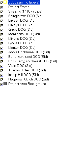 |
To view metadata about a map layer, click on a link in the table below.
| Name of Layer in Map Legend | Metadata File Name |
|---|
| Subbasin (no labels) | subbasins.shp.txt |
| Project Frame | mask1.shp.txt |
| Streams (1:100k scale) | stms100.shp.txt |
| Shingletown DOQ (Sid) | Unavailable |
| Lassen DOQ (Sid) | Unavailable |
| Finley DOQ (Sid) | Unavailable |
| Grays DOQ (Sid) | Unavailable |
| Manzanita DOQ (Sid) | Unavailable |
| Mineral DOQ (Sid) | Unavailable |
| Lyons DOQ (Sid) | Unavailable |
| Manton DOQ (Sid) | Unavailable |
| Jacks Backbone DOQ (Sid) | Unavailable |
| Bend, northeast DOQ (Sid) | Unavailable |
| Balls Ferry, southwest DOQ (Sid) | Unavailable |
| Viola DOQ (Sid) | Unavailable |
| Tuscan Buttes DOQ (Sid) | Unavailable |
| Inskip Hill DOQ (Sid) | Unavailable |
| Hagaman Gulch DOQ (Sid) | Unavailable |
| Project Area Background | battl_outl.shp.txt |
