
| Area | Mainstem Battle |
| Topic | Tour: Lower Battle Cr Aerial Photos |
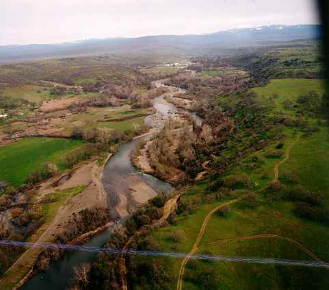
This aerial photograph shows lower Battle Creek looking upstream during spring of 1997 after a large winter storm event (January 1, 1997). Note the deposition of sediment in the margins and bar formation in the center of the stream. Photo provided by Harry Rectenwald of CDFG.
This aerial photograph shows lower Battle Creek near the Grover Diversion looking downstream. The white showing along the stream bank is rip rap installed to prevent bank erosion after the January 1, 1997 flood. Formation of bar in mid-channel is a sign of sediment over-supply. Photo provided by Harry Rectenwald of CDFG.
The aerial photo above shows lower Battle Creek in the reach owned by the California Department of Fish and Game in spring 1997. Clusters of rocks are visible on the right bank of the stream are wing deflectors installed to decrease bank erosion. Photo provided by Harry Rectenwald of CDFG.
This aerial photograph shows lower Battle Creek looking upstream below Jelly's Ferry Road. The pond at left in the photo is a gravel pit which has formed a small lake. The mainstem Sacramento River is visible at upper left. Photo provided by Harry Rectenwald of CDFG.
Lower Battle Creek appears in the foreground with the white showing along the far bank representing rip-rap that was recently installed to prevent bank erosion. The mainstem Sacramento River can be seen in the background. Photo provided by Harry Rectenwald of CDFG.
This aerial photograph shows the convergence of Baldwin Creek and main Battle Creek with the Coleman Canal running perpendicular to Baldwin Creek. Steelhead use of Baldwin Creek may be increased as part of Battle Creek restoration efforts. Photo provided by Harry Rectenwald of CDFG.
This photograph is in the furthest southwest portion of the Battle Creek watershed and shows vernal pools which form during winter months. Photo provided by Harry Rectenwald of CDFG.
 Click on image to enlarge (21K).
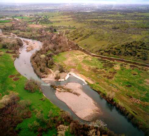 Click on image to enlarge (26K).
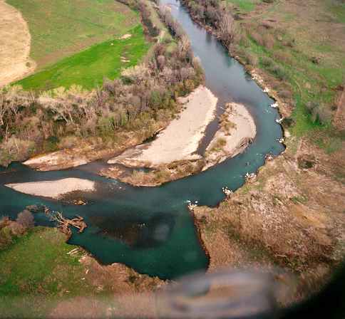 Click on image to enlarge (25K).
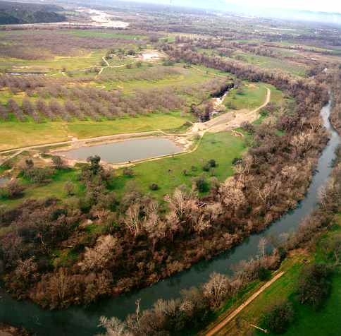 Click on image to enlarge (30K).
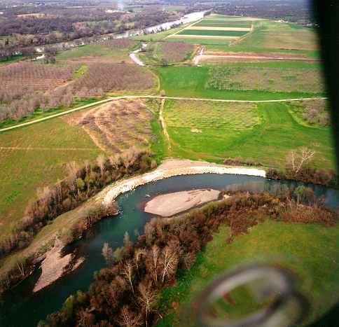 Click on image to enlarge (28K).
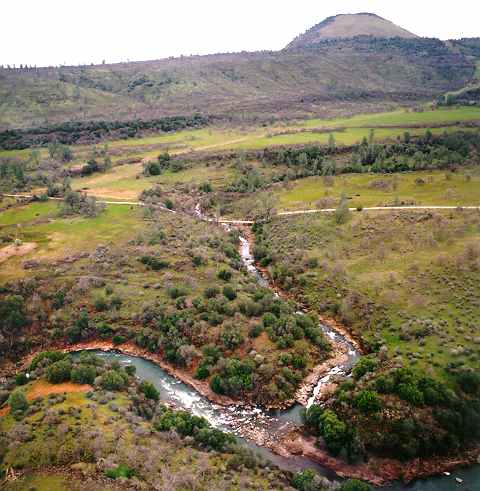 Click on image to enlarge (34K).
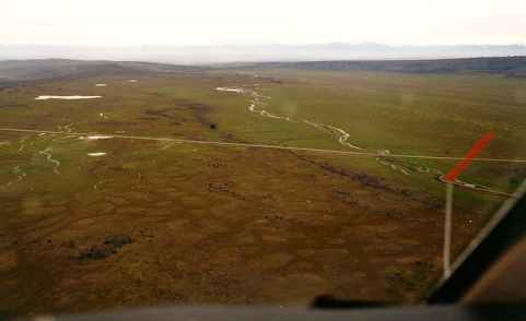 Click on image to enlarge (9K).
To view additional information (data source, aquisition date etc.) about this page, click Metadata
| www.krisweb.com |