
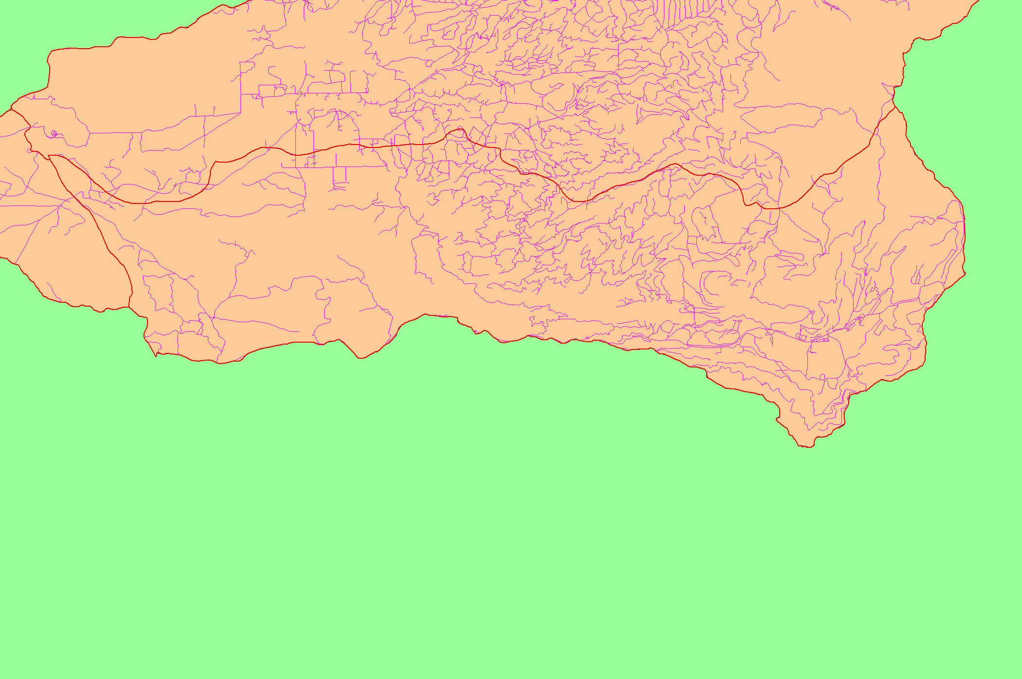
| Area | South Fork Battle |
| Topic | Map: 1C Roads, South Fork Battle Sub-basin |
| This is a map of the roads in the South Fork Battle sub-basin, displayed with KRIS sub-basins. In some areas, the GIS roads layer under-represents the network of existing roads, particularly on public land in the eastern part of the basin. Road densities are lower in the South Fork than in the North Fork, b ut bedrock geology also differs. Data were contributed by Sierra Pacific Industries and Lassen National Forest. Scale = 1:96,974 . | |||
 |
 |
||
To view metadata about a map layer, click on a link in the table below.
| Name of Layer in Map Legend | Metadata File Name |
|---|---|
| Sub-basins (no labels) | subbasins.shp.txt |
| Sub-basins (no labels) | subbasins.shp.txt |
| Project Frame | mask1.shp.txt |
| Roads (1:24k scale) | bcroads.shp.txt |
| Project Background | battl_outl.shp.txt |
| www.krisweb.com |