| Area |
South Fork Battle |
| Topic |
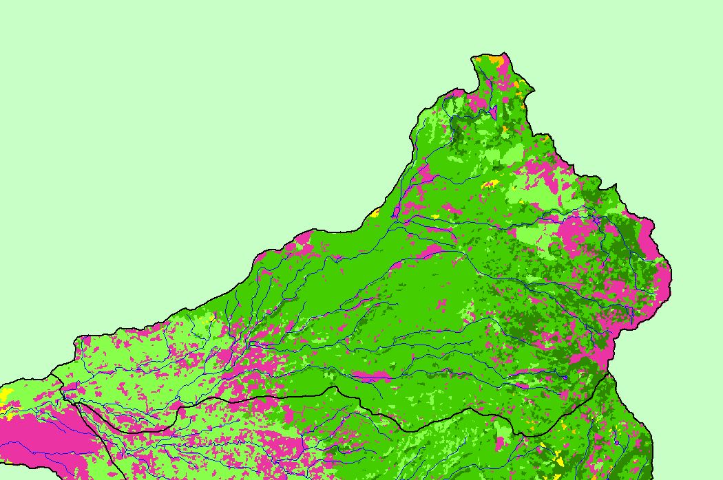
Map: 1E Vegetation Size, South Fork Battle Sub-basin |
To view a more detailed version of this map click
here
|
This is a map of 1994 vegetation size data in the South Fork Battle sub-basin, displayed with KRIS sub-basins and 1:100,000 scale streams. The tree size classifications
were derived from Landsat multi-spectral images taken in 1994. Stand conditions are accurately represented at the one hectare scale. Data were provided by the U.S.
Forest Service Pacific Southwest Region Remote Sensing Lab, in cooperation with the California Department of Forestry.
|
|
|
 |
 |
To view metadata about a map layer, click on a link in the table below.
