
|

|
| Background | Hypotheses | Bibliography | Maps | Home |
|
|
|
| Background | Hypotheses | Bibliography | Maps | Home |
KRIS Web Background Pages: Urbanization
![]()
|
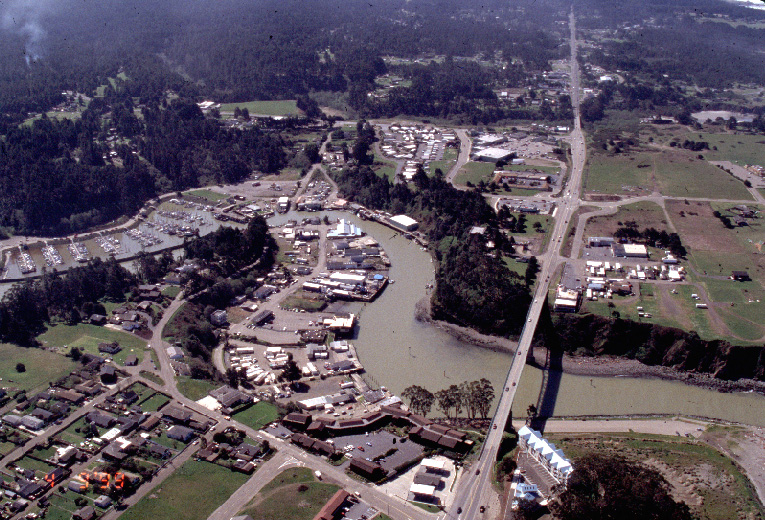
The
image at left shows the Lower Noyo River and the coastal terrace to the
south. Patches of development which have replaced timber stands can be seen.
This pattern is particularly evident in the Mitchell Creek watershed which
lies further south (see below). As paved areas increase, pulses of non-point
source pollution can be expected in coastal tributaries such as Hare
Creek and Mitchell Creek. . Photo by Graham Matthews, April 9, 1999 (68 KB) |
|
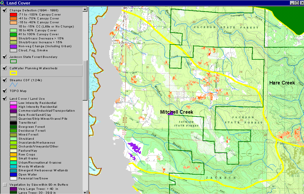
This KRIS Big River map image shows the Mitchell Creek Calwater, which is part of the KRIS Big Coastal Tributaries subbasin. Note the patches of canopy lost between 1994 to 1998, showing as red and orange in this change scene detection provided by the California Department of Forestry FRAP division in Sacramento. These changes are not associated with timber harvest, but rather with suburban development. While a logged area may undergo hydrologic recovery, development changes the hydrograph for a longer period. (243 KB) |
|
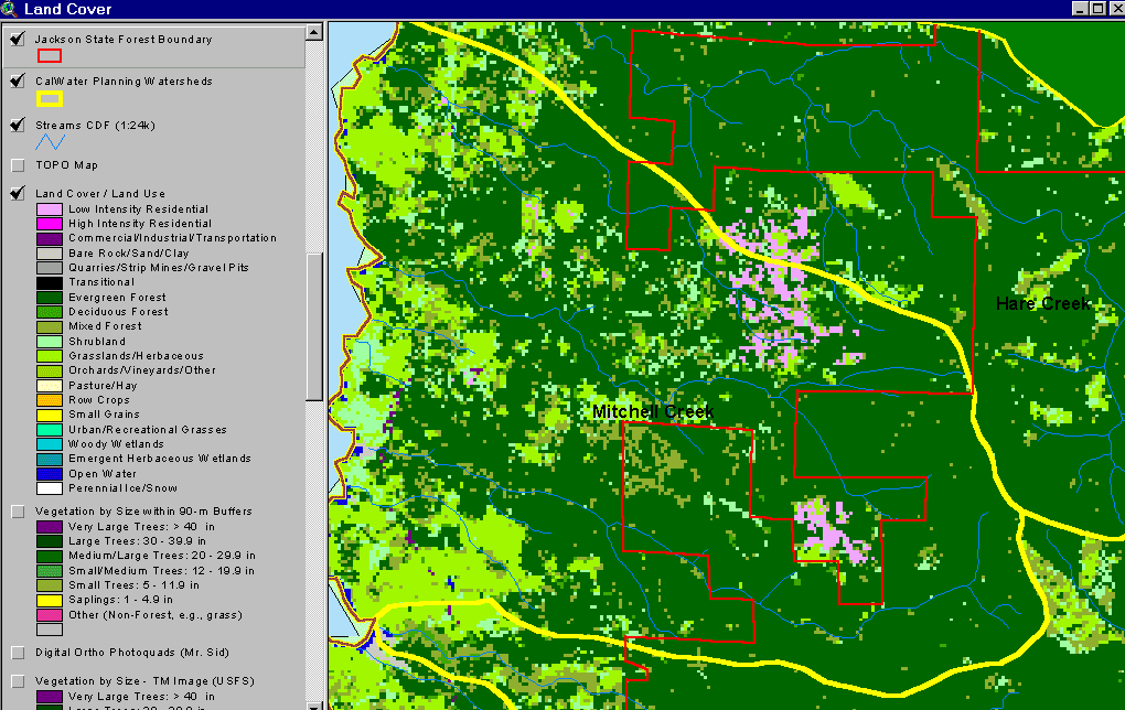
This KRIS Big River map is based on the EPA land use coverage derived from a 1994 Landsat image, and shows mostly evergreen forests to the east, in Jackson Demonstration State Forest. This theme shows that some of the Mitchell and Hare Creek CalWater basins have low intensity residential development. The area has experienced rapid change since 1994 (see above). (67 KB) |
![]()
| www.krisweb.com |