 |
 |
| Background | Hypotheses | Bibliography | Maps | Home |
|
|
| Background | Hypotheses | Bibliography | Maps | Home |
KRIS Big River Map Project:
Geology View
![]()
Note: Geologic information, electronic maps and models within KRIS projects are meant to provide background information only and not as a decision making tool. California requires that licensed geologists be involved directly in decisions related to geologic conditions (see requirement).
Geology data were obtained largely from the California Department of Conservation, Division of Mines and Geology (DMG). Major themes in this view include: annual rainfall modeled on different periods (1900-1960 and 1961-1990), locations of small slides, active and dormant slides, earthflows, amphitheaters (ancient landslides and landslide precursors), inner gorges, shear zones, and torrent tracks. Also included are bedrock geology, a colored hill shade model (10 meter resolution), and slope steepness. An image of shallow landslide risk created by IFR staff is also displayed in this view (see Modeling Shallow Landslides background page). Stream gradient developed from 10 meter DEMs occurs as a theme in the Geology View because it provides insight into sediment transport. Erodibility of the dominant soils (kkfact), derived from Natural Resources Conservation Service data, is also included in this view.
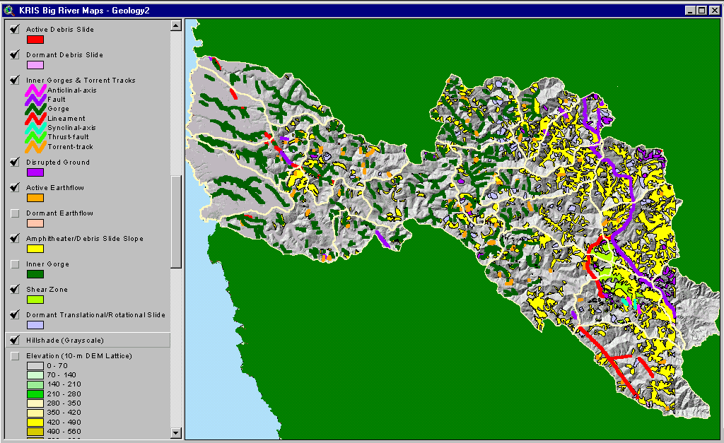 |
The image at left shows a map of Big River basin geohazards supplied by the California Division of Mines and Geology. Maps with active and dormant landslide features are useful for understanding erosion risk during watershed assessment or when planning land use activities. See Geology background page. |
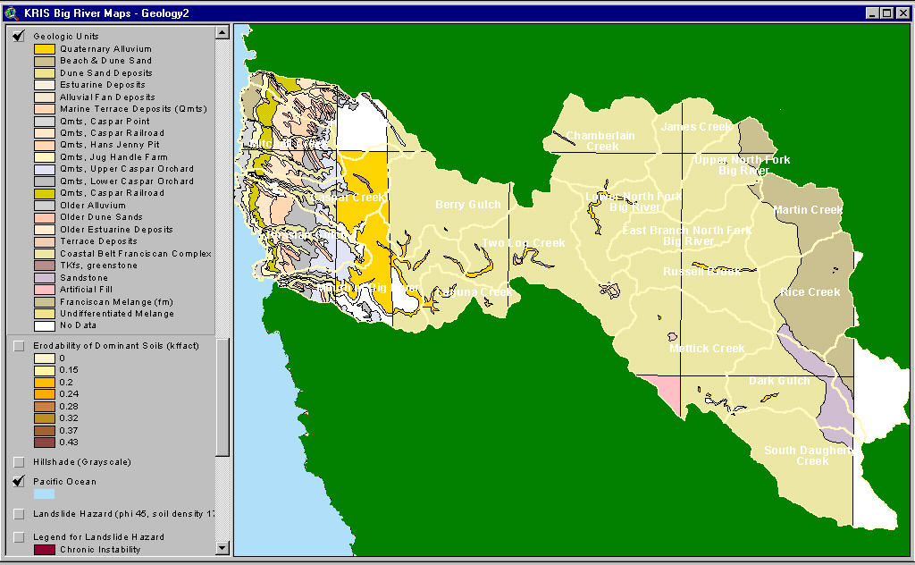 |
The map image at left shows Big River basin bedrock geology provided by the California Division of Mines and Geology. The western portion of the watershed is mostly uplifted marine sediment and sand dunes. The dominant formation in the central part of the watershed is Coastal Belt Franciscan. To the east the Central Belt Franciscan Formation intrudes into the Upper North Fork Big River, Martin Creek, and Rice Creek planning watersheds. Outlines and names of Calwater planning watersheds are shown in white. (See CDMG metadata). |
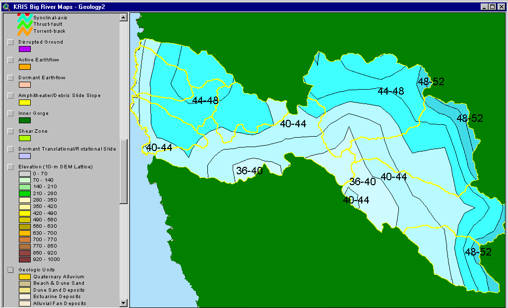 |
This image shows the rainfall isopleths for the Big River basin. Rainfall in the south is about 36-40 inches per year, whereas the northern basin areas can reach over 50 inches per year.. This layer was generated by the Oregon Climate Service at Oregon State University from 1961-1990 rainfall data. |
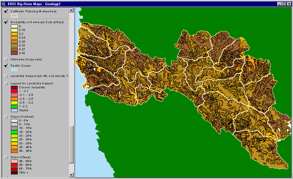 |
The image at left shows the soil erodibility in the Big River basin according to a Natural Resource Conservation Service 1:24000 Mendocino County soil map. The erodibility rating is based on detachability of soil particles and slope steepness (kkfact) |
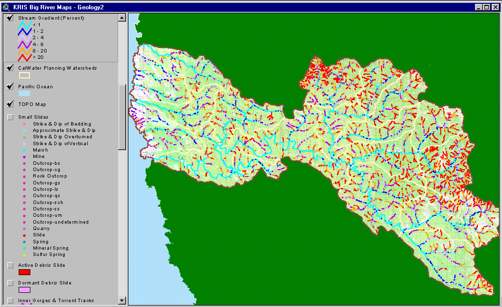 |
The stream gradient theme for the Big River basin is shown at left with a USGS topographical map backdrop. The mainstem reaches of the Big River are predominantly low gradient and, therefore optimal for coho salmon. Steeper areas of the watershed in the north and east have headwaters stream with greater than 20% gradient, which are called supply reaches because they convey sediment eroding from hillslopes. Derived from 10 meter DEM supplied by CDF FRAP. |
![]()
References
Bedrossian, T. L. 1986. Watershed Mapping in Northern California, an update. California Geology, February 1986.
Natural Resources Conservation Service (NRCS). 1998. Soil Survey Geographic (SSURGO) database for Mendocino County, Western Part, California. NRCS State Soil Scientist, Davis, CA.
| www.krisweb.com |