KRIS Big River Map Project: Timber
Harvest Plans View

The California Department of Forestry in Santa Rosa provided the timber
harvest plan (THP) maps from 1990 to 1999 for the Big River basin.
These comprise this KRIS Big River Map View. Timber harvests from 1986 through 1999 can be viewed by year or by timber harvest type.
Timber harvest may sometimes disturbs soils, increases road densities and
otherwise increases erosion risk. Increased sediment yield in turn may effect
fish habitat and water quality. Because timber harvest is a widespread activity
in northern California watersheds, it is an important factor to consider in watershed assessment.
 |
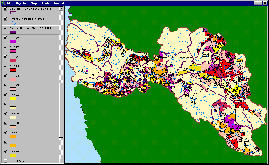
The image at left shows timber harvest plans (THPs) by
year harvest
type approved by the CDF between 1986 and 1999 for the Big River basin.
The lower mainstem, Laguna Creek, upper Big River and South Daugherty
Creek have all been intensively logged since 1986. |
 |
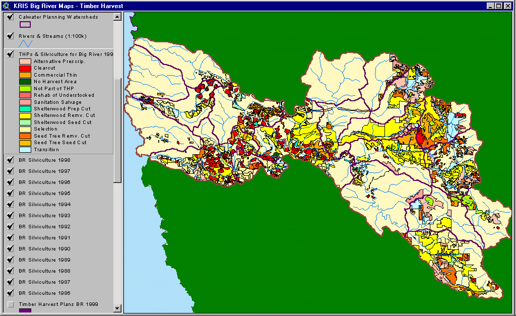
This image shows timber harvests
delineated by year and silvicultural practice approved by the CDF between
1986 and 1999 for the Big River basin.
The predominant practices in Big River Basin included shelter wood removal and clear cuts. |