
| Area | Basinwide/Regional |
| Topic | Sediment: Fines <0.85 mm by GMA, 2001 |
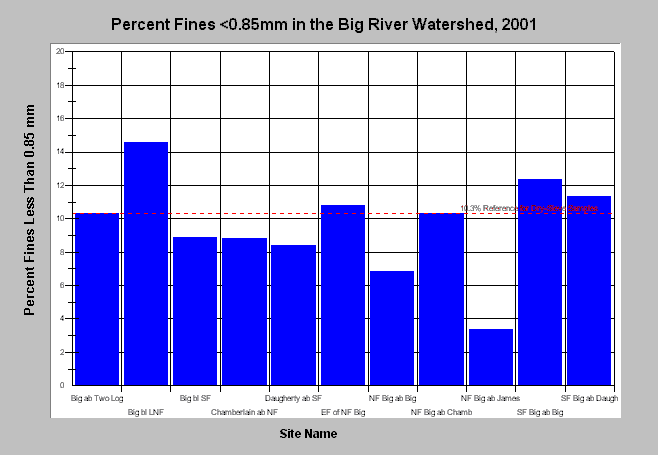
| Caption: This chart shows percent fines <0.85mm from McNeil samples by Matthews and Associates at ten Big River sites. Matthews and Associates collected and processed the bulk gravel samples in 2001 using dry-sieve/gravimetric methods. The reference value shown represents an appropriate target (10.3%) for dry-sieve results based on adjustment methods of Shirazi and Seim (1979) and the EPA TMDL threshold for percent fines <0.85mm (14%). This reference value indicates that fine sediment may be a problem for salmonids in Two Log Creek, the Little North Fork, the East Branch of the North Fork Big River, and the South Fork Big River. Click Info Links for more information. | |
 |
To learn more about this topic click here .
To view the table with the chart's data, click Chart Table web page.
To download the table with the chart's data, click gma_mcneil.dbf (size 3,427 bytes) .
To see meta information about the data table used for this topic click here
| www.krisweb.com |