
| Area | Basinwide/Regional |
| Topic | Sediment: Matthews Erosion Surface from Harvest Skid Trails 1921-2000 |
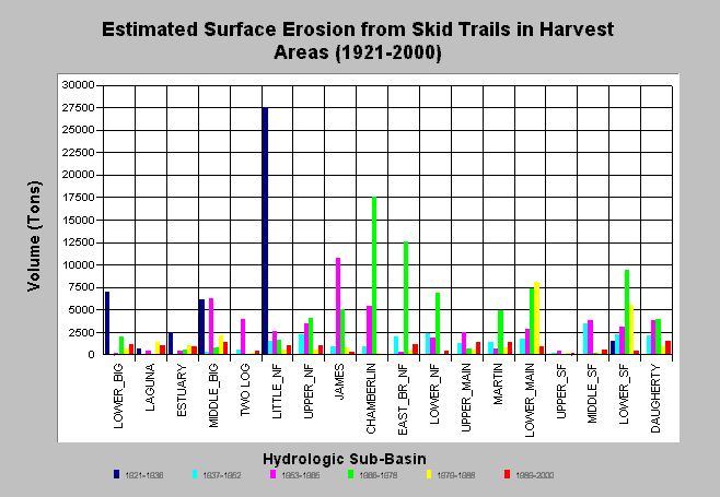
| Caption: The chart above shows the computed surface erosion volumes from skid trails in harvest units for each Big River sub-basin. Matthews and Associates (2001) state: "The results suggest a peak in surface erosion coinciding with high harvest rates using high-density tractor logging methods in the 1953-1978 periods. In the most recent period, smaller volumes of surface erosion have been produced by more extensive harvest areas due to a substantial change in harvesting techniques." Estimates are generated from CDF data and aerial photographs. See Info Links for more background information and links to references. | |
 |
To learn more about this topic click here .
To view the table with the chart's data, click Chart Table web page.
To download the table with the chart's data, click sediment_surf_harvest_period_all.dbf (size 2,752 bytes) .
To see meta information about the data table used for this topic click here
| www.krisweb.com |