
| Area | Basinwide/Regional |
| Topic | Sediment: Matthews Landslides Delivered by Sub-basin 1921-2000 |
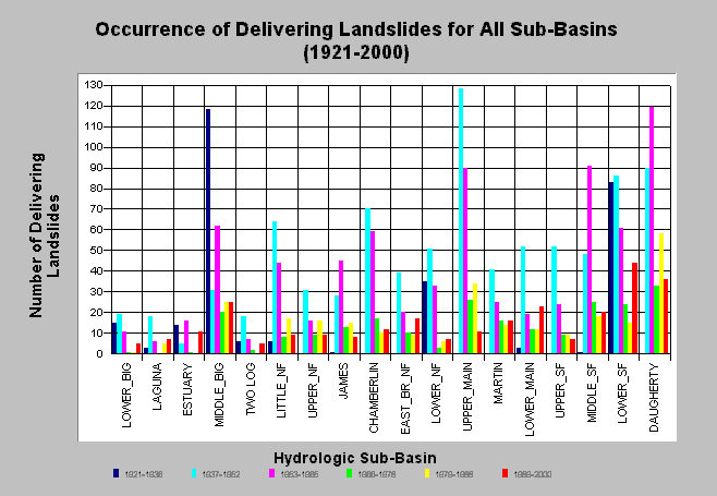
| Caption: The chart above shows the occurrence of delivered landslides during the study period for each Big River sub-basin; derived from Matthews and Associates (2001). Estimates are generated from aerial photographs. The greatest sediment delivery appears to have occurred during the 1937-1952 and 1953-1965 periods. Middle Big River, Lower Mainstem, South Fork and Daugherty Creek sub-basins show the most recent landslide activity. The actual number of slides in the 1921-1936 period is likely an underestimate, since 1936 photo coverage for the eastern half of the watershed was unavailable. See Info Links for more background information and links to references. | |
 |
To learn more about this topic click here .
To view the table with the chart's data, click Chart Table web page.
To download the table with the chart's data, click slides_period_allsubs.dbf (size 2,940 bytes) .
To see meta information about the data table used for this topic click here
| www.krisweb.com |