
| Area | Basinwide/Regional |
| Topic | Sediment: Matthews Landslides by Land-Use Big River Basins 1921-2000 |
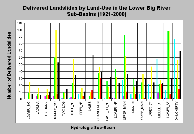
| Caption: The chart above shows the total number of delivered landslides per land-use area in the Big River basin for the period 1921-2000. Estimates were generated from aerial photographs by Matthews and Associates (2001). Mass wasting is largely active in harvest areas and road fill. Matthews and Associates (2001) state: "Significant construction of new roads has led to increasing sediment yields from road surface erosion, despite improved practices. Under current conditions (1989-1999 period), management-related sediment delivery is estimated to be 51.7% of the total input." See Info Links for more background information and links to references. | |
 |
To learn more about this topic click here .
To view the table with the chart's data, click Chart Table web page.
To download the table with the chart's data, click slides_matt_type_allsubs.dbf (size 2,676 bytes) .
To see meta information about the data table used for this topic click here
| www.krisweb.com |