
| Area | Basinwide/Regional |
| Topic | Sediment: Matthews Large Basin Areas Road Construction 1921-2000 |
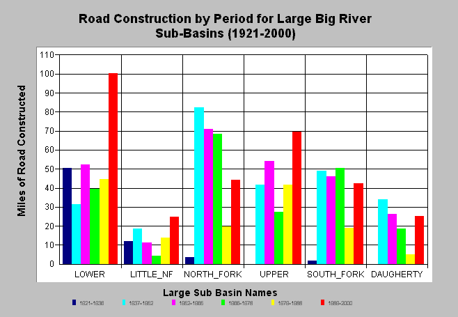
| Caption: The chart above shows the miles of road constructed by period for KRIS Big River sub-basins. Road construction continues to be active in the Big River watershed. Matthews and Associates (2001) state: "Analysis indicates that sediment production from roads has increased significantly over the study period, tracking cumulative road construction." Road data was derived from aerial photographs and from CDF data for more recent periods. Aerial photograph work focused on main and haul roads. See Info Links for more background information and links to references. | |
 |
To learn more about this topic click here .
To view the table with the chart's data, click Chart Table web page.
To download the table with the chart's data, click road_construct_period_lrgsubs.dbf (size 672 bytes) .
To see meta information about the data table used for this topic click here
To view the table with the chart's source data, click Source Table web page.
To download the table with the chart's source data, click roads_construct_period_allsubs.dbf (size 1,874 bytes)
| www.krisweb.com |