
| Area | Basinwide/Regional |
| Topic | Sediment: Matthews Road Construction All Sub-basins 1921-2000 |
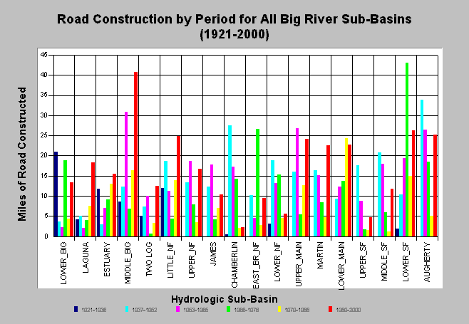
| Caption: The chart above shows the miles of road construction by period for each Big River sub-basin. Road construction continues to be active and has increased in many sub-basins. Matthews and Associates (2001) state: "Significant construction of new roads has led to increasing sediment yields from road surface erosion, despite improved practices." Mileage estimates were generated largely from CDF data and aerial photography analysis Matthews Associates (2001). See Info Links for more background information and links to references. | |
 |
To learn more about this topic click here .
To view the table with the chart's data, click Chart Table web page.
To download the table with the chart's data, click roads_construct_period_allsubs.dbf (size 1,874 bytes) .
To see meta information about the data table used for this topic click here
| www.krisweb.com |