
| Area | Caspar Creek |
| Topic | Sediment: V* from SF Caspar above the weir, 1992-2000 |
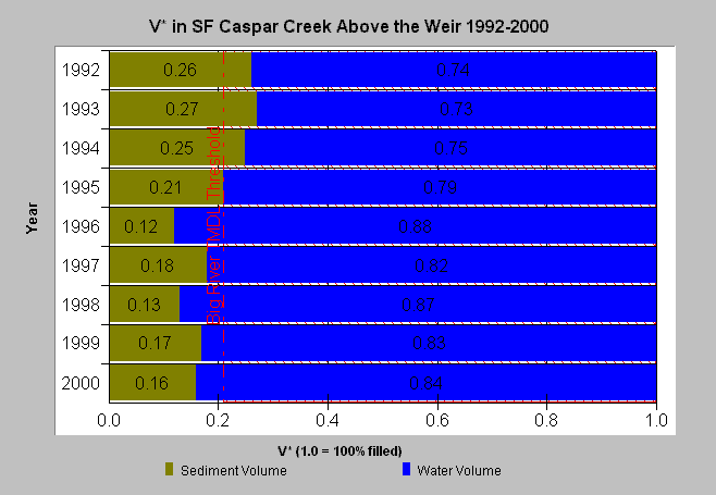
| Caption: This chart displays V* data from South Fork Caspar Creek above the weir. Data collected by Redwood Sciences Lab, USFS. The TMDL limit is from the Big River. See Info Links for more information. | |
 |
To learn more about this topic click here .
To view the table with the chart's data, click Chart Table web page.
To download the table with the chart's data, click vstar_sf.dbf (size 1,417 bytes) .
To see meta information about the data table used for this topic click here
To view the table with the chart's source data, click Source Table web page.
To download the table with the chart's source data, click v_star.dbf (size 2,343 bytes)
| www.krisweb.com |