
| Area | Lower Big River |
| Topic | Sediment: Matthews Erosion Rates from Harvest Areas LNF 1921-2000 |
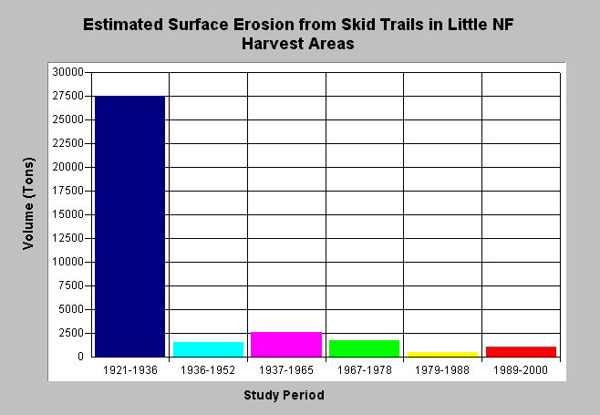
| Caption: This chart shows estimated surface erosion volumes from skid trails in harvest areas as computed by Matthews and Associates (2001). The period of 1921-1936 resulted in a large volume of surface erosion from extensive harvesting in the basin (click on Picture to see harvest areas by period). Estimates are generated from CDF data and aerial photographs. See Info Links for more background information and links to references. | |
 |
To learn more about this topic click here .
To view the table with the chart's data, click Chart Table web page.
To download the table with the chart's data, click sediment_harvest_surferosion_rates_ln.dbf (size 218 bytes) .
To see meta information about the data table used for this topic click here
To view the table with the chart's source data, click Source Table web page.
To download the table with the chart's source data, click sediment_surf_harvest_period_all.dbf (size 2,752 bytes)
| www.krisweb.com |