
| Area | Lower Big River |
| Topic | Sediment: Matthews Landslides Volumes by Land-Use Little NF 1921-2000 |
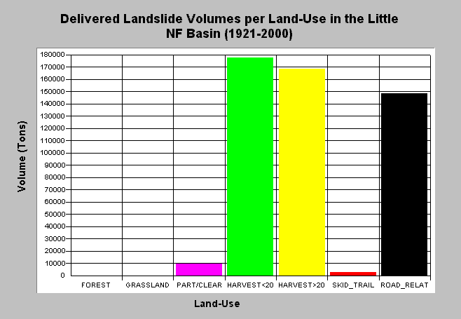
| Caption: The chart above shows the total estimated sediment volumes from delivered landslides by land-use practice in the Little North Fork Big River sub-basin (1921-2000). Sediment volumes were computed by Matthews and Associates (2001). Roads and harvest related slides contributed a majority of the sediment in the Little North Fork Big River. See Info Links for more background information and links to references. | |
 |
To learn more about this topic click here .
To view the table with the chart's data, click Chart Table web page.
To download the table with the chart's data, click slides_matthews_vol_landuse_ln.dbf (size 273 bytes) .
To see meta information about the data table used for this topic click here
To view the table with the chart's source data, click Source Table web page.
To download the table with the chart's source data, click slides_vol_tons_landuse_allsubs.dbf (size 2,464 bytes)
| www.krisweb.com |