
| Area | Lower Big River |
| Topic | Sediment: Matthews Lower Big Landslides Volumes by Land-Use 1921-2000 |
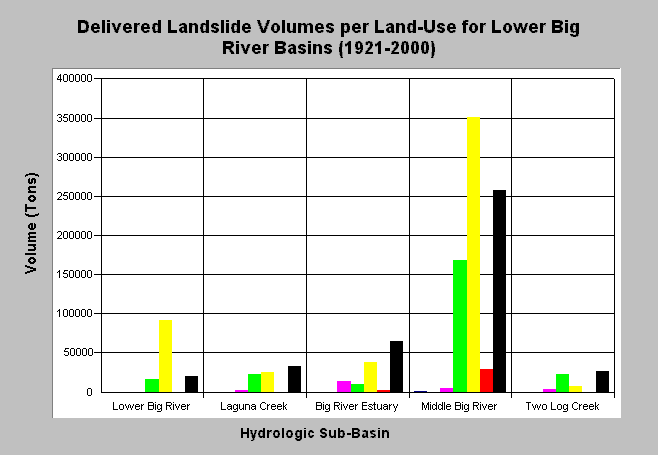
| Caption: The chart above shows the estimated sediment volumes (tons) from delivering landslides for the Lower Big River sub-basin from 1921-2000. Sediment volumes were computed by Matthews and Associates (2001). Middle Big River has contributed the largest volume of sediment to the Lower Big Basin. Failures have mainly occurred from harvested areas and roads. Matthews and Associates (2001) state: "Improvements in management practices since 1974 have resulted in decreases in road-related mass wasting and harvest-related surface erosion, although sediment delivery from these processes are still well above estimated background rates." See Info Links for more background information and links to references. | |
 |
To learn more about this topic click here .
To view the table with the chart's data, click Chart Table web page.
To download the table with the chart's data, click slides_vol_tons_landuse_lbsubs.dbf (size 2,248 bytes) .
To see meta information about the data table used for this topic click here
To view the table with the chart's source data, click Source Table web page.
To download the table with the chart's source data, click slides_vol_tons_landuse_allsubs.dbf (size 2,464 bytes)
| www.krisweb.com |