
| Area | Middle Big River |
| Topic | Timber Harvest: Matthews Harvested Percent, Lower/Middle Big 1921-2000 |
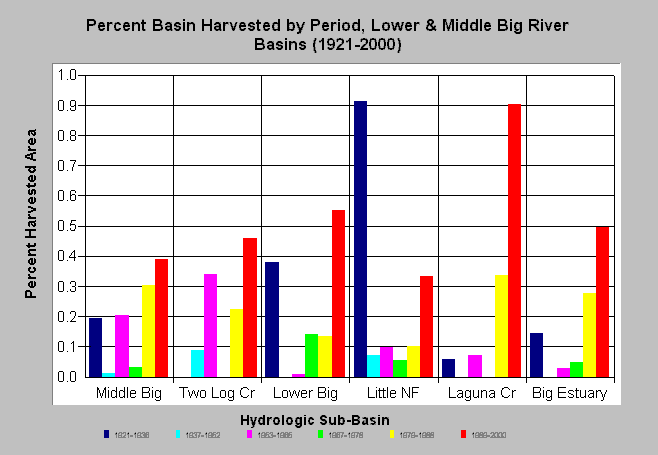
| Caption: The chart above shows the percent of total basin area harvested by period in Lower and Middle Big River sub-basins between 1921 to 2000. Laguna Creek was 90% harvested, while the Lower Big and the Big Estuary were over 50% harvested in the 1989-2000 period. Some sites may have been entered more than once so the extent of land area disturbance may be slightly over-estimated. Reeves et al. (1992) noted that Oregon coastal watersheds logged in more than 25% of their area lost diversity of salmonid species. See Info Links for more background information and links to references. | |
 |
To learn more about this topic click here .
To view the table with the chart's data, click Chart Table web page.
To download the table with the chart's data, click harvest_matthews_lowermiddle.dbf (size 3,844 bytes) .
To see meta information about the data table used for this topic click here
To view the table with the chart's source data, click Source Table web page.
To download the table with the chart's source data, click harvest_matthews.dbf (size 3,786 bytes)
| www.krisweb.com |