
| Area | North Fork Big River |
| Topic | Sediment: Matthews Erosion Surface from NF Harvest Areas 1921-2000 |
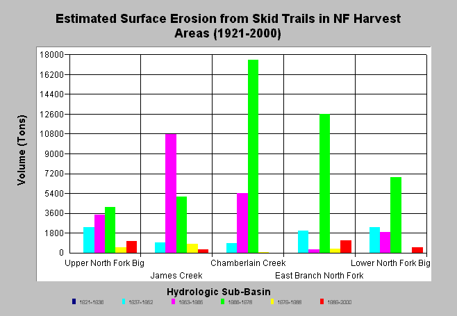
| Caption: The chart above shows the computed surface erosion from skid trails in harvest units for each North Fork Big River sub-basin. Matthews and Associates (2001) state: "The results suggest a peak in surface erosion coinciding with high harvest rates using high-density tractor logging methods in the 1953-1978 periods. In the most recent period, smaller volumes of surface erosion have been produced by more extensive harvest areas due to a substantial change in harvesting techniques." Estimates are generated from CDF data and aerial photographs. See Info Links for more background information and links to references. | |
 |
To learn more about this topic click here .
To view the table with the chart's data, click Chart Table web page.
To download the table with the chart's data, click sediment_harvest_surferosion_nf.dbf (size 1,095 bytes) .
To see meta information about the data table used for this topic click here
To view the table with the chart's source data, click Source Table web page.
To download the table with the chart's source data, click sediment_surf_harvest_period_all.dbf (size 3,072 bytes)
| www.krisweb.com |