
| Area | North Fork Big River |
| Topic | Sediment: Matthews Road Surface Type for NF Basins 2000 |
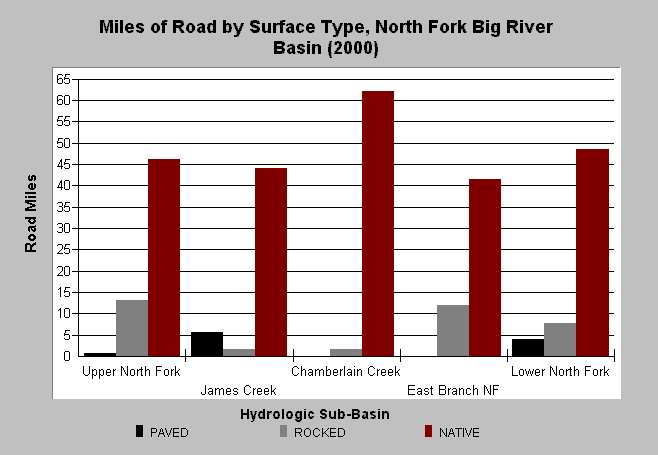
| Caption: The chart above shows the existing miles of road by road surface type as of year 2000. The dominate road surface is native (i.e. unpaved). Matthews and Associates (2001) state: "Analysis indicates that sediment production from roads has increased significantly over the study period, tracking cumulative road construction." See Info Links for more background information and links to references. | |
 |
To learn more about this topic click here .
To view the table with the chart's data, click Chart Table web page.
To download the table with the chart's data, click roads_type_location_nf.dbf (size 1,002 bytes) .
To see meta information about the data table used for this topic click here
To view the table with the chart's source data, click Source Table web page.
To download the table with the chart's source data, click roads_construct_period_allsubs.dbf (size 2,194 bytes)
| www.krisweb.com |