
| Area | North Fork Big River |
| Topic | Timber Harvest: Matthews Harvested Acres, North Fork Basin 1921-2000 |
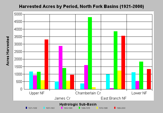
| Caption: The chart above shows total harvested acres by period in North Fork Big River sub-basins from 1921 to 2000 with the highest area of disturbance in recent periods being in the upper North Fork and East Branch. Less harvesting has gone on in Chamberlain and James Creek, which are partially within Jackson Demonstration State Forest. See Info Links for more background information and links to references. | |
 |
To learn more about this topic click here .
To view the table with the chart's data, click Chart Table web page.
To download the table with the chart's data, click harvest_matthews_nf.dbf (size 1,673 bytes) .
To see meta information about the data table used for this topic click here
To view the table with the chart's source data, click Source Table web page.
To download the table with the chart's source data, click harvest_matthews.dbf (size 3,786 bytes)
| www.krisweb.com |