
| Area | South Fork Big River |
| Topic | Sediment: Matthews Erosion Rates from Roads Surfaces Daugherty Cr |
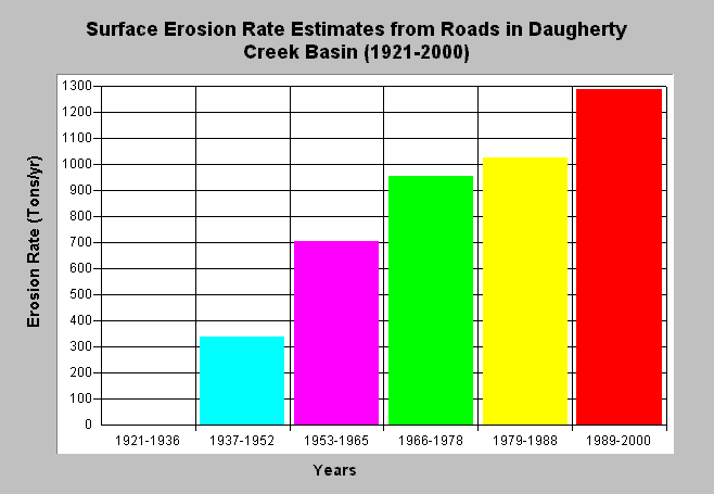
| Caption: The chart above shows Matthews and Associates (2001) computed surface erosion rates (tons/yr) from roads in the Daugherty Creek basin. Matthews and Associates (2001) state: "Significant construction of new roads has led to increasing sediment yields from road surface erosion, despite improved practices." Surface erosion was computed using method of Reid (1981). Ridge roads were assumed non-delivering. See Info Links for more background information and links to references. | |
 |
To learn more about this topic click here .
To view the table with the chart's data, click Chart Table web page.
To download the table with the chart's data, click sediment_roads_erosion_dc.dbf (size 230 bytes) .
To see meta information about the data table used for this topic click here
To view the table with the chart's source data, click Source Table web page.
To download the table with the chart's source data, click sediment_road_surferosion_rates_all.dbf (size 2,212 bytes)
| www.krisweb.com |