
| Area | South Fork Big River |
| Topic | Sediment: Matthews Road Construction by Period Daugherty Cr Basin |
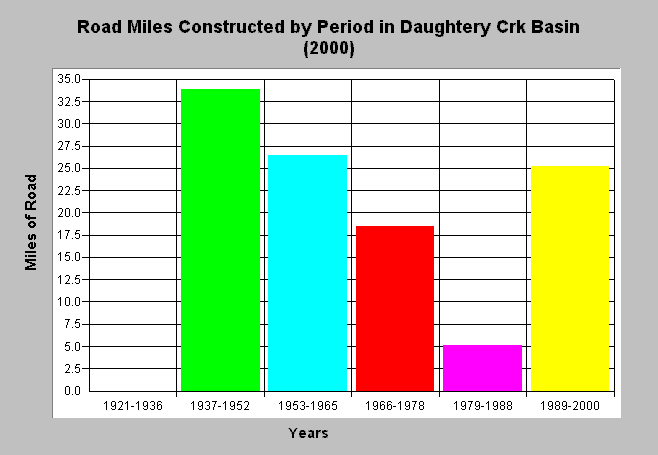
| Caption: The chart above shows the miles of constructed road by period in the Daugherty Creek basin. The majority of roads were constructed between 1937-1978 and 1989-2000. Data is from Matthews and Associates (2001), who state: "Significant construction of new roads has led to increasing sediment yields from road surface erosion, despite improved practices." See Info Links for more background information and links to references. | |
 |
To learn more about this topic click here .
To view the table with the chart's data, click Chart Table web page.
To download the table with the chart's data, click roads_construct_period_dc.dbf (size 212 bytes) .
To see meta information about the data table used for this topic click here
To view the table with the chart's source data, click Source Table web page.
To download the table with the chart's source data, click roads_construct_period_allsubs.dbf (size 2,194 bytes)
| www.krisweb.com |